Plizio Visual Lab
Kamrang

ℹ️Practical info — Kamrang
▾
🌤 Weather — 5 days
📍 Nearby
Sights nearby
💡 Tips
- Access to Kamrang is primarily by small chartered flights; always confirm weight limits for your luggage in advance.
- The tropical rainforest climate means heavy rain can occur suddenly; pack quick-dry clothing and waterproof bags.
- Electricity may be restricted to certain hours, so keep a power bank handy for your devices.
- Bring enough local currency from Georgetown, as banking facilities and ATMs are virtually non-existent here.
🍽 Food
A traditional indigenous staple made from cassava flour, often served with stews.
A rich meat stew made with cassareep (a cassava extract) and hot peppers, usually eaten with bread.
Locally caught fish from the Mazaruni or Kamarang rivers, typically grilled or fried.
🛍 Shopping · 🧘 Quiet spots
Support the local community by purchasing woven baskets or traditional beadwork directly from the makers.
Find tropical fruits and basic provisions at the small village shops near the airstrip.
Sit by the confluence of the rivers and listen to the sounds of the dense rainforest surrounding the village.
If you arrange a local guide, the hike to nearby waterfalls has pure jungle tranquility.
Water temperature…
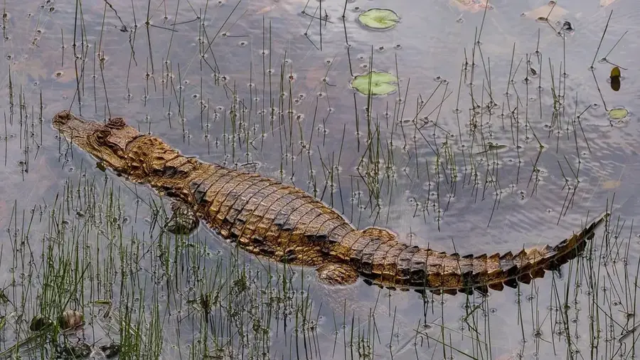
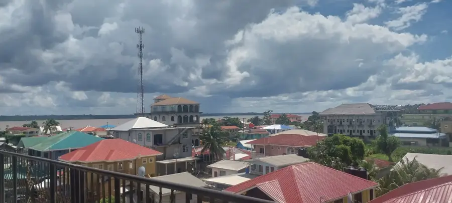
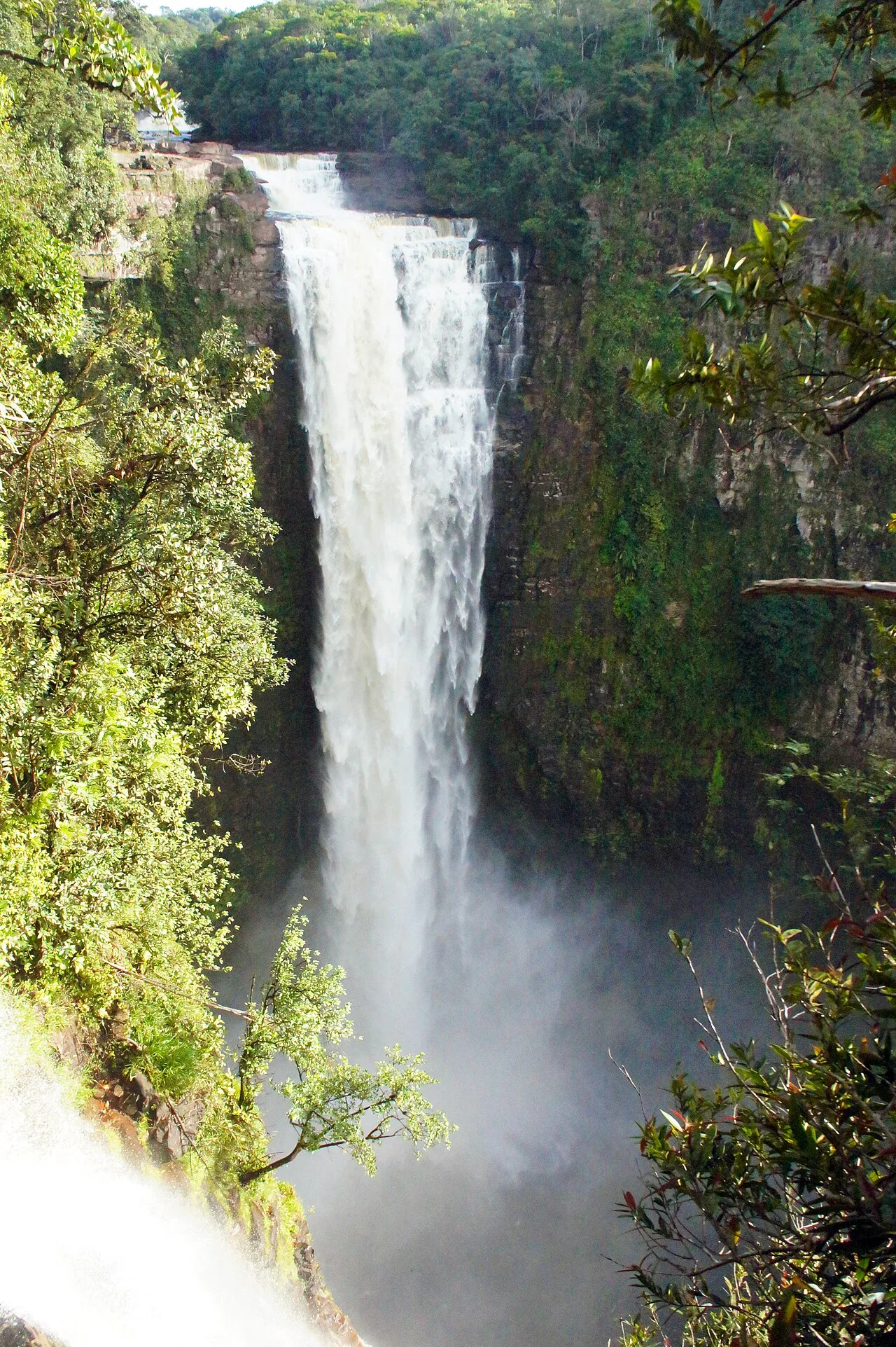
Kamrang (commonly known as Kamarang) is a significant indigenous settlement in the highlands of Guyana, located in the Cuyuni-Mazaruni region along the upper Mazaruni River. The village serves as a primary administrative and commercial hub for the surrounding Akawaio and Patamona indigenous communities. Geographically, Kamrang is characterized by its remote location within the dense tropical rainforest, situated at the confluence of the Kamarang and Mazaruni Rivers. The settlement's economy is heavily reliant on the mining industry, particularly gold and diamond extraction, alongside trading and subsistence farming. Due to the absence of road links to the coast, the Kamarang Airport is the critical logistical lifeline for transporting passengers and essential supplies. The surrounding region is renowned for its spectacular natural beauty, featuring numerous waterfalls and distant views of tepuis. Kamrang hosts essential social services, including a hospital, a school, and government offices, which provide necessary infrastructure for the indigenous population in Guyana's interior.
- Location: Guyana
- Nearby: Karuaimeng (30 km)
Best time to visit & climate
The most pleasant time to visit is Feb, Mar, Oct.
| Jan | Feb | Mar | Apr | May | Jun | Jul | Aug | Sep | Oct | Nov | Dec | |
|---|---|---|---|---|---|---|---|---|---|---|---|---|
| Avg °C | 24 | 25 | 26 | 26 | 25 | 24 | 24 | 25 | 25 | 25 | 25 | 25 |
| Rain mm | 128 | 89 | 69 | 129 | 271 | 285 | 247 | 191 | 97 | 80 | 113 | 148 |
Geography
Facts
- Administrative center for the Upper Mazaruni district
- Located in Region 7 (Cuyuni-Mazaruni)
- Situated at the confluence of the Kamarang and Mazaruni Rivers
- Major hub for gold and diamond mining activities
- Accessible primarily via the Kamarang Airport (KMR)
- Home to a majority Akawaio and Patamona population
Explore nearby
Notable places around
Route planner — Car & Motorhome
Where do you start? We build the route here, with stops and country notes along the way.
© OpenStreetMap contributors · OpenRouteService
Frequently asked questions
Where is Kamrang located?
How do you reach Kamrang?
Who lives in Kamrang?
What are the main activities?
Is it developed for tourism?
Kamrang: where is it located?
Kamrang: when is the best time to visit?
Kamrang: why is it worth visiting?

Nearby cities
Nature
More places