Plizio Visual Lab
Kamarang River
Weather…
Water temperature…
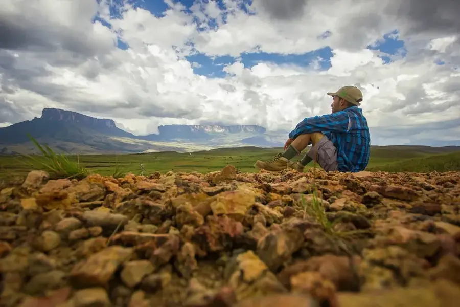
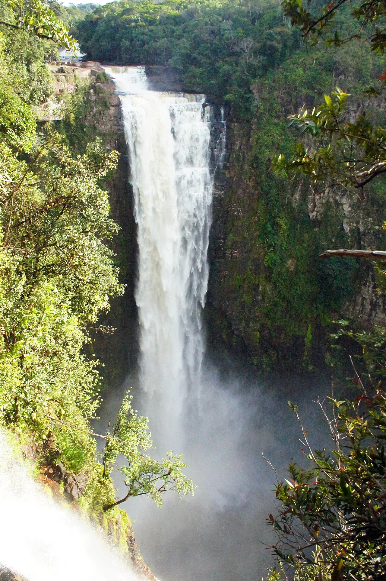
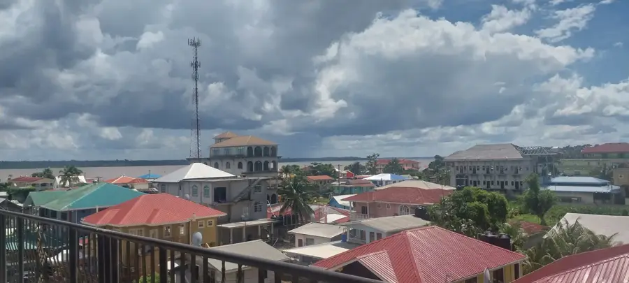
The Kamarang River is a significant tributary of the Mazaruni River in western Guyana, originating deep within the Pakaraima Mountains. It traverses a dramatic landscape of tepuis and dense rainforest before joining the Mazaruni at the settlement of Kamarang. The river is most famous for the spectacular Kamarang Falls, which are among the most remote and pristine waterfalls in the country. The region is primarily inhabited by the indigenous Akawaio people, whose culture is intimately tied to the river system and the surrounding mountains. Economically, the river has been a center for artisanal gold and diamond mining for decades, though this poses ecological challenges to water quality. The river's environment hosts exceptional biodiversity, including many endemic plant species found only on the isolated high plateaus of the Guiana Shield. The Kamarang serves as a vital transportation artery for goods and people in an area with almost no road infrastructure. Due to its scenic beauty, there is increasing discussion regarding the development of low-impact eco-tourism in the region.
- Location: Guyana
- Nearby: Kamrang (50 km)
Best time to visit & climate
The most pleasant time to visit is Jan–Mar.
| Jan | Feb | Mar | Apr | May | Jun | Jul | Aug | Sep | Oct | Nov | Dec | |
|---|---|---|---|---|---|---|---|---|---|---|---|---|
| Avg °C | 23 | 23 | 24 | 24 | 23 | 22 | 22 | 23 | 23 | 24 | 24 | 23 |
| Rain mm | 84 | 59 | 48 | 117 | 251 | 295 | 239 | 202 | 110 | 82 | 100 | 106 |
📋 Practical info
Geography
Facts
- The river is a major component of the Mazaruni River drainage basin.
- Kamarang Falls features a vertical drop of over 45 meters.
- The Kamarang settlement serves as a regional administrative hub.
- Diamond and gold mining have been active here since the early 1900s.
- The indigenous Akawaio inhabitants refer to themselves as 'Kapon'.
- It is located within the Cuyuni-Mazaruni Administrative Region (Region 7).
Explore nearby
Notable places around
Route planner — Car & Motorhome
Where do you start? We build the route here, with stops and country notes along the way.
© OpenStreetMap contributors · OpenRouteService
Sights in the town Kamarang River (1)
Sights nearby
Frequently asked questions
In which region does the Kamarang flow?
Are there waterfalls there?
What is the environment like?
Is mining practiced there?
Can the area be visited?
Kamarang River: where is it located?
Kamarang River: when is the best time to visit?
Kamarang River: why is it worth visiting?

Nearby cities
Nature
More places