Plizio Visual Lab
Mount Roraima
Weather…
Water temperature…
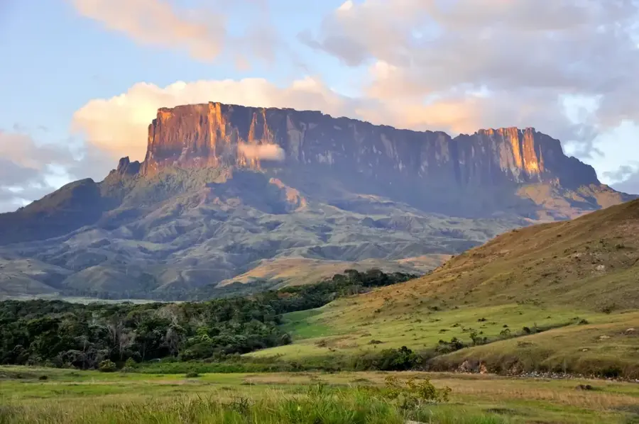
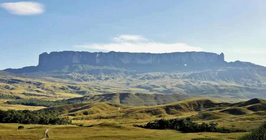
Mount Roraima is the most prominent of the tepuis, or table-top mountains, located in the Guiana Highlands at the triple border of Brazil, Venezuela, and Guyana. Reaching an elevation of 2,810 meters, it is a geological relic from the Precambrian era, composed of sandstone approximately two billion years old. Its nearly vertical cliffs rise 400 meters above the surrounding terrain, enclosing a vast plateau that hosts a unique ecosystem with numerous endemic species, including carnivorous plants and the Roraima bush toad. The mountain was first climbed in 1884 by Sir Everard im Thurn, an expedition that famously inspired Arthur Conan Doyle's novel 'The Lost World.' To the local Pemon indigenous people, Roraima is seen as the stump of a mighty tree that once held all the world's fruits and tubers. The summit experiences extreme weather with heavy rainfall, leading to the formation of spectacular ephemeral waterfalls cascading down its sheer stone faces.
- Location: Brazil
- Top sights: Wei-Assipu-tepui · Prow Viewpoint · Roraiminha viewpoint
Best time to visit & climate
The most pleasant time to visit is Jan–Mar.
| Jan | Feb | Mar | Apr | May | Jun | Jul | Aug | Sep | Oct | Nov | Dec | |
|---|---|---|---|---|---|---|---|---|---|---|---|---|
| Avg °C | 21 | 22 | 22 | 23 | 22 | 21 | 21 | 21 | 22 | 22 | 22 | 22 |
| Rain mm | 51 | 39 | 41 | 121 | 252 | 290 | 238 | 202 | 103 | 71 | 84 | 67 |
📋 Practical info
Geography
Facts
- The mountain's highest point reaches 2,810 meters
- Formed from Precambrian sandstone dating back 2 billion years
- Sir Everard im Thurn completed the first recorded ascent in 1884
- The summit plateau covers an area of approximately 31 square km
- About 35% of the plant species found on top are endemic
- It inspired the setting for the 1912 novel 'The Lost World'
Explore nearby
Notable places around
Route planner — Car & Motorhome
Where do you start? We build the route here, with stops and country notes along the way.
© OpenStreetMap contributors · OpenRouteService
Sights in the town Mount Roraima (6)
Sights nearby
Frequently asked questions
What is special about Mount Roraima?
In which countries is the mountain located?
How long does a trekking tour take?
Is the mountain accessible to hikers?
What legends are there about Mount Roraima?
Mount Roraima: where is it located?
Mount Roraima: what is there to see?
Mount Roraima: when is the best time to visit?
Mount Roraima: why is it worth visiting?

Nearby cities
Nature
More places