Plizio Visual Lab
Pyrenees National Park
Weather…
Water temperature…
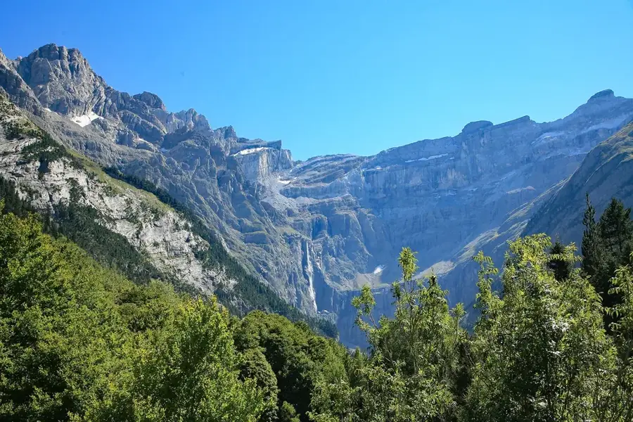
The Pyrenees National Park, established in 1967, stretches along the Franco-Spanish border in the departments of Hautes-Pyrénées and Pyrénées-Atlantiques. Covering an area of over 45,000 hectares, it protects one of Europe's most impressive mountain landscapes. The park is home to majestic peaks such as Vignemale, which at 3,298 meters is the highest point in the French Pyrenees. The area is particularly famous for its spectacular glacial cirques, such as the Cirque de Gavarnie, which is a UNESCO World Heritage site. The biodiversity within the park is exceptional, housing rare animal species like the bearded vulture, the Pyrenean chamois (isard), and a small population of brown bears. Over 2,500 plant species are native to the area, many of which are endemic to this mountain range. An extensive network of hiking trails, including parts of the GR10 long-distance path, allows visitors to explore the pristine wilderness. The national park plays a vital role in conservation and scientific research on alpine ecology.
- Location: Occitanie, France
- Top sights: Pic d'Ardiden · Pic de Chanchou · Pic de Barbe de Bouc
- Nearby: Cauterets (7 km)
Best time to visit & climate
The most pleasant time to visit is Jun–Aug.
| Jan | Feb | Mar | Apr | May | Jun | Jul | Aug | Sep | Oct | Nov | Dec | |
|---|---|---|---|---|---|---|---|---|---|---|---|---|
| Avg °C | 2 | 2 | 5 | 8 | 12 | 16 | 18 | 18 | 15 | 11 | 6 | 3 |
| Rain mm | 87 | 69 | 75 | 86 | 93 | 65 | 52 | 52 | 56 | 70 | 93 | 74 |
📋 Practical info
Geography
Facts
- Founded in 1967 as France's third national park
- Highest peak is Vignemale at 3,298 meters
- Contains approximately 230 mountain lakes
- The Cirque de Gavarnie features a 422m high waterfall
- Home to the endangered bearded vulture (gypaetus barbatus)
- The park's core zone covers 457 square kilometers
Explore nearby
Notable places around
Route planner — Car & Motorhome
Where do you start? We build the route here, with stops and country notes along the way.
© OpenStreetMap contributors · OpenRouteService
Sights in the town Pyrenees National Park (3)
Pic de Barbe de Bouc
Mountain in France, a distinctive peak in the Pyrenees mountain range.
Sights nearby
Frequently asked questions
What is the most famous spot in the National Park?
What animals can be spotted there?
Are dogs allowed in the National Park?
When is the best time for hiking?
Is there an entrance fee for the park?
Pyrenees National Park: where is it located?
Pyrenees National Park: what is there to see?
Pyrenees National Park: when is the best time to visit?
Pyrenees National Park: why is it worth visiting?

Nearby cities