Plizio Visual Lab
Cirque de Gavarnie
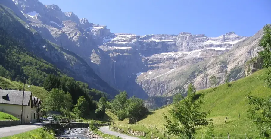
The Cirque de Gavarnie is a massive natural amphitheater in the central Pyrenees, located within the Pyrenees National Park. Formed by glacial erosion, it features near-vertical rock walls rising up to 1,500 meters above the valley floor. At the heart of the cirque, the Grande Cascade de Gavarnie plunges 422 meters, making it one of the tallest waterfalls in Europe. Victor Hugo famously described the site as the 'Colosseum of nature.' Since 1997, the area has been designated a UNESCO World Heritage site, together with the neighboring Ordesa y Monte Perdido National Park in Spain. Beyond its geological splendor, the region supports unique flora and fauna, such as the Pyrenean chamois (isard) and the rare bearded vulture. The cirque is a premier destination for hikers and mountaineers worldwide.
- Location: Occitanie, France
- Top sights: La Grande Cascade de Gavarnie · Hôtellerie du Cirque · Picos de la Cascada Central
- Nearby: Gavarnie (5 km)
Best time to visit & climate
The most pleasant time to visit is Jun–Aug.
| Jan | Feb | Mar | Apr | May | Jun | Jul | Aug | Sep | Oct | Nov | Dec | |
|---|---|---|---|---|---|---|---|---|---|---|---|---|
| Avg °C | 1 | 1 | 4 | 7 | 11 | 16 | 18 | 18 | 14 | 10 | 4 | 1 |
| Rain mm | 60 | 48 | 60 | 72 | 71 | 50 | 37 | 37 | 47 | 59 | 68 | 50 |
📋 Practical info
Geography
Facts
- The Grande Cascade is one of Europe's highest waterfalls at 422 meters.
- Part of the UNESCO World Heritage site 'Pyrénées - Mont Perdu' since 1997.
- The amphitheater spans approximately 6 kilometers in diameter at its crest.
- The cliffs are primarily composed of Cretaceous and Eocene limestone.
- Victor Hugo described the cirque as nature's own 'Colosseum.'
- A critical sanctuary for the endangered bearded vulture (Gypaetus barbatus).
Explore nearby
Notable places around
Route planner — Car & Motorhome
Where do you start? We build the route here, with stops and country notes along the way.
© OpenStreetMap contributors · OpenRouteService
Sights in the town Cirque de Gavarnie (8)
Punda deras Crepas
Mountain in France, a high point in the Pyrenees.
Festival de Gavarnie
Theatre festival held in summer in the Cirque de Gavarnie.
Gruta Casteret
Ice cave in the Monte Perdido massif, west side of Pico Anónimo (2773 m).
Cirque de Gavarnie
Viewpoint overlooking the famous Pyrenean cirque.
Sights nearby
Frequently asked questions
How do you get to the Cirque de Gavarnie?
How high is the great waterfall?
Is the path accessible with a stroller?
Can you go on horseback or donkey?
When is the best time to visit?
Cirque de Gavarnie: where is it located?
Cirque de Gavarnie: what is there to see?
Cirque de Gavarnie: when is the best time to visit?
Cirque de Gavarnie: why is it worth visiting?

Nearby cities