Plizio Visual Lab
Torotoro National Park
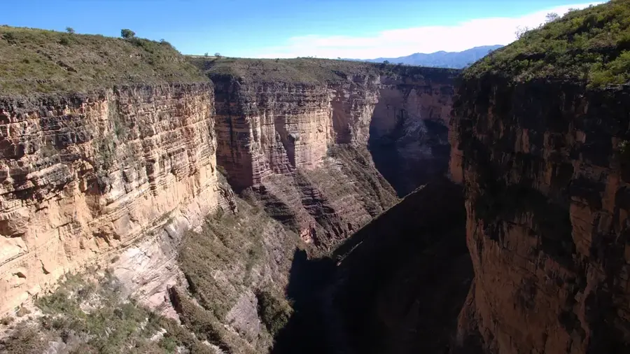
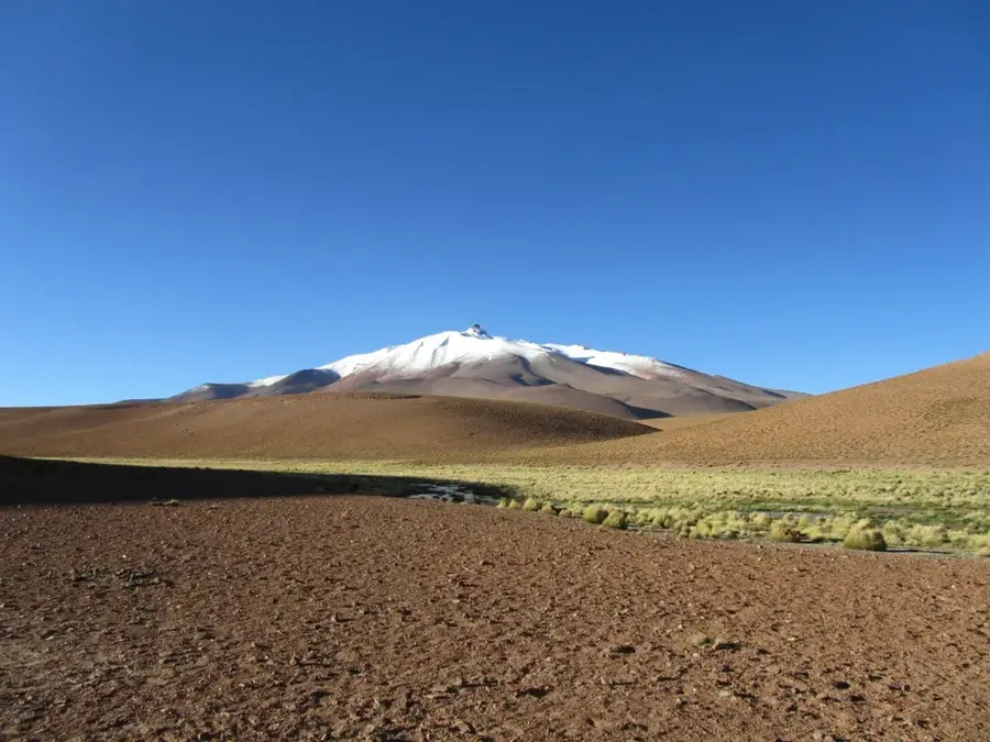
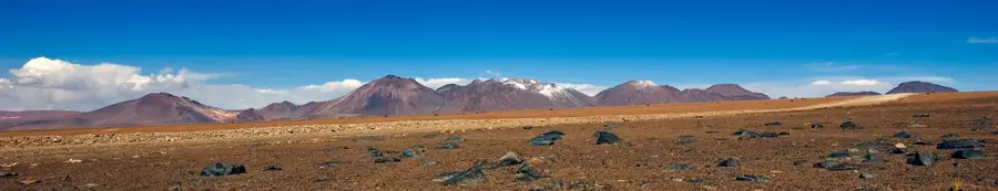
Torotoro National Park, located in the Potosí Department, is a paradise for geologists, paleontologists, and adventure seekers. Spanning 165 square kilometers in the Eastern Cordillera of the Andes, the park features a surreal landscape of deep canyons, bizarre rock formations, and massive cave systems like Uma Jalanta. Torotoro is most famous for its exceptionally well-preserved dinosaur footprints, found throughout the park on fossilized surfaces, testifying to a time when the region was a lush coastal area. Another highlight is the Torotoro Canyon, a vast gorge where red-fronted macaws can be spotted, leading to spectacular waterfalls such as El Vergel. The park's geological history spans millions of years, evident in the diverse sedimentary layers and fossils of ancient marine life. Managed by the local community, the park gives an authentic experience of Bolivia's natural heritage. The combination of prehistoric tracks, speleological wonders, and sweeping scenery makes Torotoro one of the most unique protected areas in the country.
- Location: Bolivia
- Top sights: Caverna Umajalanta · Huellas de Dinosaurios · Cima Cerro Ararias 3875 msnm
Best time to visit & climate
The most pleasant time to visit is Sep–Nov.
| Jan | Feb | Mar | Apr | May | Jun | Jul | Aug | Sep | Oct | Nov | Dec | |
|---|---|---|---|---|---|---|---|---|---|---|---|---|
| Avg °C | 12 | 12 | 12 | 11 | 10 | 8 | 8 | 9 | 11 | 13 | 13 | 13 |
| Rain mm | 102 | 92 | 53 | 20 | 6 | 45 | 5 | 8 | 14 | 25 | 32 | 81 |
📋 Practical info
Geography
Facts
- Torotoro National Park was officially established in 1989.
- Uma Jalanta is the deepest cave in Bolivia, with over 4 kilometers of explored passages.
- Researchers have documented more than 2,500 individual dinosaur footprints in the park.
- The Torotoro Canyon reaches depths of up to 300 meters.
- The park contains fossilized remains of marine life, such as brachiopods and trilobites.
- Elevation in the park ranges from 2,000 to 3,500 meters above sea level.
Explore nearby
Notable places around
Route planner — Car & Motorhome
Where do you start? We build the route here, with stops and country notes along the way.
© OpenStreetMap contributors · OpenRouteService
Sights in the town Torotoro National Park (7)
Sights nearby
Frequently asked questions
What can you see in Torotoro?
Do you need a guide?
How difficult are the hikes?
When is the best time to visit?
How do you reach the park?
Torotoro National Park: where is it located?
Torotoro National Park: what is there to see?
Torotoro National Park: when is the best time to visit?
Torotoro National Park: why is it worth visiting?

History & landmarks

Nature

More places