Plizio Visual Lab
Pentecost Central Range

Weather…
Water temperature…
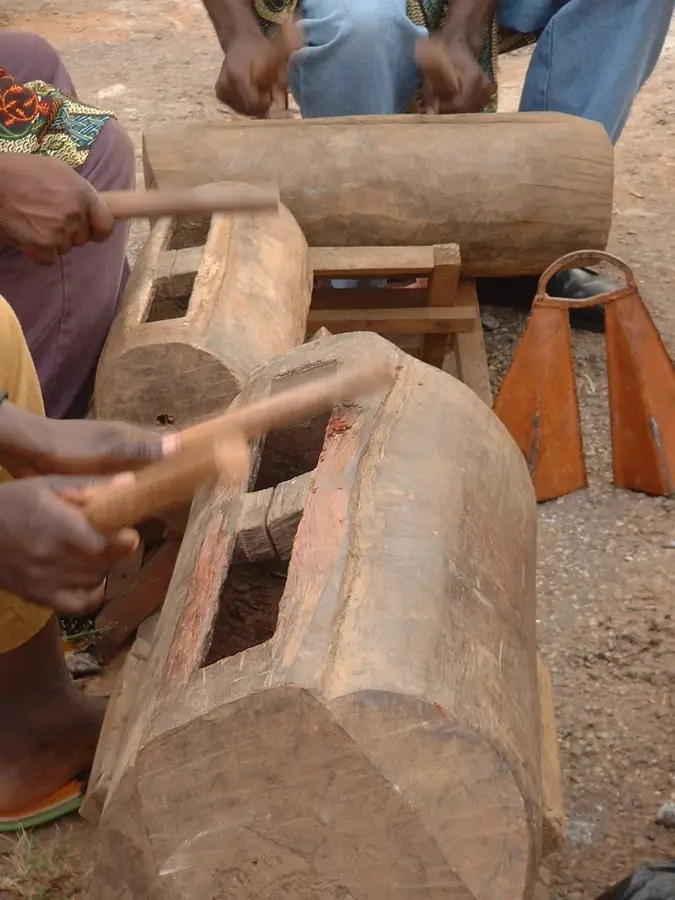
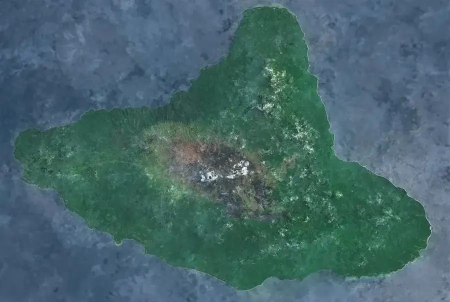
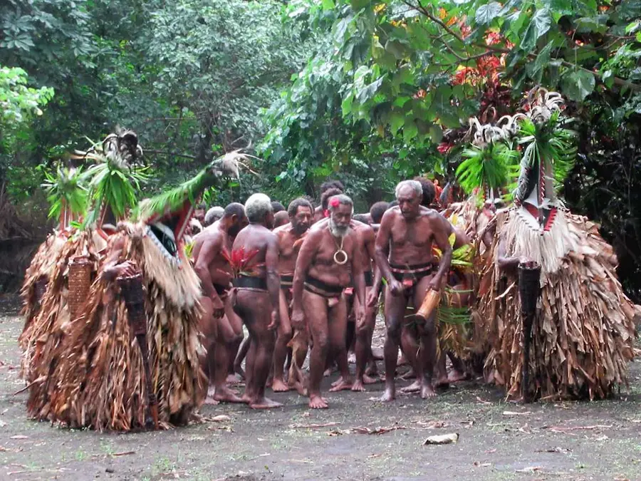
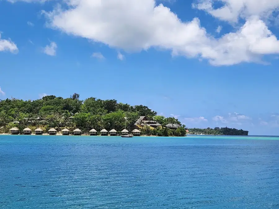
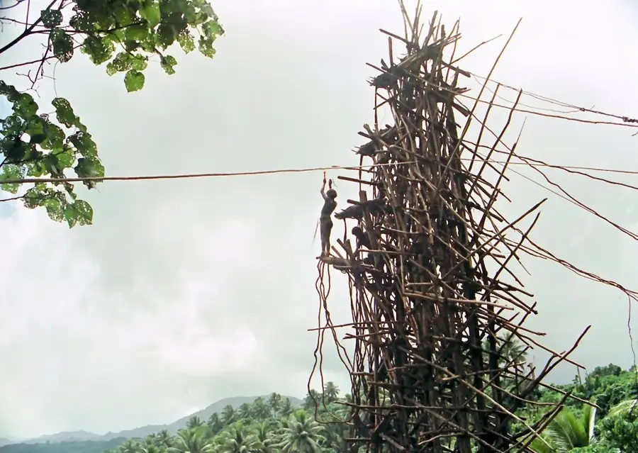
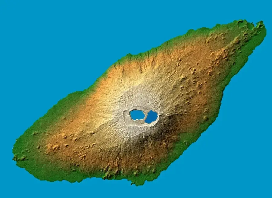
The Pentecost Central Range extends along the entire length of the narrow Pentecost Island and is world-renowned for its steep slopes, which are the birthplace of the traditional land-diving ritual (Nagol). This mountain range is characterized by a sharp central spine that divides the island into a windward eastern side and a more sheltered western coast. Its geological formation is a blend of volcanic rock and uplifted limestone, resulting in a rugged topography marked by deep gorges and fast-flowing streams. The vegetation is a dense tropical rainforest that is often shrouded in clouds at higher elevations due to the high humidity. Mount Vulmat is the highest point of the range, reaching an elevation of nearly 950 meters (3,117 feet). For the local people, the range is not only a vital source of timber and food but also a spiritual place deeply rooted in indigenous customs. The range's unique microclimate allows for the cultivation of premium kava, which is regarded as some of the finest in the Pacific. The Pentecost Central Range is an impressive example of the intersection between dramatic topography and a living cultural identity.
- Location: Vanuatu
- Nearby: Fanla Village (48 km)
Best time to visit & climate
The most pleasant time to visit is Jul–Sep.
| Jan | Feb | Mar | Apr | May | Jun | Jul | Aug | Sep | Oct | Nov | Dec | |
|---|---|---|---|---|---|---|---|---|---|---|---|---|
| Avg °C | 28 | 28 | 28 | 28 | 27 | 26 | 25 | 25 | 26 | 26 | 27 | 27 |
| Rain mm | 237 | 228 | 247 | 251 | 154 | 143 | 96 | 86 | 92 | 143 | 155 | 175 |
📋 Practical info
Geography
Facts
- Mount Vulmat is the highest peak on the island at approximately 947 meters.
- The mountain range is about 60 kilometers long but only a few kilometers wide.
- Nagol diving towers are traditionally built on the western slopes of the range.
- The geology is dominated by basalt and Miocene limestone formations.
- The range acts as a significant barrier against southeast trade winds.
- Pentecost is famous for the high-quality kava grown in these highland soils.
Explore nearby
Notable places around
Route planner — Car & Motorhome
Where do you start? We build the route here, with stops and country notes along the way.
© OpenStreetMap contributors · OpenRouteService
Sights nearby
Frequently asked questions
Is Pentecost known for its culture?
What is the terrain like on Pentecost?
Can you explore the mountains without a guide?
Are there accommodations there?
When should you book?
Pentecost Central Range: where is it located?
Pentecost Central Range: when is the best time to visit?
Pentecost Central Range: why is it worth visiting?

Nearby cities


History & landmarks


Nature
More places