Plizio Visual Lab
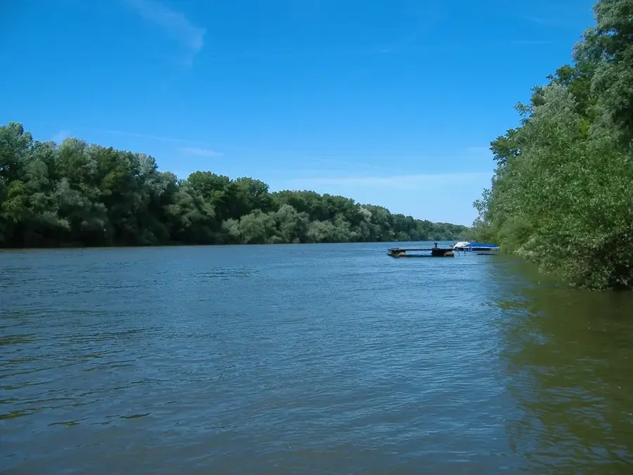
Tysa River
Weather…
Water temperature…
The Tysa (Tisza) River is one of Central Europe's most significant waterways and the longest tributary of the Danube, with its headwaters located in the heart of the Ukrainian Carpathians. Formed by the confluence of the Black Tysa and White Tysa near the town of Rakhiv, it flows for a considerable distance along the borders of Ukraine, Romania, and Hungary. The river is the lifeblood of the Zakarpattia region, though it is also known for its unpredictable nature and historically devastating floods that have shaped local engineering and urban planning. Ecologically, the Tysa is home to diverse aquatic life, including the rare Hucho hucho (Danube salmon), and supports vast riparian forests that act as vital wildlife corridors. Historically, the river served as a major transport route for salt from the Solotvyno mines and timber from the highlands. Today, it is a focal point for international environmental efforts aimed at protecting water quality and preserving the unique biodiversity of the Tisza river basin.
- Location: Ukraine
- Nearby: Vynohradiv (7 km)
Best time to visit & climate
The most pleasant time to visit is Jun–Aug.
| Jan | Feb | Mar | Apr | May | Jun | Jul | Aug | Sep | Oct | Nov | Dec | |
|---|---|---|---|---|---|---|---|---|---|---|---|---|
| Avg °C | -3 | -1 | 4 | 11 | 16 | 20 | 22 | 22 | 17 | 10 | 5 | -1 |
| Rain mm | 52 | 48 | 54 | 47 | 84 | 87 | 91 | 60 | 62 | 62 | 55 | 56 |
📋 Practical info
Geography
Facts
- Ranked as the longest tributary of the Danube
- Forms at Rakhiv via the White and Black Tysa confluence
- Acts as a natural international border for long stretches
- Infamous for rapid and unpredictable flooding cycles
- Critical habitat for the endangered Danube salmon
- Historically vital for the transport of salt and timber
Explore nearby
Notable places around
Route planner — Car & Motorhome
Where do you start? We build the route here, with stops and country notes along the way.
© OpenStreetMap contributors · OpenRouteService
Sights nearby
Frequently asked questions
Where does the Tysa originate?
Which countries does the Tysa flow through?
Is rafting possible on the Tysa?
What fish live in the Tysa?
How long is the Tysa in total?
Tysa River: where is it located?
Tysa River: when is the best time to visit?
Tysa River: why is it worth visiting?

Nearby cities