Plizio Visual Lab
Ouadane Ruins
Weather…
Water temperature…
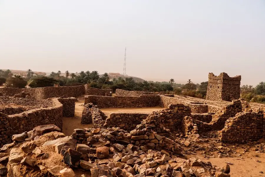
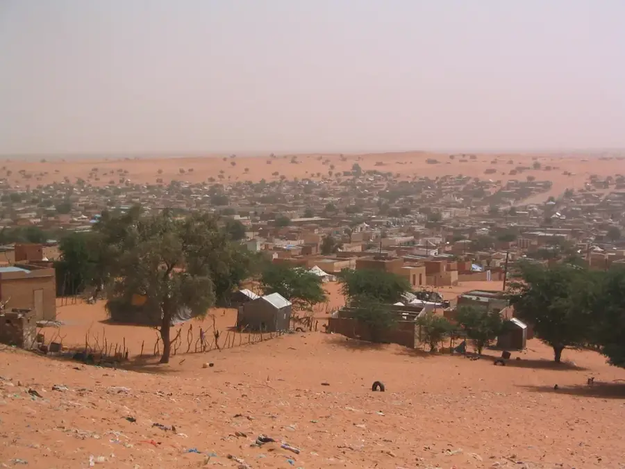
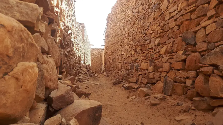
The ruins of Ouadane, founded in 1147 by Berbers, are among the most significant historical sites in Mauritania. Perched dramatically on a cliff at the edge of the Adrar plateau, this fortified city (ksar) was once a flourishing hub of the trans-Saharan trade in gold, salt, and dates. During its golden age between the 14th and 16th centuries, it was a center of Islamic scholarship and commerce. The ancient ruins include the remains of a fortified mosque and stone dwellings that showcase the ingenious urban planning of desert civilizations. Designated a UNESCO World Heritage site, Ouadane provides an unparalleled glimpse into the medieval history of the Sahara. The site remains a hauntingly beautiful destination, where the silence of the desert meets the echoes of a once-powerful commercial empire.
Best time to visit & climate
The most pleasant time to visit is Feb, Mar, Nov.
| Jan | Feb | Mar | Apr | May | Jun | Jul | Aug | Sep | Oct | Nov | Dec | |
|---|---|---|---|---|---|---|---|---|---|---|---|---|
| Avg °C | 16 | 18 | 22 | 26 | 30 | 32 | 34 | 34 | 32 | 28 | 22 | 17 |
| Rain mm | 1 | 1 | 2 | 0 | 1 | 2 | 3 | 13 | 12 | 38 | 1 | 2 |
📋 Practical info
Geography
Facts
- Founded: 12th century
- Ruins area: 15 hectares
- Mosque construction: 14th century
- Town abandonment: 18th century
- Number of manuscripts: several thousand
- Tallest remaining structure: 10 meters
Explore nearby
Notable places around
Route planner — Car & Motorhome
Where do you start? We build the route here, with stops and country notes along the way.
© OpenStreetMap contributors · OpenRouteService
Sights nearby
Frequently asked questions
How much time should one plan for Ouadane?
Is a guide necessary in Ouadane?
When is the best time to visit?
How to get to Ouadane?
Is photography of the ruins allowed?
Ouadane Ruins: where is it located?
Ouadane Ruins: when is the best time to visit?
Ouadane Ruins: why is it worth visiting?

Nearby cities


History & landmarks


More places