Plizio Visual Lab
Kamoro Suspension Bridge
Weather…
Water temperature…
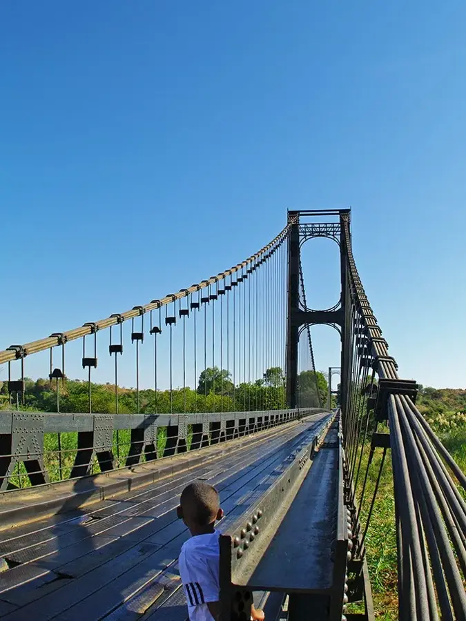
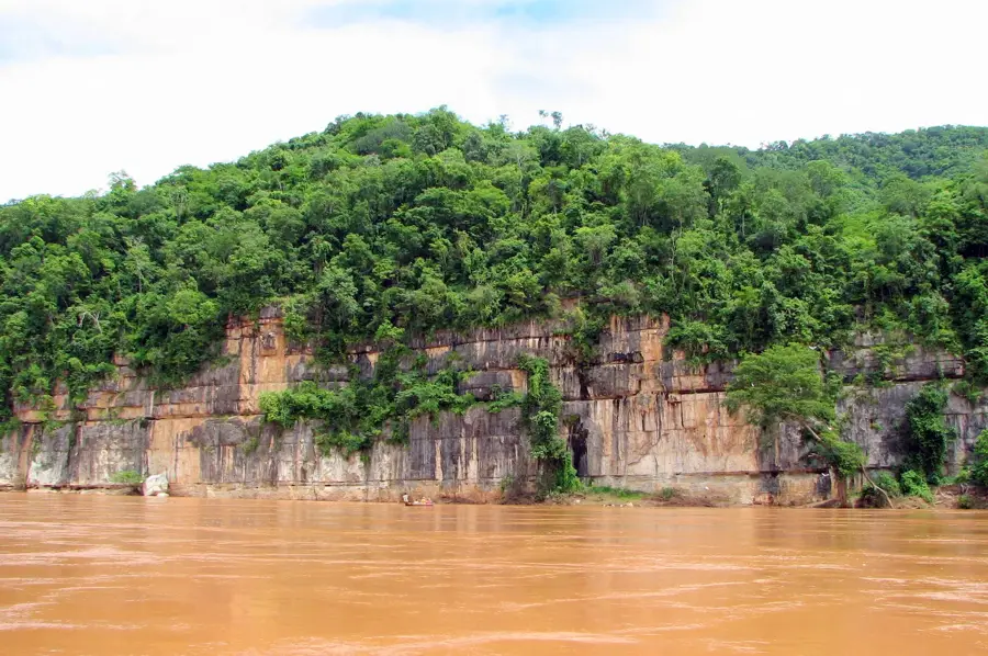
The Kamoro Suspension Bridge is a major engineering landmark located on National Road 4 (RN4), connecting the capital Antananarivo with the port city of Mahajanga. The original bridge was constructed in 1934 by French engineers in the Eiffel style and was long considered one of the longest suspension bridges in Africa. Due to increasing traffic demands and structural aging, a new, modern bridge was built directly adjacent to it between 2014 and 2017. This 280-meter-long structure was completed with international support, specifically Japanese funding, and now ensures the safe crossing of the Kamoro River. The bridge is strategically vital for trade in northwestern Madagascar, facilitating the transport of agricultural products and industrial goods. The juxtaposition of the historic steel structure and the modern replacement highlights the technological evolution of Malagasy infrastructure over the course of a century.
- Location: Madagascar
- Nearby: Maevatanana (51 km)
Best time to visit & climate
The most pleasant time to visit is Jun–Aug.
| Jan | Feb | Mar | Apr | May | Jun | Jul | Aug | Sep | Oct | Nov | Dec | |
|---|---|---|---|---|---|---|---|---|---|---|---|---|
| Avg °C | 27 | 26 | 27 | 26 | 24 | 22 | 22 | 24 | 26 | 29 | 29 | 28 |
| Rain mm | 558 | 381 | 258 | 73 | 24 | 12 | 19 | 10 | 14 | 45 | 143 | 295 |
📋 Practical info
Geography
Facts
- The original bridge was completed in 1934.
- Located on National Road 4, the main link to Mahajanga.
- The new replacement bridge is 280 meters long.
- Funding for the new bridge was provided by Japan (JICA).
- The old structure reflects the iconic Eiffel engineering style.
- Crucial for transporting commercial goods to the northwest coast.
Explore nearby
Notable places around
Route planner — Car & Motorhome
Where do you start? We build the route here, with stops and country notes along the way.
© OpenStreetMap contributors · OpenRouteService
Sights nearby
Frequently asked questions
Is the bridge passable?
Are there viewpoints?
When is it safest?
Am I allowed to stop there?
Is it pedestrian-friendly?
Kamoro Suspension Bridge: where is it located?
Kamoro Suspension Bridge: when is the best time to visit?
Kamoro Suspension Bridge: why is it worth visiting?

Nearby cities


History & landmarks
Nature
More places