Plizio Visual Lab
Antsalova

ℹ️Practical info — Antsalova
▾
🌤 Weather — 5 days
📍 Nearby
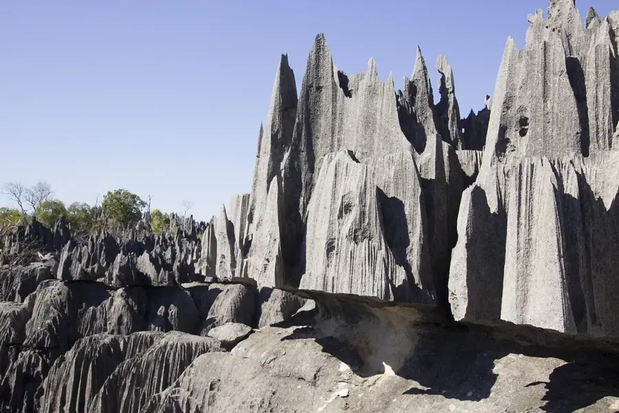
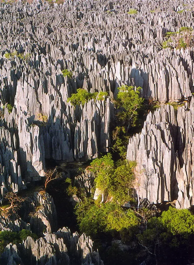
Sights nearby
💡 Tips
- This remote town is the gateway to the Tsingy de Bemaraha; independent travel here requires a sturdy 4x4 vehicle.
- There are no ATMs; bring all the cash (Ariary) you will need for guides, park fees, and accommodation from the city.
- Medical facilities are extremely basic; carry a well-stocked first-aid kit and all essential medications.
- Temperatures can be sweltering; start your park excursions very early in the morning to beat the heat.
🍽 Food
Beef from the humpbacked zebu is a staple, often served with rice and beans at small hotelys.
Caught locally, usually grilled or fried, depending on the season.
Mangoes or papayas bought directly from village vendors make for a safe and refreshing snack.
🛍 Shopping · 🧘 Quiet spots
Shopping is restricted to basic necessities in small local stalls; buy souvenirs at the park entrance instead.
Sometimes sold in repurposed bottles by locals along the rural roads.
Peaceful spots near the river, but always ask locals where it is safe from crocodiles.
Quiet areas excellent for spotting lemurs and listening to the unique sounds of the dry forest.
Water temperature…
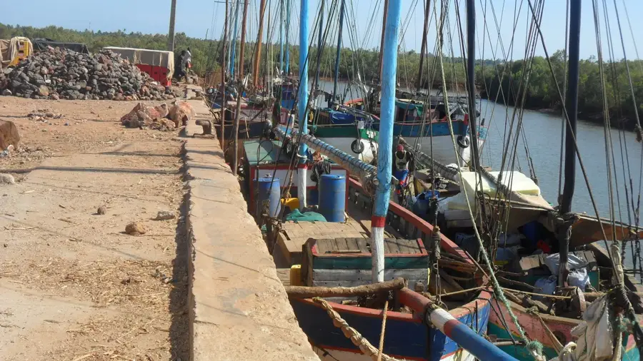
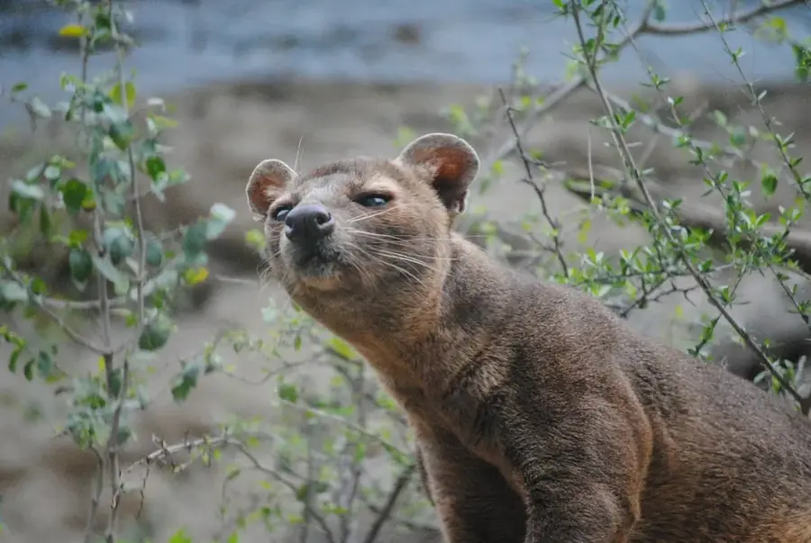
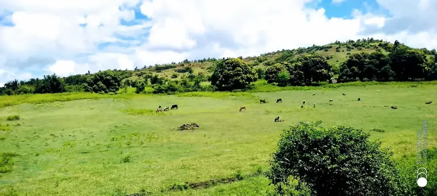
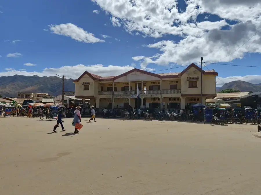
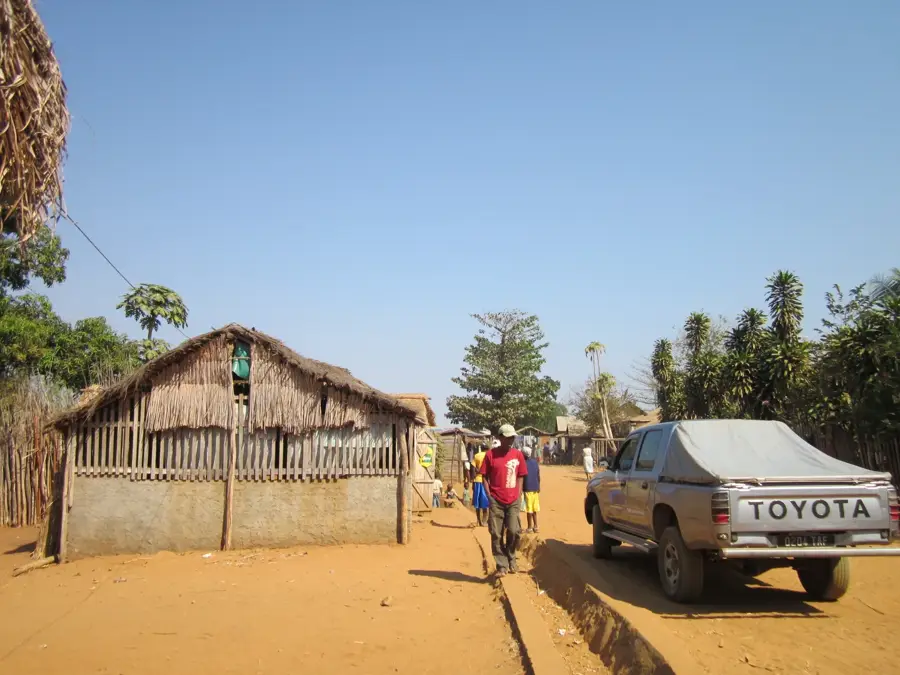
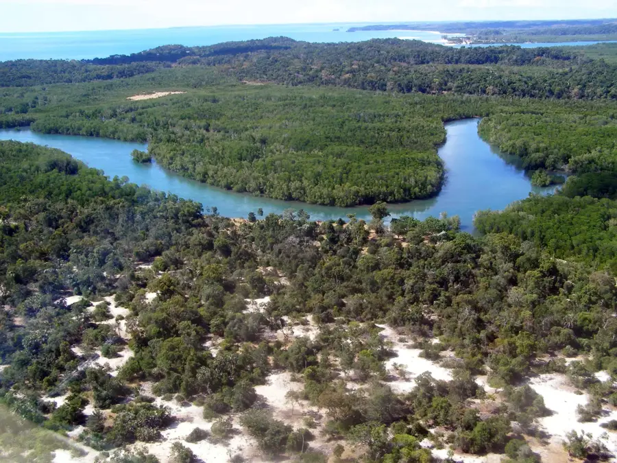
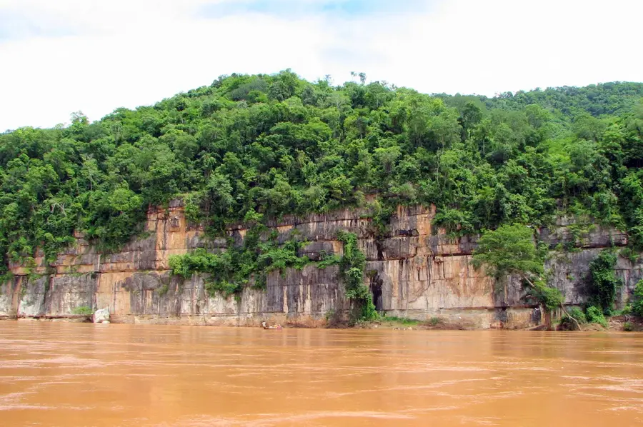
Antsalova is a remote but strategically important village in the Melaky region of western Madagascar, primarily known as the western gateway to the famous Tsingy de Bemaraha National Park. The geography of the site is defined by its proximity to the spectacular limestone formations, which have been designated a UNESCO World Heritage site. Due to its isolated location, Antsalova is often inaccessible by land for months during the rainy season, making air travel via the local airstrip a vital lifeline. Economically, tourism dominates the region, with local guides and small accommodations catering to visitors of the national park. In addition to tourism, agriculture, particularly rice cultivation along river courses like the Manambolo, plays a role in local subsistence. Historically, the region is a settlement area for the Sakalava people, whose culture is deeply rooted in the traditions of western Madagascar. The nature surrounding Antsalova is home to numerous endemic animal species, including the Madagascar fish eagle and rare lemur species.
- Location: Madagascar
- Nearby: Bekopaka (36 km)
- Population: ~58.280 (2024)
Best time to visit & climate
The most pleasant time to visit is Jun–Aug.
| Jan | Feb | Mar | Apr | May | Jun | Jul | Aug | Sep | Oct | Nov | Dec | |
|---|---|---|---|---|---|---|---|---|---|---|---|---|
| Avg °C | 27 | 27 | 27 | 26 | 25 | 23 | 23 | 25 | 27 | 28 | 29 | 28 |
| Rain mm | 380 | 249 | 161 | 77 | 16 | 13 | 10 | 6 | 10 | 39 | 69 | 180 |
Geography
Facts
- Antsalova is the primary access point for the UNESCO World Heritage Tsingy de Bemaraha.
- The village features an airstrip used by small charter aircraft.
- The Manambolo River flows south of the village through impressive gorges.
- The region is home to the rare Madagascar fish eagle (Ankoay).
- During the rainy season (December to April), the town is nearly inaccessible by land.
- The local population primarily belongs to the Sakalava ethnic group.
Explore nearby
Notable places around
Route planner — Car & Motorhome
Where do you start? We build the route here, with stops and country notes along the way.
© OpenStreetMap contributors · OpenRouteService
Frequently asked questions
How long for Antsalova?
When is it best?
How to get there?
Sights?
Safe?
Antsalova: where is it located?
Antsalova: when is the best time to visit?
Antsalova: why is it worth visiting?

Nearby cities

History & landmarks
Nature
More places