Plizio Visual Lab
Kerlingarfjöll
Weather…
Water temperature…
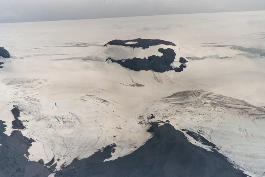
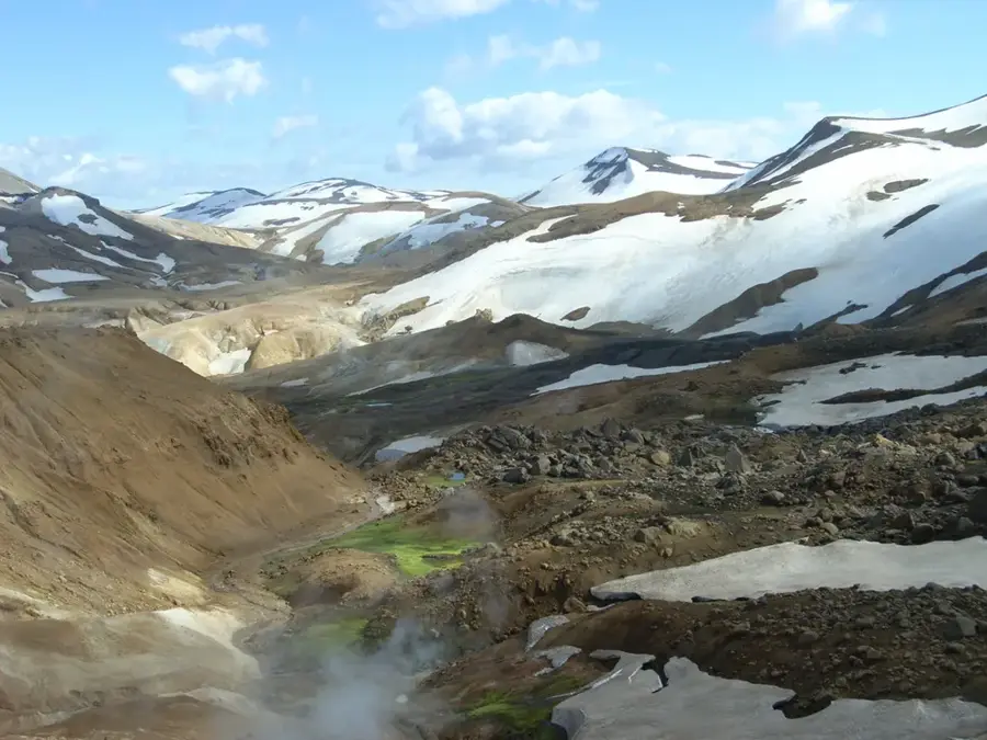
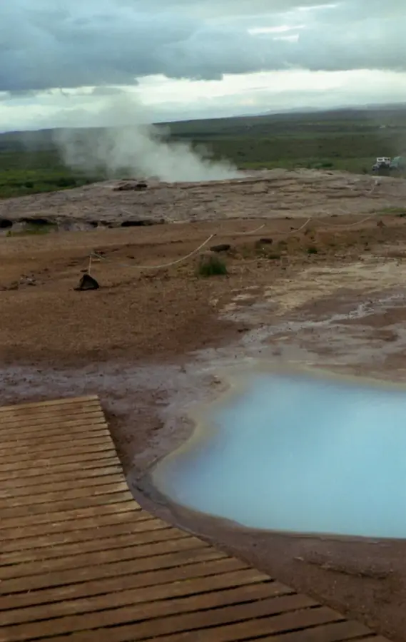
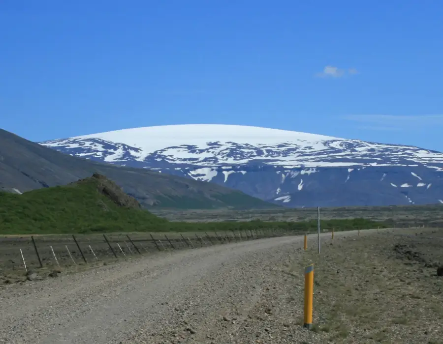
Kerlingarfjöll is a prominent mountain range located in the central Highlands of Iceland, near the Kjölur mountain road and situated between the Hofsjökull and Langjökull glaciers. Part of a large tuya volcano system, the area is renowned for its diverse geological features, including rhyolite mountains that display a striking spectrum of red, yellow, and green hues. The range reaches a maximum elevation of 1,477 meters at the Snækollur peak, offering extensive views over the surrounding arctic wilderness and ice fields. Historically, the area was associated with outlaws and folk legends, specifically the "old woman" who is said to have turned into stone upon witnessing the sunrise. Today, the Hveradalir geothermal area within the mountains serves as one of the most active hot spring regions in the country, featuring bubbling mud pots and intense steam vents. This landscape was shaped by subglacial volcanic activity during the last ice age, leaving behind a complex terrain of ridges and deep valleys. Scientific interest in the region remains high due to its unique mineral compositions and the ongoing tectonic activity. The area was officially designated as a nature reserve in 2017 to protect its delicate geothermal formations and biodiversity.
- Location: Iceland
- Top sights: Kerlingarfjöll · Snækollur · Ögmundur
- Nearby: Landmannalaugar (72 km)
Best time to visit & climate
The most pleasant time to visit is Jun–Aug.
| Jan | Feb | Mar | Apr | May | Jun | Jul | Aug | Sep | Oct | Nov | Dec | |
|---|---|---|---|---|---|---|---|---|---|---|---|---|
| Avg °C | -6 | -6 | -5 | -2 | 0 | 4 | 6 | 5 | 2 | -1 | -4 | -6 |
| Rain mm | 159 | 145 | 142 | 115 | 85 | 77 | 100 | 101 | 158 | 133 | 135 | 163 |
📋 Practical info
Geography
Facts
- The highest peak in the range is Snækollur, standing at 1,477 meters.
- The mountains are primarily composed of colorful rhyolite rock.
- Hveradalir is among the largest and most active geothermal areas in Iceland.
- The name Kerlingarfjöll translates to "Old Woman's Mountains."
- The area was officially designated as a nature reserve in 2017.
- The landscape was significantly shaped by subglacial volcanic activity.
Explore nearby
Notable places around
Route planner — Car & Motorhome
Where do you start? We build the route here, with stops and country notes along the way.
© OpenStreetMap contributors · OpenRouteService
Sights in the town Kerlingarfjöll (3)
Sights nearby
Frequently asked questions
Why are the mountains colorful here?
What is Hveradalir?
Do I need a 4x4?
Is there accommodation available?
Is there snow there in summer?
Kerlingarfjöll: where is it located?
Kerlingarfjöll: what is there to see?
Kerlingarfjöll: when is the best time to visit?
Kerlingarfjöll: why is it worth visiting?

Nearby cities


History & landmarks


Nature
More places