Plizio Visual Lab
Langjökull
Weather…
Water temperature…
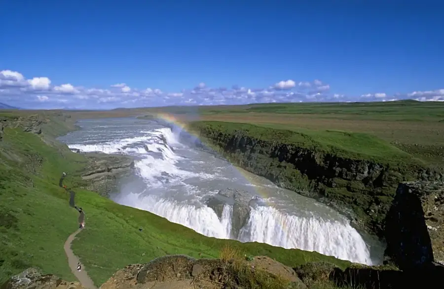
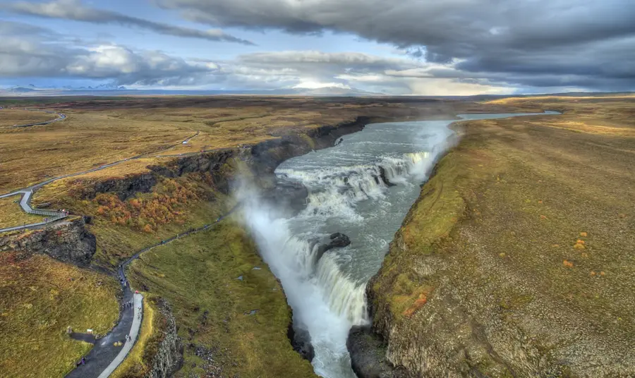
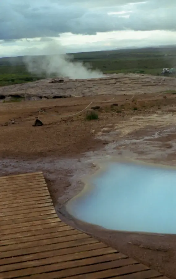
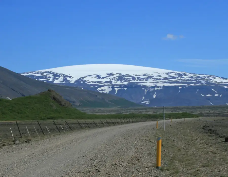
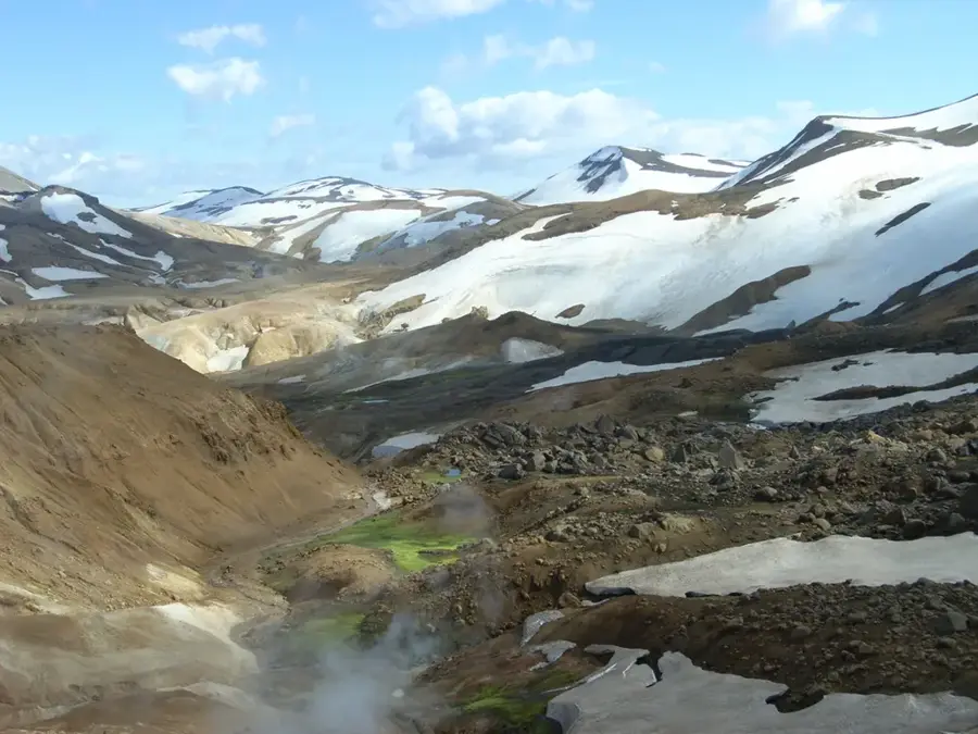
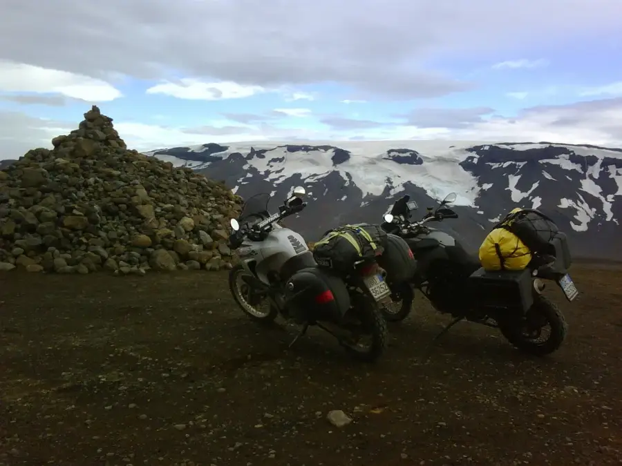
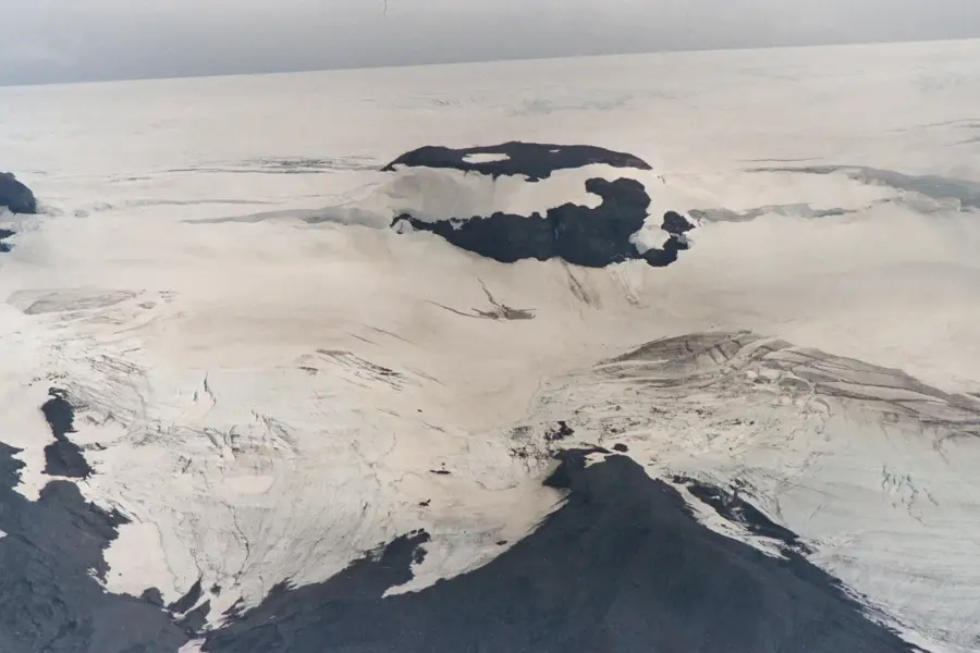
Langjökull is the second largest glacier in Iceland, spanning an area of approximately 950 square kilometers in the western part of the central highlands. Its name translates to 'long glacier', reflecting its elongated shape of about 50 kilometers in length and up to 20 kilometers in width. Beneath the ice cover, there are at least two active volcanic systems, with the Hveravellir area to the east being famous for its geothermal activity. The glacier's highest elevation is around 1,450 meters above sea level at the Péturshorn peak. Langjökull is a significant destination for tourism, particularly known for its man-made ice tunnels that allow visitors to see the interior of the glacier. Meltwaters from the glacier feed important rivers such as the Hvítá, which creates the world-famous Gullfoss waterfall. Scientific studies warn that Langjökull could completely disappear within the next 150 years due to global warming. Monitoring its mass balance is therefore a key component of Icelandic climate research.
- Location: Iceland
- Nearby: Laugarvatn (69 km)
Best time to visit & climate
The most pleasant time to visit is Jun–Aug.
| Jan | Feb | Mar | Apr | May | Jun | Jul | Aug | Sep | Oct | Nov | Dec | |
|---|---|---|---|---|---|---|---|---|---|---|---|---|
| Avg °C | -6 | -6 | -5 | -2 | 1 | 5 | 8 | 6 | 3 | -1 | -5 | -6 |
| Rain mm | 129 | 118 | 117 | 102 | 81 | 73 | 98 | 97 | 138 | 121 | 118 | 133 |
📋 Practical info
Geography
Facts
- Covers about 950 km², second only to Vatnajökull in size.
- Measures roughly 50 km long and up to 20 km wide.
- Associated with the active Hveravellir geothermal area.
- Feeds the Hvítá river, which flows into Gullfoss waterfall.
- Home to man-made ice tunnels for tourism and research.
- Predicted to disappear entirely within the next 150 years.
Explore nearby
Notable places around
Route planner — Car & Motorhome
Where do you start? We build the route here, with stops and country notes along the way.
© OpenStreetMap contributors · OpenRouteService
Sights nearby
Frequently asked questions
Why is Langjökull so popular?
What is the 'Into the Glacier' project?
What kind of tours start here?
What does the name mean?
Can you ski there?
Langjökull: where is it located?
Langjökull: when is the best time to visit?
Langjökull: why is it worth visiting?

Nearby cities


History & landmarks