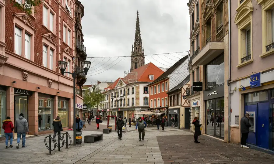
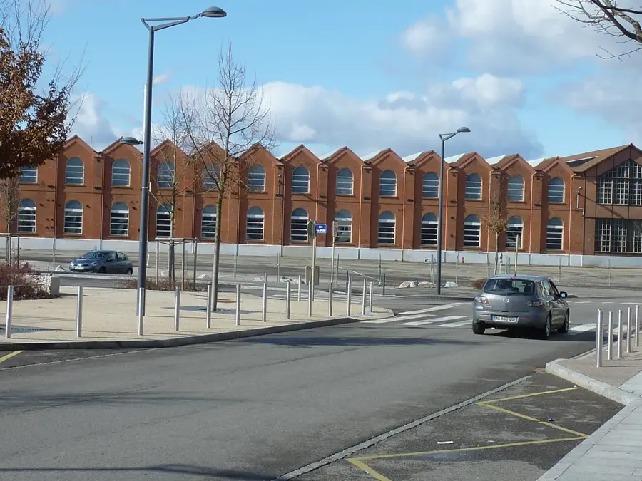
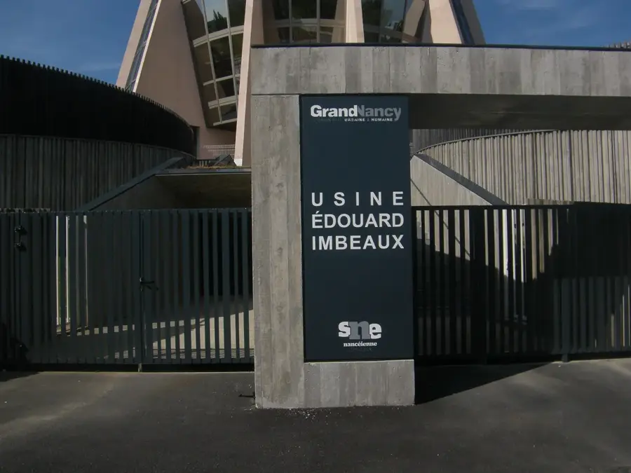
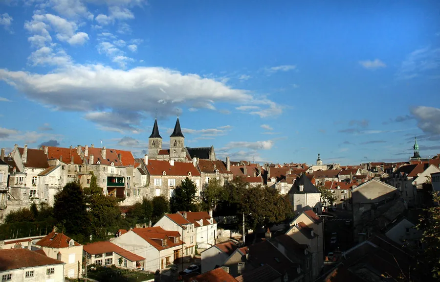
Wittelsheim is situated in southern Alsace within the Haut-Rhin department, and its modern history is inextricably tied to the potash mining industry. In the early 20th century, the discovery of massive underground potash deposits transformed the area into a booming mining basin. The town's architecture is still heavily characterized by the distinctive mining settlements built to house the influx of workers from across Europe. The industrial heritage is carefully preserved at the "Carreau Joseph-Else" historical site, where visitors can see the towering headframes and learn about the grueling conditions faced by the miners. Despite this strong industrial background, Wittelsheim also has plenty of access to nature. The banks of the nearby Thur river and the surrounding local forests provide peaceful trails for walking and cycling. Geographically, the town is perfectly positioned halfway between the major cities of Mulhouse and Colmar. This makes it a quiet, convenient base camp for travelers looking to explore the Alsace Wine Route, the Vosges foothills, or Mulhouse's world-famous automobile museum.
Location: Grand Est, France
Top sights: Carreau Joseph-Else · Saint-Michel Church · Wittelsheim Municipal Park
Nearby: Cernay (5 km)
Population: ~10.645
Best time to visit & climate
The most pleasant time to visit is Jun–Aug.
Jan
Feb
Mar
Apr
May
Jun
Jul
Aug
Sep
Oct
Nov
Dec
Avg °C
0
1
4
9
13
17
18
18
14
10
4
1
Rain mm
78
63
69
60
94
83
78
85
67
84
78
90
Live webcam – Wittelsheim
See what it looks like near Wittelsheim right now.
Morschwiller-le-Bas: Lutterbach-A36 à l’entrée de Mulhouse dans le sens Beaune - Mulhouse · 7 km · Open webcam on Windy · Webcams provided by Windy.com
Geography
Population
10,220
Coordinates
47.80530, 7.23750
Facts
Potash was first discovered here in 1904.
The municipal territory covers 23.63 square kilometers.
Elevation ranges from 223 to 273 meters above sea level.
The mining era officially ended with the 2002 closure of Joseph-Else.
Postal code is 68310.
It is the central town of the Canton of Wittelsheim.
Pick weather + travel mode, get a concrete day plan.
09:00→16:034.8 km walk5 places0/5
Day budget: ≈ 12–16 €Entries 14€ · Transport 0€
Start in the city center with a peaceful visit to Saint-Michel Church. Then, enjoy a refreshing walk through the lush pathways of the Municipal Park.
Discover the quiet Chapelle Saint-Jean-Bosco during midday before heading south towards the historical industrial heart of the city.
Spend your afternoon at Carreau Joseph-Else, learning about the mining heritage that defined Wittelsheim for generations.
Finish your walk at Église Notre-Dame-du-Rosaire, soaking in the late afternoon sun before grabbing a hearty Alsatian dinner nearby.
← swipe for more places →
⛪
09:10 · 50'
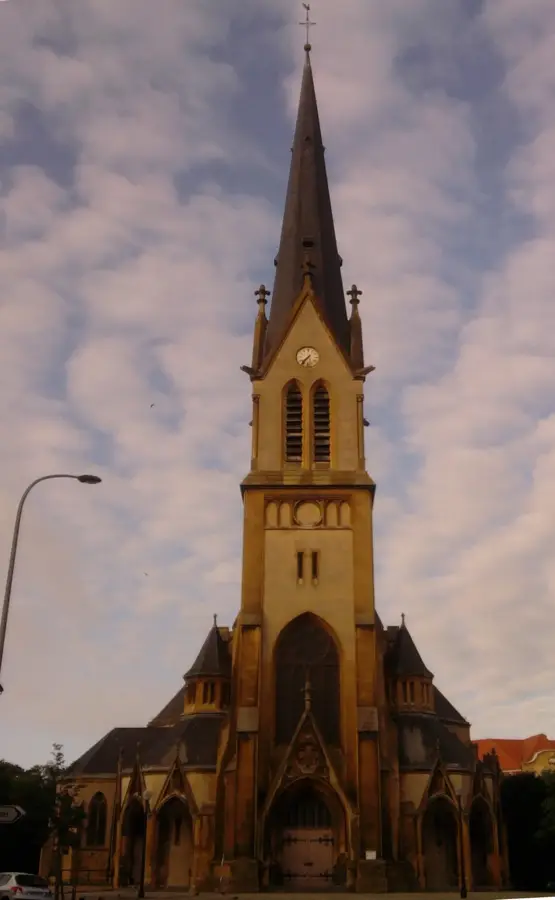
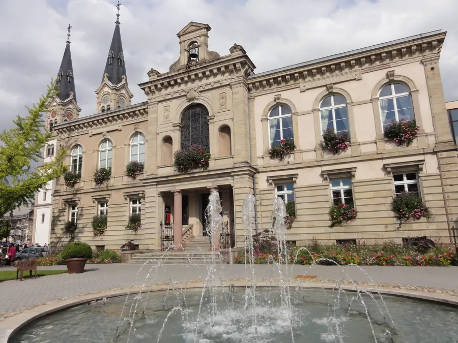
Saint-Michel Church
Admire the beautiful stained glass windows of this central church and find a quiet moment of reflection, as morning light perfectly illuminates the nave.
Explore this preserved mining site to understand Wittelsheim's industrial past, and wear comfortable shoes as the historical grounds are partly unpaved.
Morning showers call for umbrellas, but the nearby churches offer perfect dry sanctuaries. By noon, carefully navigate the wet paths of the municipal park in waterproof boots. During the afternoon, the indoor industrial mining history provides excellent shelter. Conclude the rainy evening reflecting warmly inside the final historic church.
← swipe for more places →
⛪
09:10 · 50'
Saint-Michel Church
Admire the beautiful stained glass and intricate altar from inside, providing a handy, completely dry refuge from the heavy morning rain showers.
The freezing morning demands thick layers for your walk. By noon, the frost sparkles beautifully across the municipal park. During the afternoon, dusk falls early (around 17:00) at the historic mining sites. The dark winter evening finally offers a warming and peaceful refuge inside the softly illuminated churches.
← swipe for more places →
⛪
09:10 · 50'
Saint-Michel Church
Notice the grand historic architecture while stepping inside to quickly warm up your hands and face from the biting morning winter frost outside.
Pedal south in the morning to uncover the rich history at Découverte de la potasse d'Alsace and admire the architecture of Église du Christ-Roi.
Ride to Carreau Joseph-Else during midday for an immersive historical experience, then head towards the center to see Chapelle Saint-Jean-Bosco.
Cycle through the relaxing Municipal Park in the afternoon and stop by Saint-Michel Church to appreciate its beautiful stained glass.
Conclude your ride in the north at Place du Chaperon Rouge, a whimsical spot perfect for unwinding after an active day of cycling.
← swipe for more places →
🏛️
09:10 · 80'
Découverte de la potasse d'Alsace
Immerse yourself in the story of potash mining that shaped the region, and look for the detailed boards explaining complex extraction techniques.
Start your wet morning ride carefully, ensuring you wear bright waterproof gear. By midday, industrial sites and chapels provide welcome indoor shelter from the persistent showers. Afternoon riding requires extreme caution on slippery, leaf-covered streets. Conclude your evening ride safely as the rain continues to fall.
← swipe for more places →
🏛️
09:10 · 80'
Découverte de la potasse d'Alsace
Start by exploring the potassium mining exhibits indoors; it's a great dry spot to prepare your rain gear before the real biking begins.
Bundle up with thermal gear for a freezing morning ride. The midday sun offers little warmth, but historical indoor exhibits let you easily thaw out. Afternoon shadows lengthen quickly, with a very early sunset approaching around 17:00. End your evening ride early to avoid the deep night freeze and icy roads.
← swipe for more places →
🏛️
09:10 · 80'
Découverte de la potasse d'Alsace
Learn about the deep mining history; this heated indoor exhibit is an excellent place to aggressively warm your freezing hands and feet.
Drive in the morning to the northern Église Saint-Gall and Place du Chaperon Rouge, actively exploring the quieter residential neighborhoods.
Head downtown midday to visit Saint-Michel Church, followed by a pleasant stroll in the Municipal Park and a quick stop at Chapelle Saint-Jean-Bosco.
Navigate south in the afternoon to dive deep into Wittelsheim's roots at Carreau Joseph-Else and the fascinating Découverte de la potasse d'Alsace.
Finish your driving tour at Église Notre-Dame-du-Rosaire. Park nearby and enjoy the relaxing evening atmosphere in this historically rich Alsatian town.
← swipe for more places →
⛪
09:10 · 50'
Église Saint-Gall
Marvel at the historical significance and solid structure of this northern church, where the preserved altar provides a deep sense of continuity.
Drive comfortably in the heavy morning rain, easily darting into churches for quick, dry visits. Midday park strolls require a sturdy umbrella and brief stops. Afternoon historic sites are mostly sheltered indoors, keeping you completely dry. Drive carefully in the evening as wet, shimmering roads reflect your headlights.
← swipe for more places →
⛪
09:10 · 50'
Église Saint-Gall
Dash quickly from your parked car to the church entrance to stay perfectly dry while admiring the beautiful rainy morning architecture.
Enjoy heated car seats on this cold winter morning while exploring the religious heritage. Midday park stops are short but beautiful in the heavy frost. As a very early sunset hits around 17:00, enjoy the afternoon indoors at the museums. Evening drives are incredibly cozy under the dark, freezing early night sky.
← swipe for more places →
⛪
09:10 · 50'
Église Saint-Gall
Take advantage of the heated car seats between stops; the church interior has a remarkable, quiet atmosphere on a crisp winter morning.