Plizio Visual Lab
Maanselkä Ridge
Weather…
Water temperature…
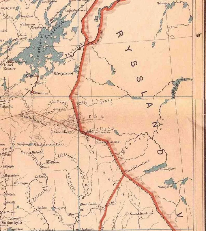
The Maanselkä Ridge serves as a major economic and infrastructural divide in eastern Finland. While the region is sparsely populated, its forests provide timber for the Finnish paper and pulp industry, and the numerous rivers offer hydroelectric power potential. Tourism has grown steadily, with hiking and cross-country skiing attracting visitors to the unspoiled wilderness. The ridge also forms part of the border between Finland and Russia for a stretch, influencing cross-border trade and security policies. In recent decades, reindeer herding by the Sámi people has faced challenges from forestry and tourism, leading to conflicts over land use. The Finnish state owns most of the land, managed by Metsähallitus, which balances conservation and economic use. The area's gravel and sand deposits are extracted for construction.
- Location: Finland
- Nearby: Salla (21 km)
Best time to visit & climate
The most pleasant time to visit is Jun–Aug.
| Jan | Feb | Mar | Apr | May | Jun | Jul | Aug | Sep | Oct | Nov | Dec | |
|---|---|---|---|---|---|---|---|---|---|---|---|---|
| Avg °C | -13 | -13 | -8 | -2 | 5 | 11 | 15 | 12 | 7 | 0 | -6 | -10 |
| Rain mm | 45 | 37 | 41 | 47 | 75 | 87 | 110 | 94 | 81 | 70 | 56 | 52 |
📋 Practical info
Geography
Facts
- The ridge extends 200 km from northwest to southeast.
- Its highest point, Ukonvaara, stands at 412 m.
- The bedrock is Precambrian, over 1.5 billion years old.
- The area is home to about 5,000 reindeer.
- Forest cover exceeds 80% of the region.
- The ridge forms the watershed between the Baltic Sea and the White Sea basins.
Explore nearby
Notable places around
Route planner — Car & Motorhome
Where do you start? We build the route here, with stops and country notes along the way.
© OpenStreetMap contributors · OpenRouteService
Sights nearby
Frequently asked questions
What is Maanselkä?
How high are the hills there?
Can you do multi-day tours there?
What flora is typical?
Are there accommodations nearby?
Maanselkä Ridge: where is it located?
Maanselkä Ridge: when is the best time to visit?
Maanselkä Ridge: why is it worth visiting?

Nearby cities