Plizio Visual Lab
Mossaka Rice Fields

Weather…
Water temperature…
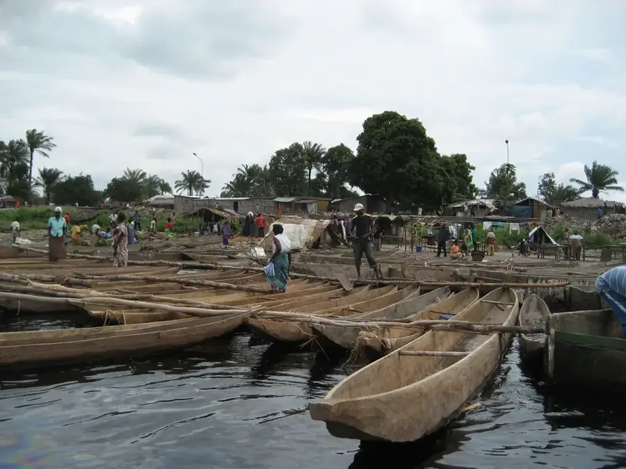
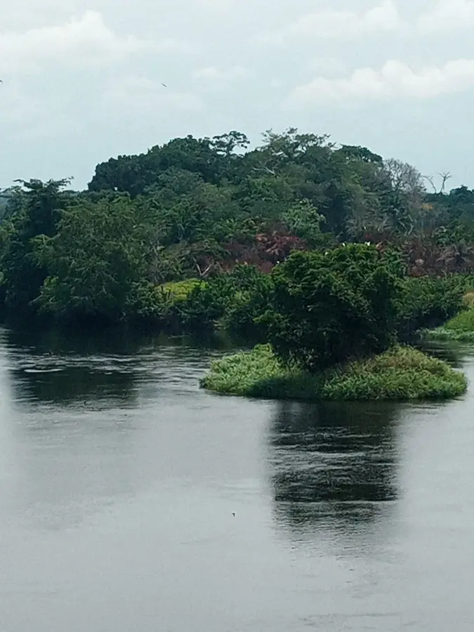
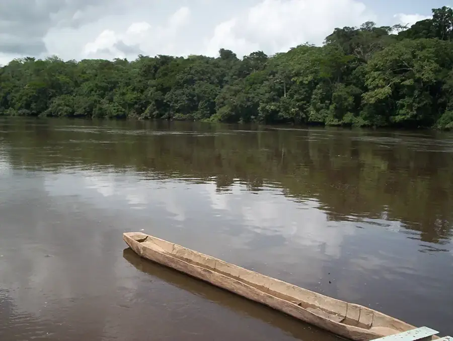
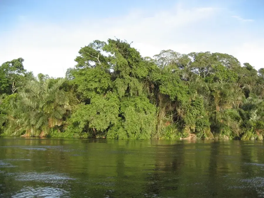
The rice fields of Mossaka are situated in a strategically important aquatic region at the confluence of the Likouala-aux-Herbes and Congo rivers. Traditionally known for its fishing industry, Mossaka has evolved in recent years into a significant center for rice cultivation. The regular flooding of the rivers deposits fertile sediment, which largely eliminates the need for artificial fertilizers. The local population employs traditional farming methods adapted to the seasonal cycles of water levels. Rice has become a vital staple food, strengthening food security within the Cuvette region. The harvest is frequently transported by boat to the capital, Brazzaville, as the river remains the most efficient connection. The fields serve as an example of successful agricultural diversification within Central Africa's wetlands.
- Location: Congo - Brazzaville
- Nearby: Lukolela (18 km)
Best time to visit & climate
The most pleasant time to visit is Jun–Aug.
| Jan | Feb | Mar | Apr | May | Jun | Jul | Aug | Sep | Oct | Nov | Dec | |
|---|---|---|---|---|---|---|---|---|---|---|---|---|
| Avg °C | 26 | 26 | 26 | 26 | 26 | 26 | 27 | 27 | 26 | 25 | 25 | 25 |
| Rain mm | 106 | 142 | 163 | 155 | 147 | 76 | 33 | 71 | 159 | 214 | 202 | 164 |
📋 Practical info
Geography
Facts
- Located at the confluence of two major rivers.
- Hub for rice cultivation in the Cuvette region.
- Utilizes natural sediment fertilization from floods.
- Traditionally a major fishing location.
- Harvest transport is mainly conducted by boat.
- Vital for regional food security.
Explore nearby
Notable places around
Route planner — Car & Motorhome
Where do you start? We build the route here, with stops and country notes along the way.
© OpenStreetMap contributors · OpenRouteService
Sights nearby
Frequently asked questions
Where are the Mossaka rice fields?
How do you get there?
What role does rice cultivation play?
Can the fields be visited?
What is the best time to travel?
Mossaka Rice Fields: where is it located?
Mossaka Rice Fields: when is the best time to visit?
Mossaka Rice Fields: why is it worth visiting?

Nearby cities

History & landmarks
Nature
More places