Plizio Visual Lab
Makoua
ℹ️Practical info — Makoua
▾
🌤 Weather — 5 days
📍 Nearby
Sights nearby
💡 Tips
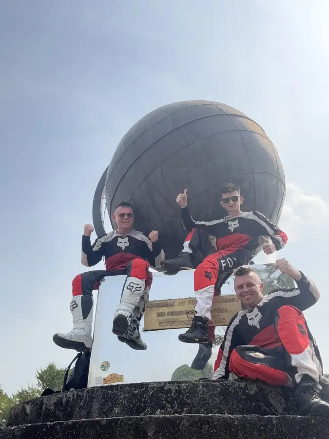
- Visit the Equator monument, a popular photo spot where you can stand with one foot in the Northern and the other in the Southern Hemisphere.
- The market is liveliest in the morning, making it handy for observing local traders.
- The heat can be intense, so schedule your activities for early morning or late afternoon.
- A local guide can help you better understand the trading history of the region.
🍽 Food
A local favorite in downtown restaurants.
A ubiquitous snack along the trading routes.
A filling dish found in local eateries.
🛍 Shopping · 🧘 Quiet spots
Gives a wide range of agricultural products and trade goods.
Look for traditional ceramics at stalls on the outskirts of town.
A peaceful spot away from the bustling center.
Once the tourist buses leave, it becomes very quiet.
Water temperature…
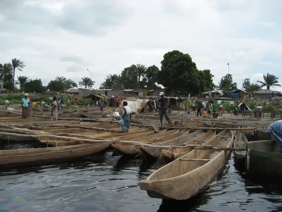
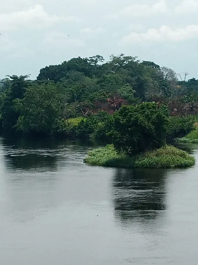
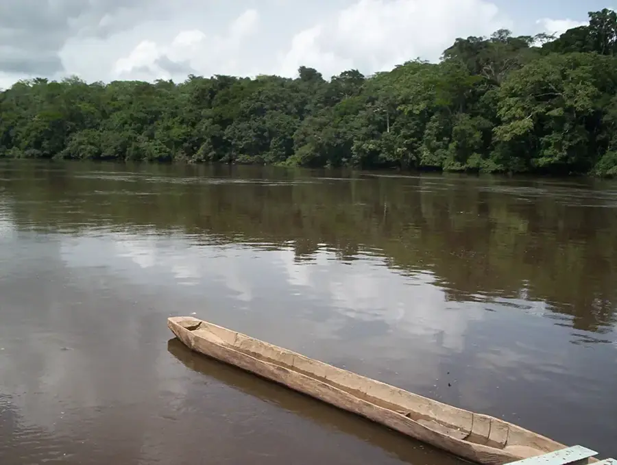
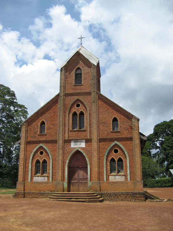
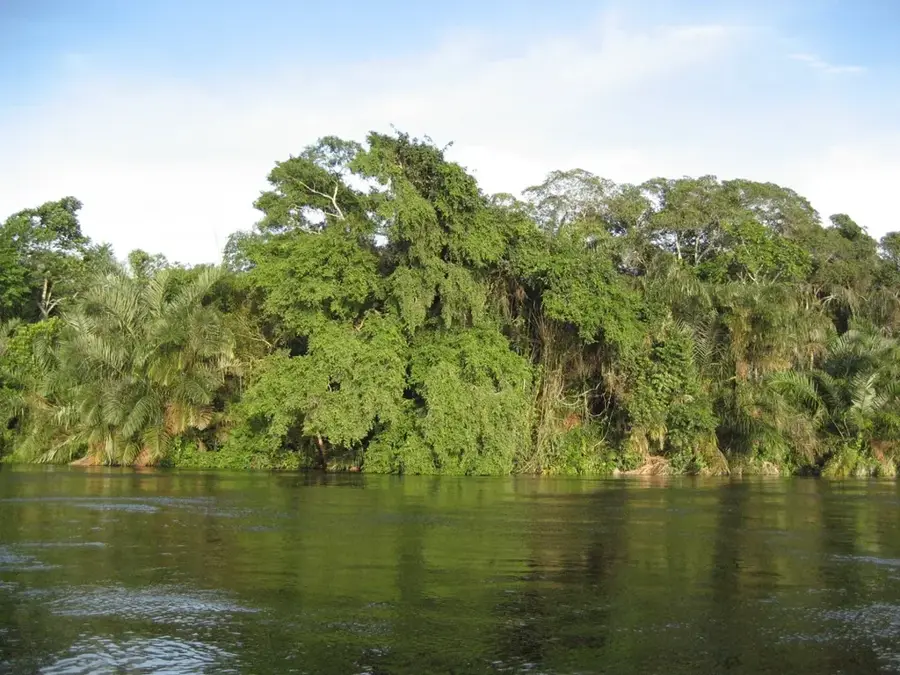
Makoua is a prominent town in the Cuvette Department of northern Republic of the Congo, situated directly on the Equator along the banks of the Likouala River. This unique geographic positioning gives it symbolic significance, often being referred to as the 'heart of Africa.' The town has a long-standing history as a religious and educational center, rooted in the establishment of a Catholic mission in the early 20th century. Today, the local economy is driven by agriculture, river fishing, and the trade of forestry products. Makoua serves as a vital regional transport hub, located on the N2 national highway and featuring its own airport that facilitates access to the north. The surrounding environment is characterized by dense rainforests and rich biodiversity, providing the town with significant potential for ecotourism. Social infrastructure includes schools and hospitals that are indispensable for the rural population of the northern Cuvette region. The town's cultural diversity is reflected in the spirited traditions of its resident ethnic groups.
- Location: Congo - Brazzaville
- Nearby: Owando (59 km)
- Population: ~20.550 (2023)
Best time to visit & climate
The most pleasant time to visit is Jan, Jun, Jul.
| Jan | Feb | Mar | Apr | May | Jun | Jul | Aug | Sep | Oct | Nov | Dec | |
|---|---|---|---|---|---|---|---|---|---|---|---|---|
| Avg °C | 26 | 26 | 26 | 25 | 25 | 25 | 25 | 25 | 25 | 25 | 25 | 25 |
| Rain mm | 87 | 134 | 184 | 165 | 167 | 114 | 63 | 115 | 201 | 247 | 212 | 161 |
Geography
Facts
- The town is geographically situated exactly on the Equator.
- Located on the banks of the Likouala River in northern Congo.
- The local Catholic mission was established as early as 1900.
- Served by Makoua Airport, which carries the IATA code MKJ.
- A major transit point along the N2 national highway to the north.
- Situated at an average elevation of approximately 385 meters.
Explore nearby
Notable places around
Route planner — Car & Motorhome
Where do you start? We build the route here, with stops and country notes along the way.
© OpenStreetMap contributors · OpenRouteService
Sights in the town Makoua (1)
Frequently asked questions
Where is Makoua located?
Which river flows through Makoua?
How is the transport connection?
What is special about the location on the Equator?
Are there hospitals?
Makoua: where is it located?
Makoua: when is the best time to visit?
Makoua: why is it worth visiting?

Nearby cities
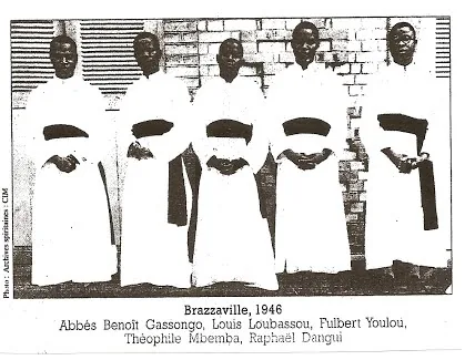

History & landmarks
Nature
More places