Plizio Visual Lab
Ulu Temburong National Park

Weather…
Water temperature…
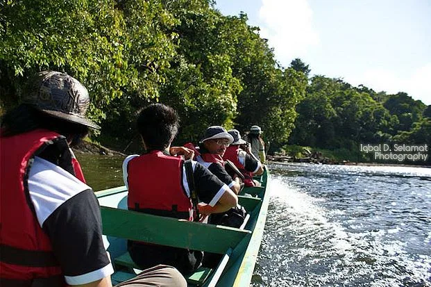
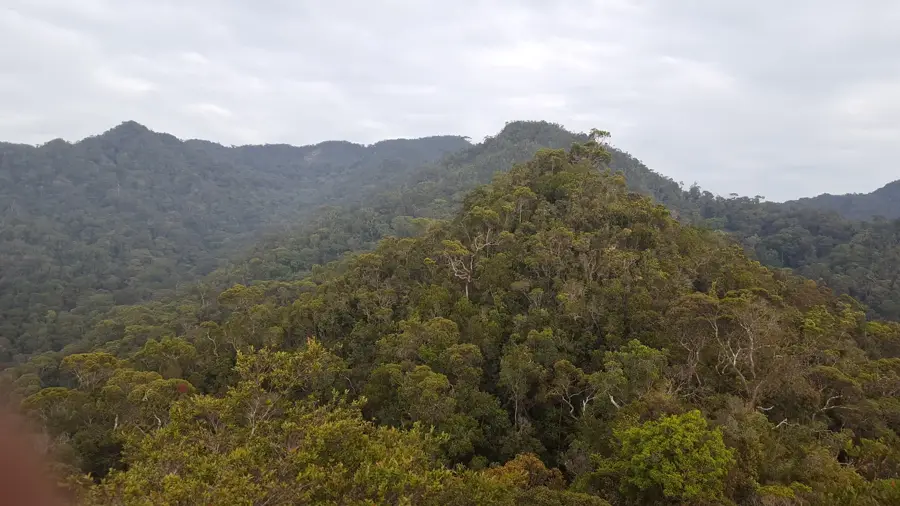
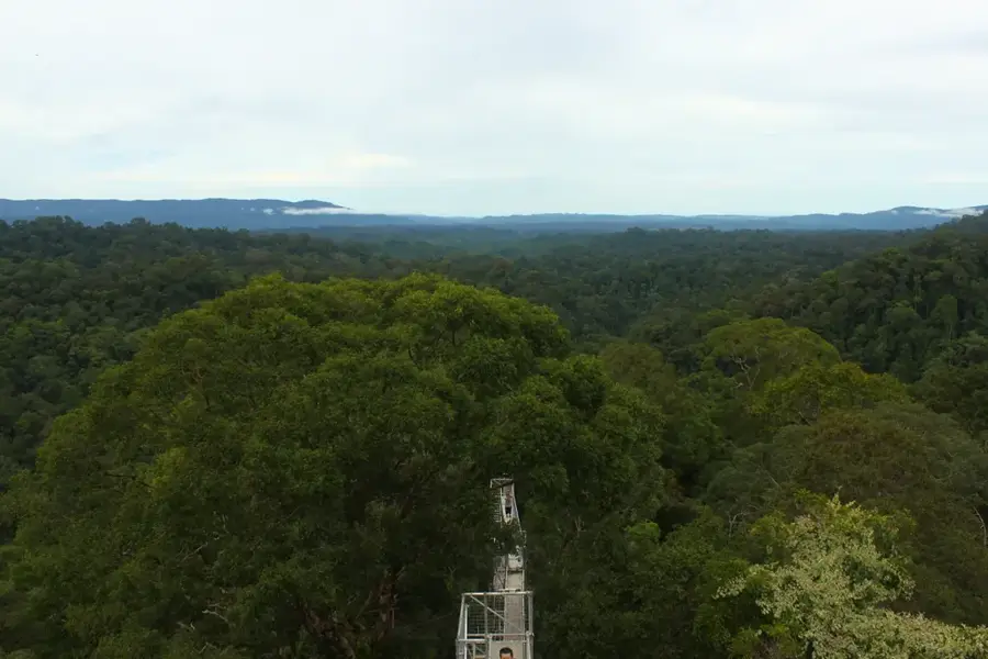
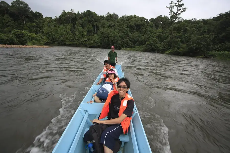
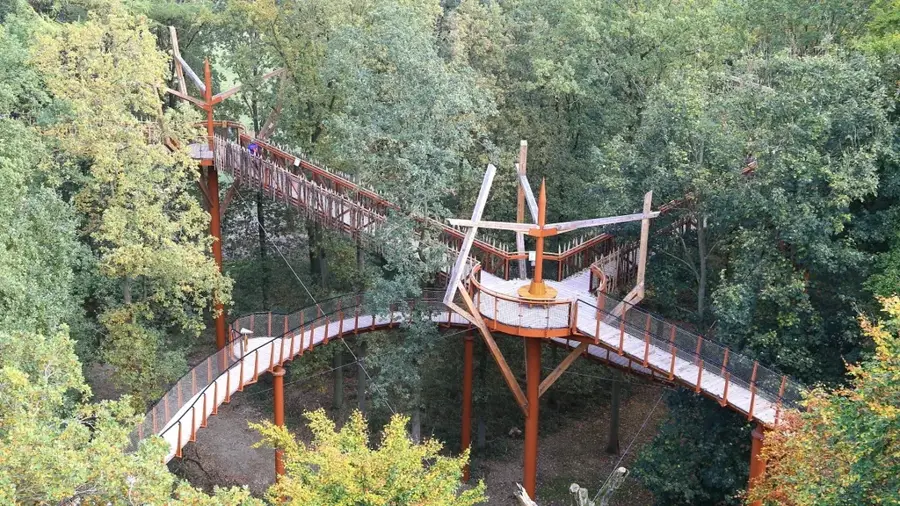
Ulu Temburong National Park is Brunei's first national park, established in 1991 to protect the pristine rainforests within the Temburong District. Spanning over 50,000 hectares, the area is accessible only by boat along the Temburong River, a seclusion that has been instrumental in preserving its ecosystem from large-scale development. A standout feature of the park is its Canopy Walkway, a steel tower and bridge system that allows visitors to walk 60 meters above the forest floor to observe the vertical stratification of the jungle. The park is home to an immense variety of flora and fauna, including rare bird species like hornbills, numerous butterflies, and the iconic proboscis monkeys. Scientific research is a cornerstone of the park's management, particularly through the Belalong Canopy Walkway project focused on biodiversity studies. In addition to the canopy walk, the park gives trails leading to hidden waterfalls and crystal-clear streams. Strict conservation policies permit only regulated tourism to maintain ecological integrity. The park stands as a symbol of Brunei’s commitment to nature conservation and is one of the best-preserved forest areas on the island of Borneo.
- Location: Brunei
- Nearby: Batu Apoi (9 km)
Best time to visit & climate
The most pleasant time to visit is Feb, Mar, Aug.
| Jan | Feb | Mar | Apr | May | Jun | Jul | Aug | Sep | Oct | Nov | Dec | |
|---|---|---|---|---|---|---|---|---|---|---|---|---|
| Avg °C | 25 | 25 | 25 | 26 | 26 | 26 | 25 | 25 | 25 | 25 | 25 | 25 |
| Rain mm | 305 | 161 | 166 | 223 | 242 | 248 | 238 | 224 | 240 | 306 | 315 | 339 |
📋 Practical info
Geography
Facts
- Established in 1991 as the first national park in Brunei.
- Covers an extensive area of over 50,000 hectares.
- The Canopy Walkway is elevated 60 meters above ground.
- Accessible only via traditional longboats called 'temuai'.
- Home to unique wildlife including the proboscis monkey.
- Serves as a global hub for biodiversity and forest research.
Explore nearby
Notable places around
Route planner — Car & Motorhome
Where do you start? We build the route here, with stops and country notes along the way.
© OpenStreetMap contributors · OpenRouteService
Sights nearby
Frequently asked questions
How do you get to the national park?
Is there a canopy walk there?
Do you need a guide?
What clothing is recommended?
Is overnight stay possible?
Ulu Temburong National Park: where is it located?
Ulu Temburong National Park: when is the best time to visit?
Ulu Temburong National Park: why is it worth visiting?

Nearby cities

History & landmarks
Nature

More places