Plizio Visual Lab
Batu Apoi
ℹ️Practical info — Batu Apoi
▾
🌤 Weather — 5 days
📍 Nearby
Sights nearby
💡 Tips
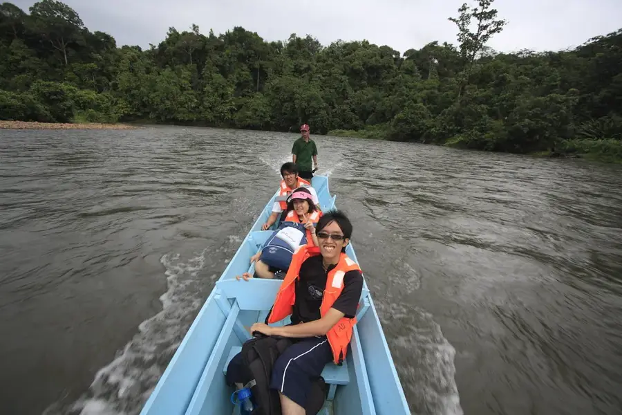
- Batu Apoi is the main jumping-off point for Ulu Temburong National Park; ensure you book your longboat tour in advance.
- There are no ATMs in the village, so bring enough cash from Bandar Seri Begawan or Bangar.
- Wear lightweight, breathable clothing and bring strong insect repellent for the humid jungle environment.
- The area is very quiet in the evenings; embrace the tranquility and the sounds of the surrounding rainforest.
- Respect the pristine environment by taking all your trash back with you to the city.
🍽 Food
Sometimes available at local eateries or arranged by guesthouses, caught fresh from the river.
Try this sticky rice dessert wrapped in Nyirik leaves, a unique local specialty of the district.
Dining options are sparse; rely on small local stalls for Nasi Katok or simple stir-fries.
🛍 Shopping · 🧘 Quiet spots
Occasionally, you can find woven baskets or traditional crafts made by the local Iban community.
Look for wild fruits or local honey sometimes sold by villagers along the roadside.
Sit by the river and listen to the incredible biodiversity of the rainforest right at the village edge.
Take a gentle, self-guided walk on the outskirts of the village to spot birds and butterflies.
Water temperature…
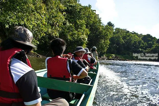
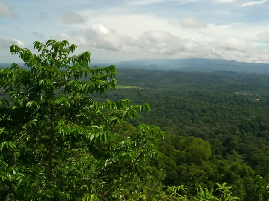
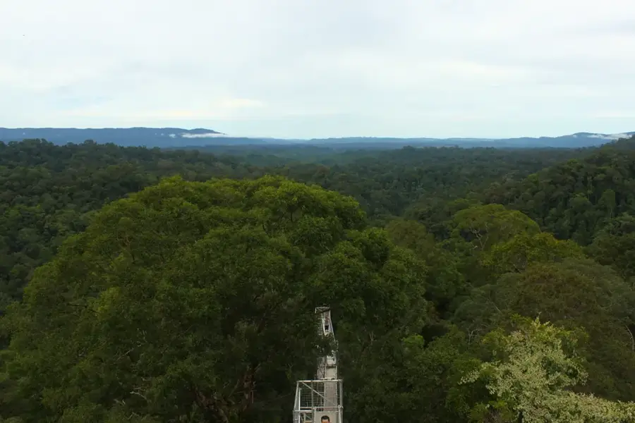
Batu Apoi is an administrative mukim in the Temburong District of Brunei Darussalam, widely recognized as the primary gateway to the Ulu Temburong National Park. The region is named after and bisected by the Batu Apoi River, which serves as a crucial transportation route for the local population living in inland settlements. Geographically, the area is characterized by dense primary rainforests and a rugged, hilly terrain typical of central Borneo. Historically, its remote inland location shielded Batu Apoi from significant industrialization, allowing its natural ecosystems to remain largely intact. The town of Bangar, Temburong's administrative capital, is located nearby and acts as a hub for travelers heading further into the jungle. Various indigenous groups reside within the mukim, maintaining a lifestyle that is deeply interconnected with the surrounding forest and river systems. Batu Apoi is central to Brunei's commitment to sustainable eco-tourism and environmental conservation. Visitors often travel by traditional longboats to navigate the river, which remains the most effective way to experience the area's pristine natural beauty.
- Location: Brunei
- Nearby: Amo (8 km)
Best time to visit & climate
The most pleasant time to visit is Feb, Mar, Aug.
| Jan | Feb | Mar | Apr | May | Jun | Jul | Aug | Sep | Oct | Nov | Dec | |
|---|---|---|---|---|---|---|---|---|---|---|---|---|
| Avg °C | 25 | 25 | 25 | 26 | 26 | 26 | 25 | 25 | 25 | 25 | 25 | 25 |
| Rain mm | 305 | 161 | 166 | 223 | 242 | 248 | 238 | 224 | 240 | 306 | 315 | 339 |
Geography
Facts
- Batu Apoi is an administrative mukim in southeastern Temburong District.
- The Batu Apoi River is the primary waterway for inland transportation.
- The area provides the main access point to the Ulu Temburong National Park.
- Several British Army training camps are located within this rugged region.
- The topography consists of steep ridges and undisturbed primary rainforest.
- Travel to remote settlements is mostly conducted via traditional longboats.
Explore nearby
Notable places around
Route planner — Car & Motorhome
Where do you start? We build the route here, with stops and country notes along the way.
© OpenStreetMap contributors · OpenRouteService
Sights in the town Batu Apoi (1)
Frequently asked questions
Why is Batu Apoi an important hub?
How safe are the boat tours?
Are there restaurants in Batu Apoi?
Can you park there?
What should you bring?
Batu Apoi: where is it located?
Batu Apoi: when is the best time to visit?
Batu Apoi: why is it worth visiting?

Nearby cities

History & landmarks
Nature

More places