Plizio Visual Lab
Labu
ℹ️Practical info — Labu
▾
🌤 Weather — 5 days
📍 Nearby
Sights nearby
💡 Tips
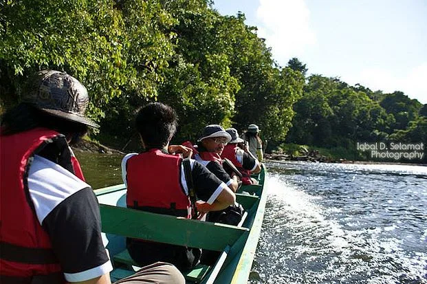
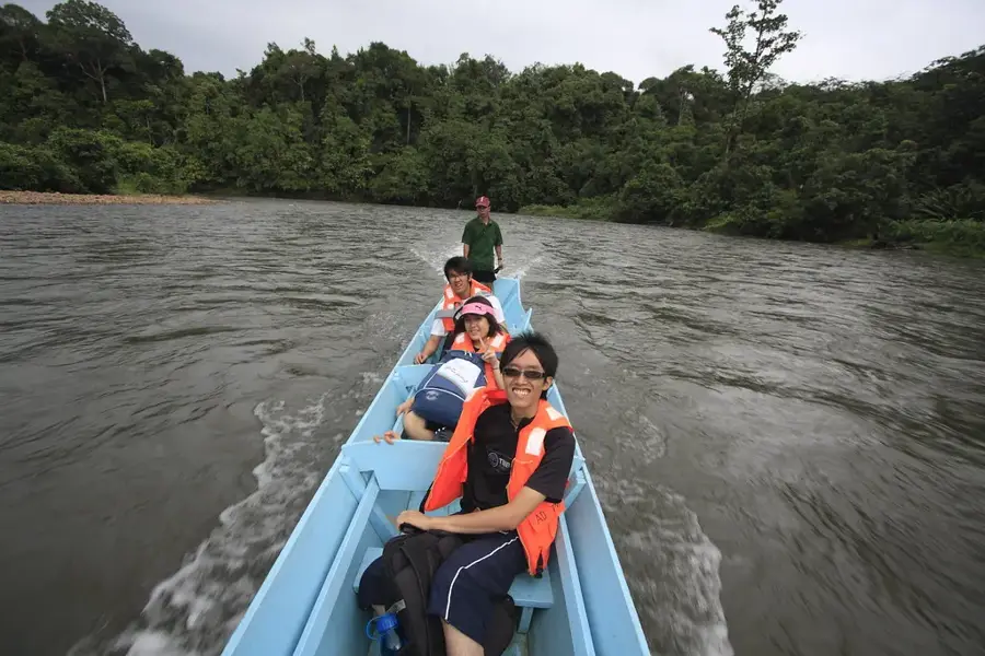
- Take a boat early in the morning to explore the mangroves before it gets too hot.
- Bring insect repellent as mosquitoes are prevalent near the water.
- Arrange transport in advance as local taxis are scarce.
- Wear lightweight, breathable clothing for the tropical humidity.
🍽 Food
Find this local sago dish in small eateries across the district.
Try these at the riverside food stalls for the best catch.
🛍 Shopping · 🧘 Quiet spots
Look out for hand-woven baskets in the small village market.
Buy fresh, local fruits directly from the farmers.
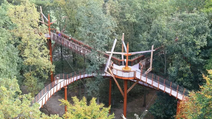
Take a peaceful stroll on the wooden boardwalks through nature.
Great for a small break to observe the local wildlife.
Water temperature…
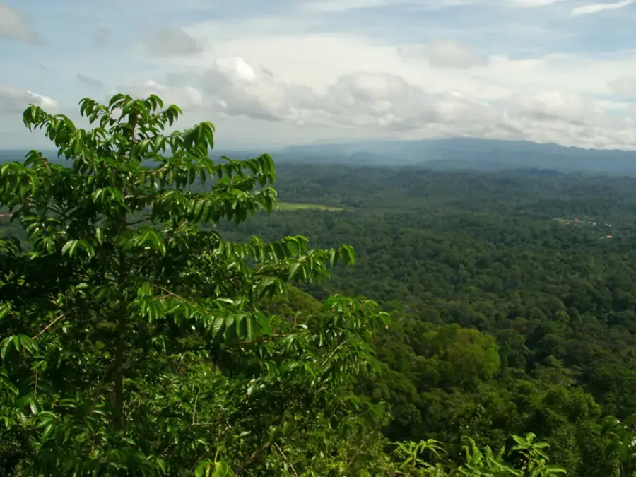
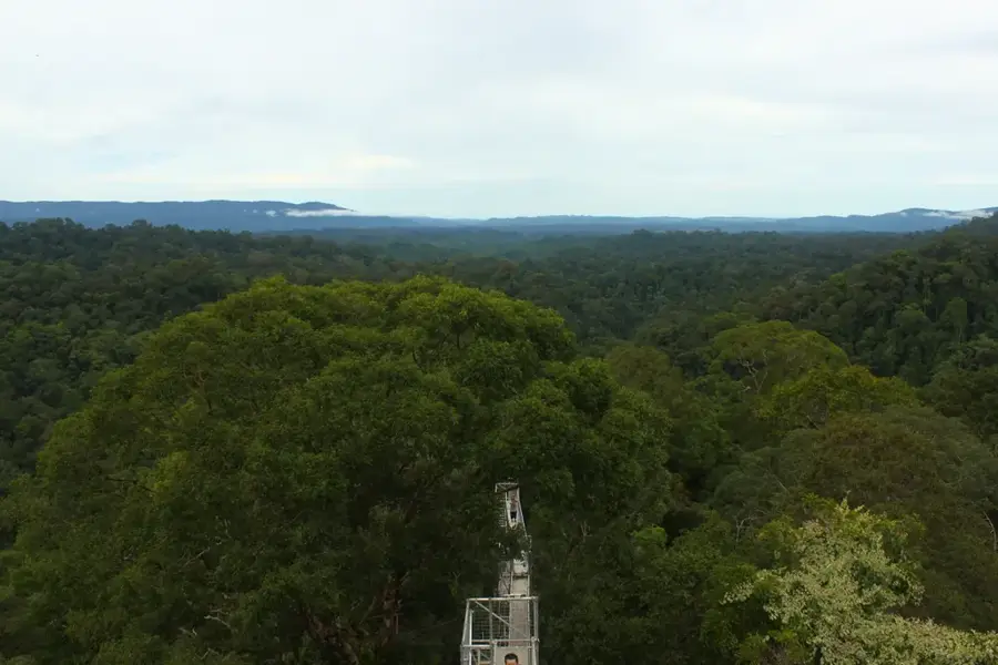
Labu is a significant administrative division (mukim) within the Temburong District, the exclave of Brunei Darussalam. Located in the northeastern part of the country, it shares a direct land border with the Malaysian state of Sarawak. Geographically, Labu is defined by its extensive mangrove forests and the estuary of the Temburong River, making it an ecologically vital area for regional biodiversity. Historically, the region remained relatively isolated and was primarily accessible by water until the completion of the Sultan Haji Omar Ali Saifuddien Bridge in 2020, which integrated the district with mainland Brunei. Labu is home to the Labu Forest Reserve, a protected area that preserves a portion of Borneo's pristine tropical rainforest. The local economy has traditionally relied on subsistence farming and fishing, though eco-tourism has seen growth due to the area's natural landscapes. The settlement pattern consists of small villages known as kampongs, where traditional Malay customs and cultural heritage continue to play a central role in daily life.
- Location: Brunei
- Nearby: Batu Apoi (9 km)
Best time to visit & climate
The most pleasant time to visit is Feb–Apr.
| Jan | Feb | Mar | Apr | May | Jun | Jul | Aug | Sep | Oct | Nov | Dec | |
|---|---|---|---|---|---|---|---|---|---|---|---|---|
| Avg °C | 27 | 27 | 27 | 28 | 28 | 28 | 28 | 28 | 28 | 27 | 27 | 27 |
| Rain mm | 285 | 143 | 155 | 212 | 241 | 258 | 249 | 229 | 253 | 312 | 321 | 333 |
Geography
Facts
- Labu is located in the Temburong District, Brunei's eastern exclave.
- The region borders the Malaysian state of Sarawak to the east and south.
- The Labu Forest Reserve protects large areas of untouched mangrove forest.
- The opening of the Temburong Bridge in 2020 linked the area to the capital.
- Traditional longhouses are still utilized by some communities in the region.
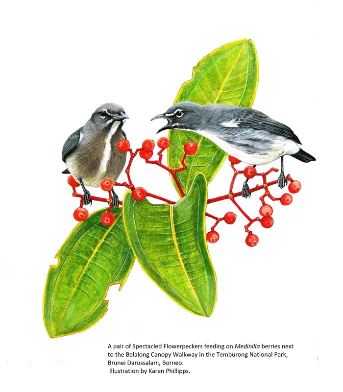
- Local wildlife features proboscis monkeys and various tropical bird species.
Explore nearby
Notable places around
Route planner — Car & Motorhome
Where do you start? We build the route here, with stops and country notes along the way.
© OpenStreetMap contributors · OpenRouteService
Sights in the town Labu (1)
Frequently asked questions
Where exactly is Labu located?
How do you reach Labu?
What is the Labu Forest Reserve?
Are there shops in Labu?
Can you go birdwatching?
Labu: where is it located?
Labu: when is the best time to visit?
Labu: why is it worth visiting?

Nearby cities
History & landmarks
Nature
More places