Plizio Visual Lab
Amo
ℹ️Practical info — Amo
▾
🌤 Weather — 5 days
📍 Nearby
Sights nearby
💡 Tips
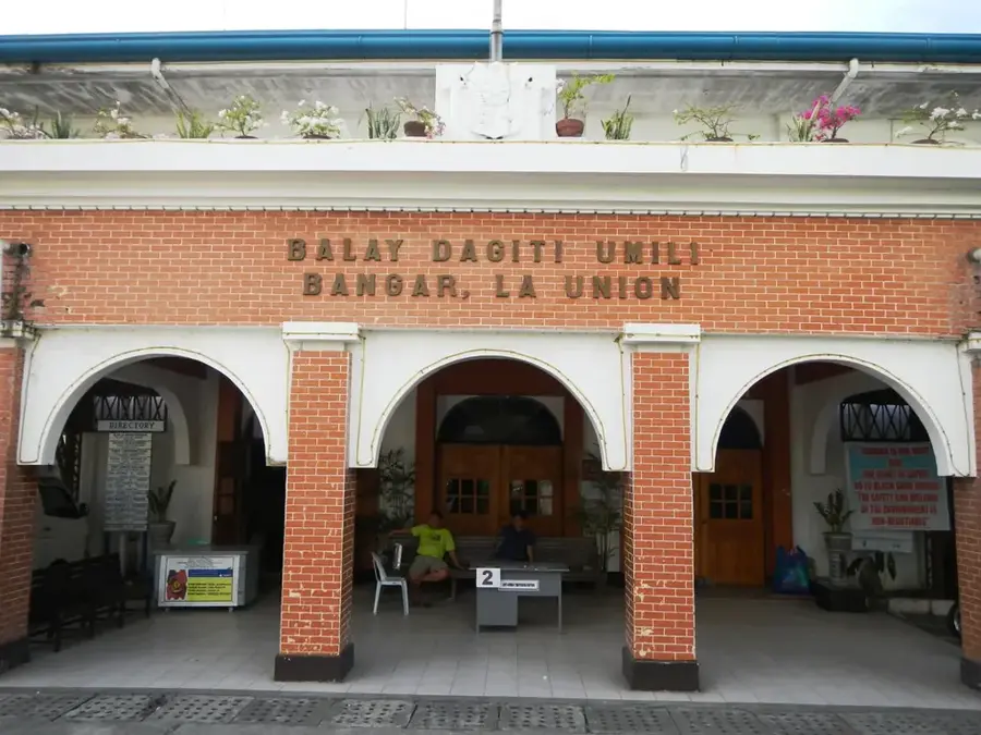
- Arrange a guided tour from Bandar Seri Begawan or Bangar, as independent travel to remote Temburong villages can be challenging.
- Respect local customs by dressing modestly and asking for permission before taking photos of residents.
- Bring sufficient cash with you, as there are no ATMs or card payment options in the village.
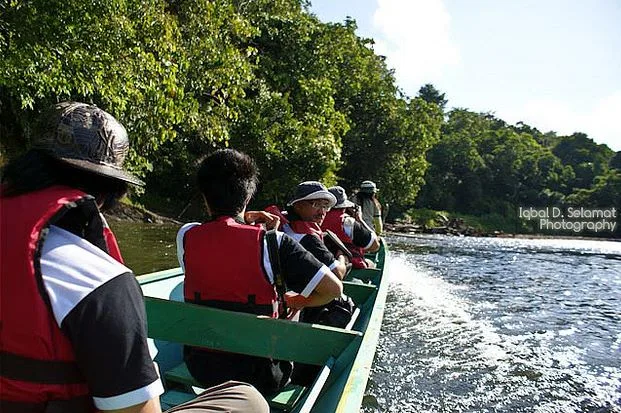
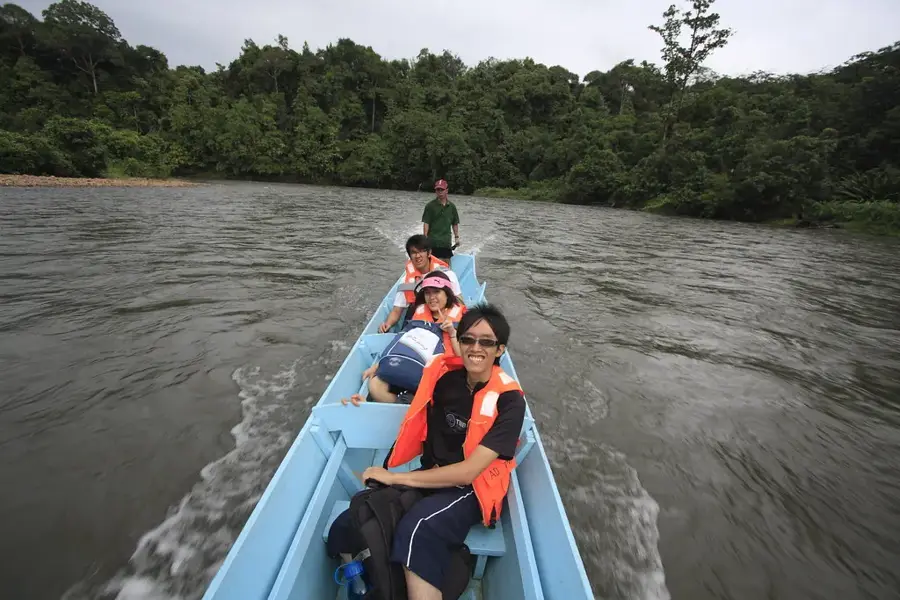
- Travel by traditional longboat (temuai) is often the best way to reach or explore the surrounding river networks.
🍽 Food
A traditional indigenous meal typically served in local community settings or homestays.
Locally caught and traditionally prepared over open fires by the villagers.
Chicken cooked slowly inside a bamboo stalk, offering a unique local flavor.
🛍 Shopping · 🧘 Quiet spots
Made from local jungle materials, buy them directly from the village artisans.
Look for authentic tools and carved items from local woodworkers.
Especially peaceful at dawn when the jungle awakens.
An immersive spot for birdwatching and listening to nature sounds.
Water temperature…
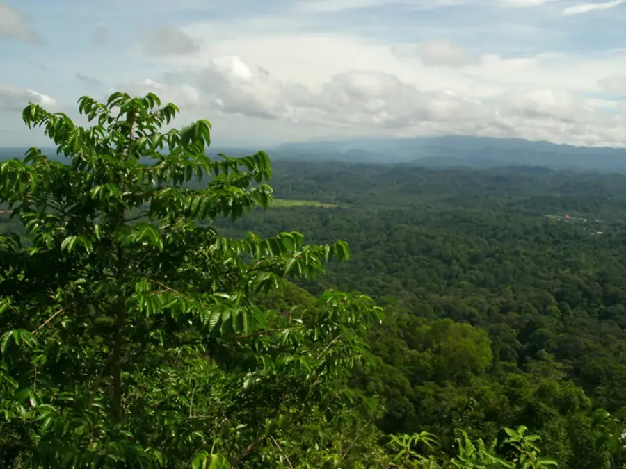
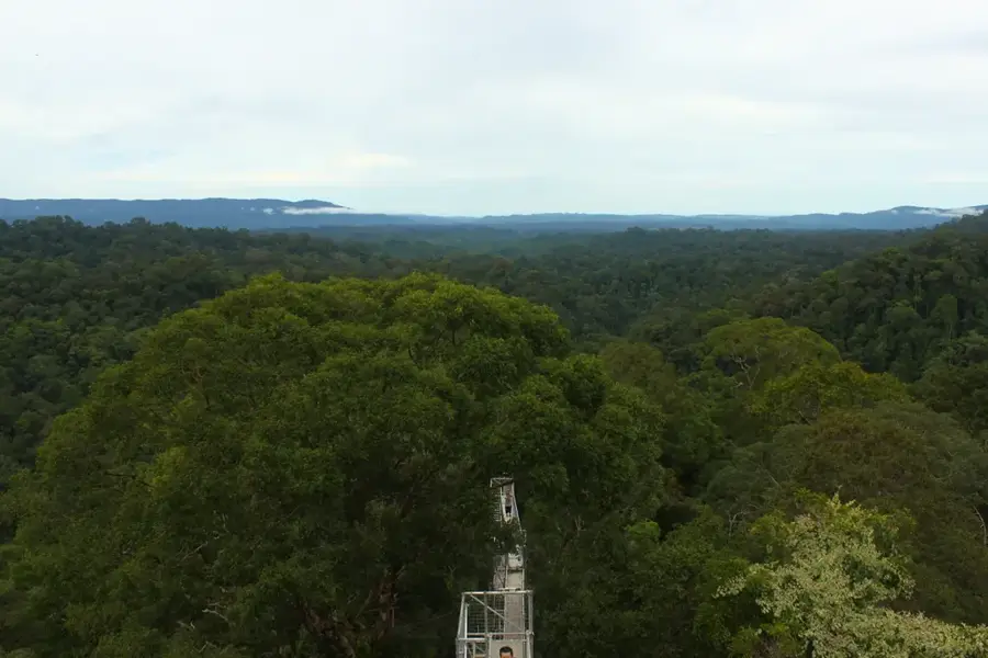
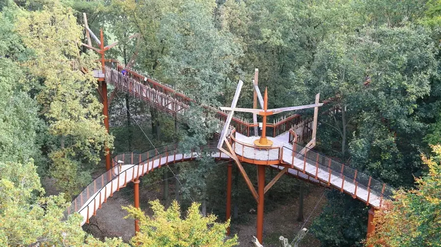
Amo is the southernmost administrative mukim in the Temburong District and contains the majority of the Ulu Temburong National Park, Brunei's premier conservation area. The region is almost entirely covered by undisturbed tropical rainforest and features a mountainous terrain that signals the transition into the central highlands of Borneo. Geographically, Amo is shaped by the upper reaches of the Temburong River, characterized by dramatic rapids and deep river valleys. Historically, the lack of human settlement in this rugged area has preserved one of the most biodiverse ecosystems on Earth. The mukim hosts scientific facilities such as the Kuala Belalong Field Studies Centre, which provides international researchers with a unique environment for studying rainforest ecology. Tourism within Amo is strictly controlled to minimize environmental impact, prioritizing educational experiences and sustainable nature exploration. Access to the interior is primarily via river from Bangar, with traditional 'perahu' longboats being the essential mode of transport. The climate is characterized by high humidity and frequent rainfall, which sustains the lush, dense canopy of the primary jungle.
- Location: Brunei
- Nearby: Batu Apoi (8 km)
Best time to visit & climate
The most pleasant time to visit is Feb, Mar, Aug.
| Jan | Feb | Mar | Apr | May | Jun | Jul | Aug | Sep | Oct | Nov | Dec | |
|---|---|---|---|---|---|---|---|---|---|---|---|---|
| Avg °C | 25 | 25 | 25 | 26 | 26 | 26 | 25 | 25 | 25 | 25 | 25 | 25 |
| Rain mm | 305 | 161 | 166 | 223 | 242 | 248 | 238 | 224 | 240 | 306 | 315 | 339 |
Geography
Facts
- Amo contains the Kuala Belalong Field Studies Centre for ecological research.
- Ulu Temburong National Park covers the vast majority of the mukim's area.
- It is Brunei's largest mukim by land area but has the lowest population density.
- Bukit Belalong, reaching 913 meters, is a major peak in the region.
- The area features an extensive canopy walkway for scientific and tourist use.
- The headwaters of the Temburong River originate in the southern mountains.
Explore nearby
Notable places around
Route planner — Car & Motorhome
Where do you start? We build the route here, with stops and country notes along the way.
© OpenStreetMap contributors · OpenRouteService
Frequently asked questions
How remote is Amo?
What culture can be found in Amo?
Can you visit a longhouse?
Are there hiking trails?
What is the best souvenir?
Amo: where is it located?
Amo: when is the best time to visit?
Amo: why is it worth visiting?

Nearby cities
History & landmarks
Nature
More places