Plizio Visual Lab
Mékrou River

Weather…
Water temperature…
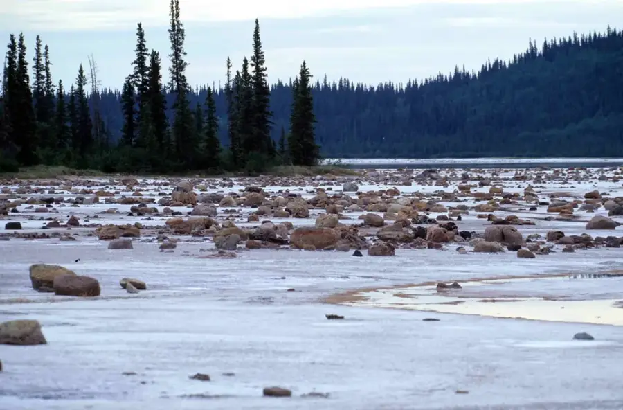
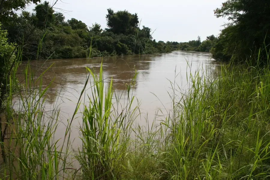
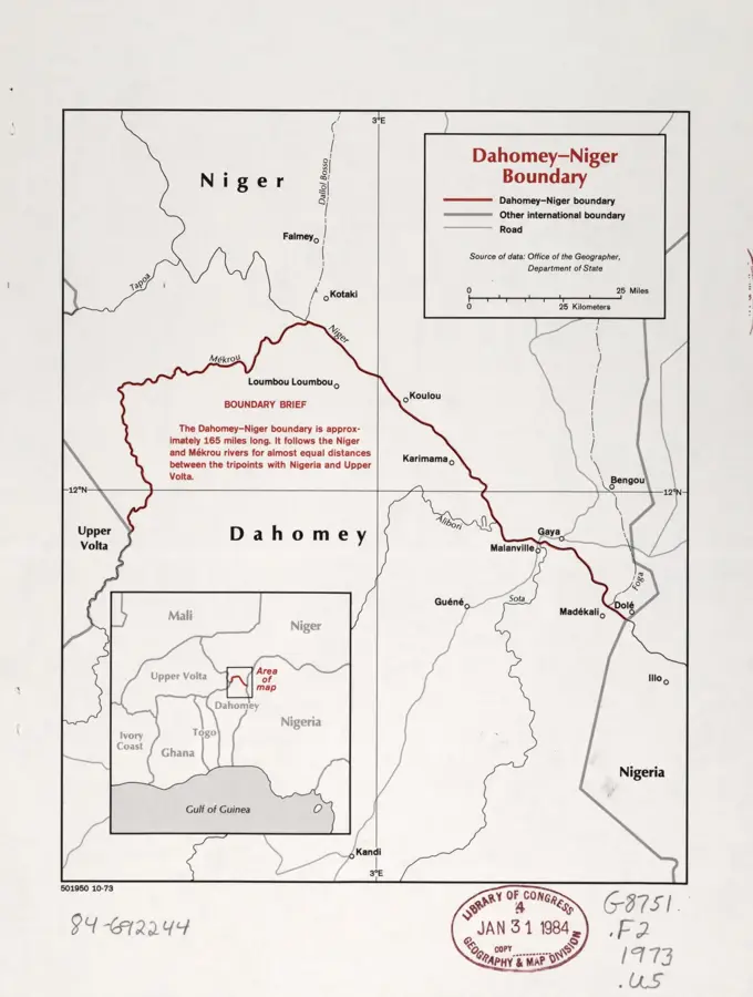
The Mékrou is a major tributary of the Niger River in northern Benin, forming part of the international borders with Burkina Faso and Niger. It originates in the northern foothills of the Atakora Mountains and flows for approximately 410 kilometers toward the northeast. The river is a central component of the W National Park, a transboundary UNESCO World Heritage site, where it forms deep-cut valleys and distinctive rapids such as the Koudou Falls. The landscape along the Mékrou is characterized by pristine savanna and dense gallery forests, providing sanctuary for endangered species like the West African lion. Geographically, the river marks the transition to the Sahelian zone and has remained largely free from human settlement due to its remoteness. During the rainy season, the Mékrou swells into a torrential stream, while in the dry season, it fragments into isolated waterholes. The preservation of this river system is of outstanding importance for West Africa's ecological network. It remains one of the most pristine waterways in the region.
Best time to visit & climate
The most pleasant time to visit is Jan, Nov, Dec.
| Jan | Feb | Mar | Apr | May | Jun | Jul | Aug | Sep | Oct | Nov | Dec | |
|---|---|---|---|---|---|---|---|---|---|---|---|---|
| Avg °C | 24 | 28 | 31 | 34 | 33 | 31 | 28 | 27 | 27 | 28 | 27 | 25 |
| Rain mm | 0 | 0 | 4 | 12 | 45 | 98 | 152 | 218 | 117 | 32 | 1 | 0 |
📋 Practical info
Geography
Facts
- The Mékrou has a total length of approximately 410 km.
- The river forms the border between the W National Park in Benin and in Niger.
- The Koudou Falls are the most famous geological formation on the river.
- The region along the river is one of the last refuges for the West African lion.
- The river is almost entirely seasonal, carrying little water in the dry season.
- Archaeological finds attest to an early human presence in the Mékrou Valley.
Explore nearby
Notable places around
Route planner — Car & Motorhome
Where do you start? We build the route here, with stops and country notes along the way.
© OpenStreetMap contributors · OpenRouteService
Sights nearby
Frequently asked questions
Where does the Mékrou flow?
What landscapes characterize the river course?
Is the river suitable for canoes?
Are there waterfalls on the Mékrou?
When is the best time for a hike along the bank?
Mékrou River: where is it located?
Mékrou River: when is the best time to visit?
Mékrou River: why is it worth visiting?

History & landmarks
Nature
More places