Plizio Visual Lab
Pendjari Plain

Weather…
Water temperature…
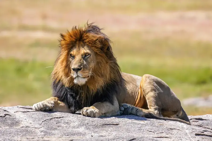
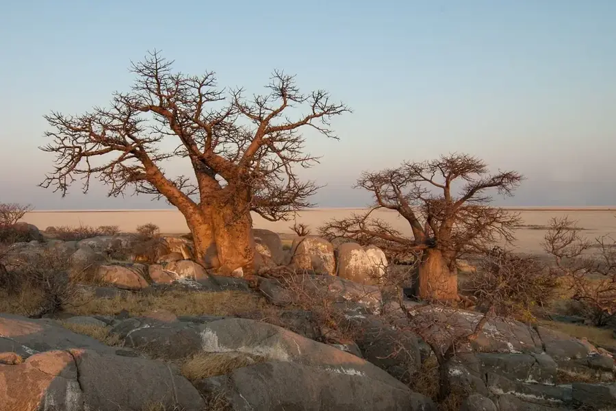
The Pendjari Plain in extreme northern Benin is a vast alluvial plain shaped by the Pendjari River and its seasonal flooding. Situated at an elevation of approximately 150 to 200 meters, it forms the core of the Pendjari National Park, part of the transboundary W-Arly-Pendjari complex. The plain's geology is characterized by sedimentary deposits and sandstones that transform large areas into wetlands during the rainy season. This dynamic is essential for maintaining biodiversity, providing fertile grazing grounds for elephants, buffaloes, and the last West African lions. Vegetation alternates between grass savannas and dense gallery forests along the riverbanks. Climatically, the plain undergoes a severe dry season, during which permanent water holes become vital resources for wildlife. Historically a major hunting ground, the plain was placed under strict nature conservation in 1961 to secure one of West Africa's most significant wildlife sanctuaries.
Best time to visit & climate
The most pleasant time to visit is Jan, Nov, Dec.
| Jan | Feb | Mar | Apr | May | Jun | Jul | Aug | Sep | Oct | Nov | Dec | |
|---|---|---|---|---|---|---|---|---|---|---|---|---|
| Avg °C | 25 | 28 | 31 | 31 | 30 | 28 | 26 | 26 | 26 | 27 | 27 | 25 |
| Rain mm | 1 | 4 | 10 | 56 | 100 | 156 | 220 | 268 | 197 | 83 | 6 | 0 |
📋 Practical info
Geography
Facts
- Part of the UNESCO Pendjari Biosphere Reserve
- Elevation between 150 and 200 meters
- Shaped by seasonal Pendjari River flooding
- One of the last sanctuaries for West African lions
- Consists predominantly of grass savannas
- Directly borders Burkina Faso
Explore nearby
Notable places around
Route planner — Car & Motorhome
Where do you start? We build the route here, with stops and country notes along the way.
© OpenStreetMap contributors · OpenRouteService
Sights nearby
Frequently asked questions
What can you see in Pendjari Plain?
Do I need a 4WD car?
Is the plain open all year?
Are there guided safaris?
What is the temperature like?
Pendjari Plain: where is it located?
Pendjari Plain: when is the best time to visit?
Pendjari Plain: why is it worth visiting?

Nearby cities
History & landmarks
Nature
More places