Plizio Visual Lab
Hadhramaut Plateau

Weather…
Water temperature…
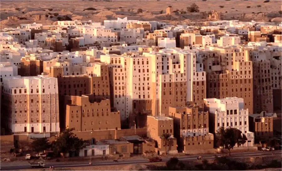
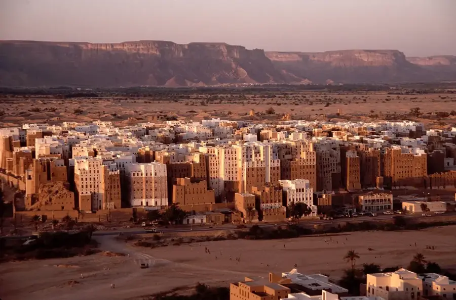
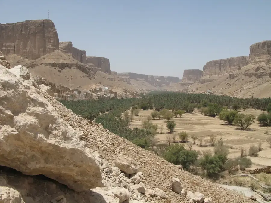
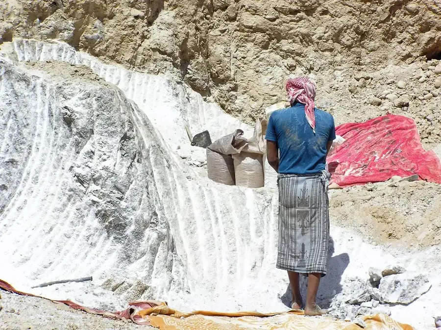
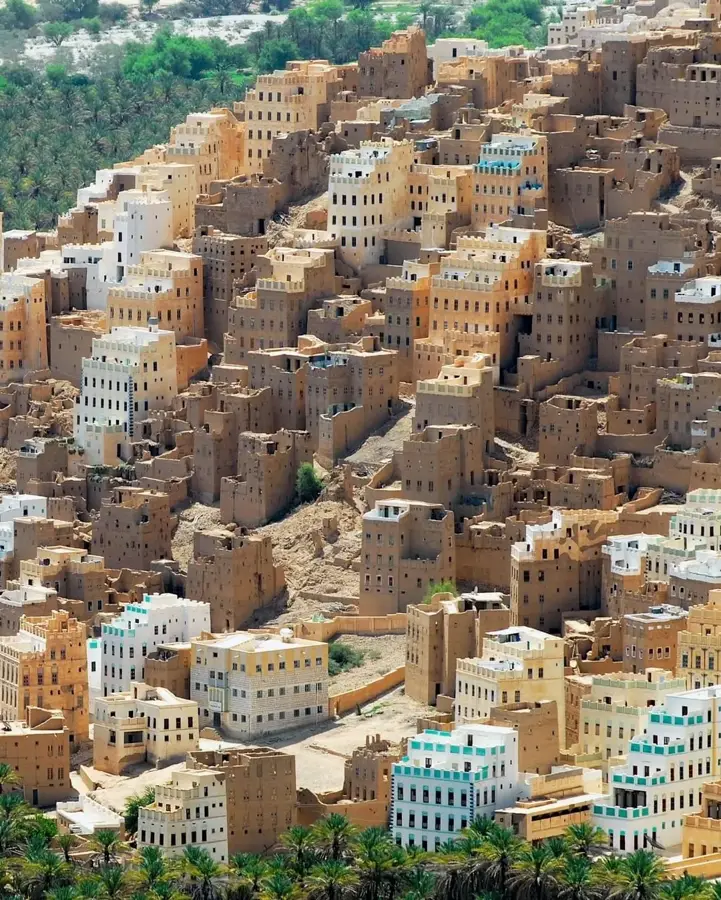
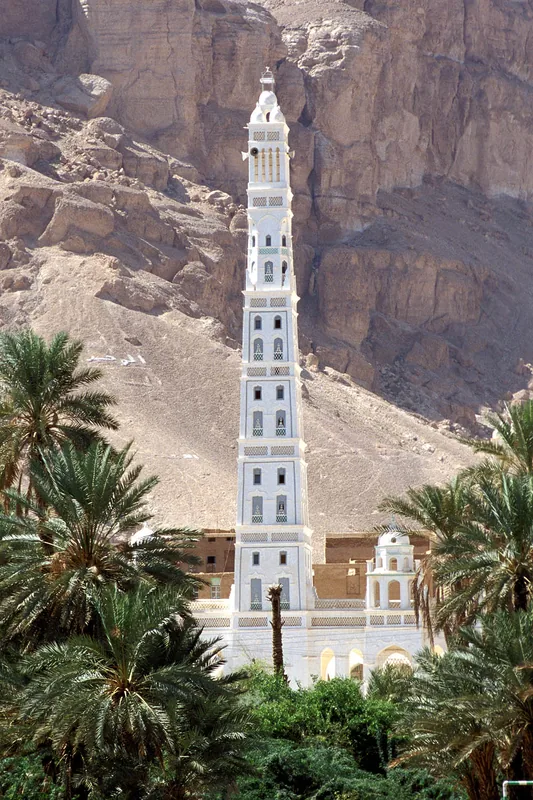
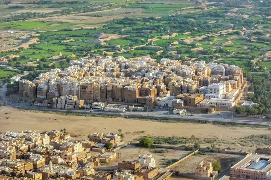
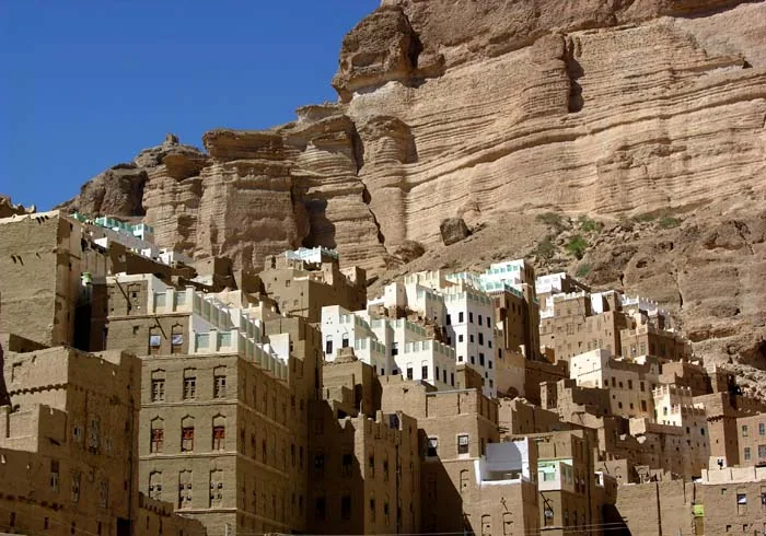
The Hadhramaut Plateau in eastern Yemen is a vast, arid upland dissected by deep erosional canyons and wide wadis into a complex geographical system. Averaging 1,000 meters above sea level, the plateau is primarily composed of Mesozoic limestone, creating a barren yet sweeping desert landscape. Its most defining feature is Wadi Hadhramaut, the largest dry river valley on the Arabian Peninsula, which slices through the plateau and hosts fertile oases with millennia of human settlement. Historically, the region was a pivotal center for the frankincense trade and home to significant ancient kingdoms that amassed wealth by controlling caravan routes. The region's architecture is world-famous for its multi-story mud-brick buildings, particularly in the city of Shibam, often dubbed the 'Manhattan of the Desert.' The plateau itself is sparsely populated but serves as home to Bedouin communities perfectly adapted to its extreme conditions. Geologically, the area is characterized by sharp escarpments and flat-topped mountains known as 'jols,' formed by tectonic uplift. The climate is extremely arid, with scorching days and cold nights, restricting vegetation to hardy thorn bushes. The Hadhramaut Plateau remains a place of deep cultural mysticism and historical importance, shaping the identity of eastern Yemen.
- Location: Yemen
- Nearby: Seiyun (32 km)
Best time to visit & climate
The most pleasant time to visit is Feb, Mar, Nov.
| Jan | Feb | Mar | Apr | May | Jun | Jul | Aug | Sep | Oct | Nov | Dec | |
|---|---|---|---|---|---|---|---|---|---|---|---|---|
| Avg °C | 18 | 20 | 23 | 26 | 29 | 31 | 32 | 32 | 30 | 25 | 21 | 18 |
| Rain mm | 0 | 0 | 2 | 2 | 0 | 0 | 1 | 3 | 0 | 0 | 2 | 0 |
📋 Practical info
Geography
Facts
- The plateau covers an area of approximately 100,000 square kilometers.
- The main Wadi Hadhramaut stretches for more than 600 kilometers.
- Shibam was built with mud-brick skyscrapers up to 8 stories high in the 16th century.
- The region was the heartland of the ancient Kingdom of Hadhramaut.
- Annual rainfall on the plateau often totals less than 100 mm.
- The 'jols' are geologically composed of Eocene and Cretaceous limestone.
Explore nearby
Notable places around
Route planner — Car & Motorhome
Where do you start? We build the route here, with stops and country notes along the way.
© OpenStreetMap contributors · OpenRouteService
Sights nearby
Frequently asked questions
What is the Hadhramaut Plateau known for?
Is the plateau safe for tourists?
When is the best time to visit the plateau?
Is there a visitor center there?
What can you visit nearby?
Hadhramaut Plateau: where is it located?
Hadhramaut Plateau: when is the best time to visit?
Hadhramaut Plateau: why is it worth visiting?

Nearby cities
History & landmarks
Nature
More places