Plizio Visual Lab
Polissian Upland
Weather…
Water temperature…
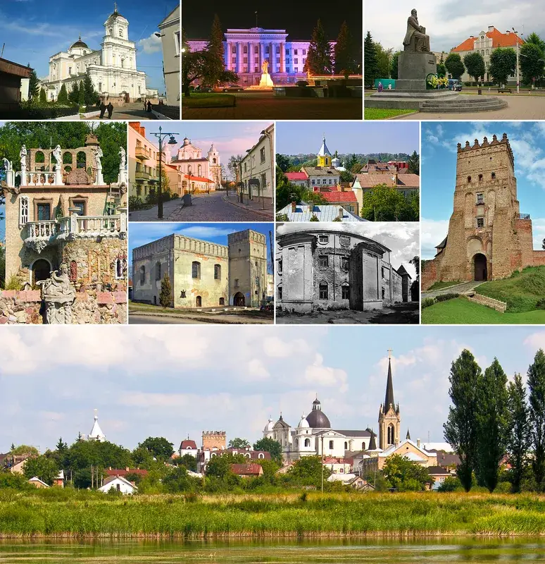
The Polissian Upland extends across northern Ukraine, representing the southern fringe of the vast East European Plain. Geomorphologically, it is characterized by a gently undulating landscape shaped by Pleistocene glacial deposits and subsequent fluvial erosion from major rivers like the Dnieper and Pripyat. The region is notable for its extensive wetlands, dense coniferous and mixed forests, and a multitude of lakes that form a complex hydrological network. Historically, the upland's inaccessible marshes provided sanctuary for various cultures and served as a strategic base for partisan movements during World War II. The soils are predominantly sandy and nutrient-poor, which restricts intensive farming but supports a robust forestry industry. Today, the area is ecologically sensitive, particularly following the Chernobyl nuclear disaster which directly impacted the eastern sectors of the upland. Despite this, it remains one of Eastern Europe's most significant reservoirs for biological diversity.
- Location: Ukraine
- Nearby: Korosten (24 km)
Best time to visit & climate
The most pleasant time to visit is Jun–Aug.
| Jan | Feb | Mar | Apr | May | Jun | Jul | Aug | Sep | Oct | Nov | Dec | |
|---|---|---|---|---|---|---|---|---|---|---|---|---|
| Avg °C | -6 | -5 | 1 | 8 | 15 | 19 | 21 | 21 | 15 | 8 | 2 | -4 |
| Rain mm | 44 | 41 | 47 | 45 | 73 | 78 | 81 | 56 | 47 | 53 | 46 | 47 |
📋 Practical info
Geography
Facts
- Average elevations in the upland range from 150 to 200 meters.
- The Pripyat River serves as the primary drainage system for the area.
- The geological basement consists of the Ukrainian Crystalline Shield.
- Home to the Polissia Nature Reserve, founded in 1968.
- Approximately 20% of Ukraine's total forest cover is located here.
- The landscape was significantly altered during the Riss glaciation.
Explore nearby
Notable places around
Route planner — Car & Motorhome
Where do you start? We build the route here, with stops and country notes along the way.
© OpenStreetMap contributors · OpenRouteService
Sights nearby
Frequently asked questions
Where is the Polissia Upland located?
What are the most distinctive features of this landscape?
Are there national parks in the area?
Is the region developed for tourism?
What is the climate like in the Polissia Upland?
Polissian Upland: where is it located?
Polissian Upland: when is the best time to visit?
Polissian Upland: why is it worth visiting?

Nearby cities