Plizio Visual Lab
Bogou
ℹ️Practical info — Bogou
▾
🌤 Weather — 5 days
📍 Nearby
Sights nearby
💡 Tips
- Wear sturdy walking shoes, as exploring the table mountains and accessing the caves involves rocky and uneven terrain.
- Bring a good flashlight or headlamp if you plan to venture inside the caves.
- Hire a local guide from the village; they are essential for finding the ancient rock paintings and safely navigating the trails.
- Start your treks very early in the morning to enjoy the scenery before the afternoon heat peaks.
🍽 Food
The staple cornmeal or yam dough, widely served with a spicy vegetable or peanut sauce at local homes and small eateries.
A local specialty found in small roadside spots, heavily spiced and roasted over an open fire.
A traditional, naturally fermented sorghum or millet beer brewed locally and consumed from a calabash.
🛍 Shopping · 🧘 Quiet spots
Purchase unique, hand-fired clay pots made by local village artisans using age-old techniques.
Sturdy and colorful baskets woven from local grasses, great as authentic souvenirs.
Sit quietly near the cool, shaded mouths of the caves and enjoy the expansive views of the valley below.
Find a safe, flat spot on the plateaus at sunset for an uninterrupted and deeply peaceful panorama.
Water temperature…
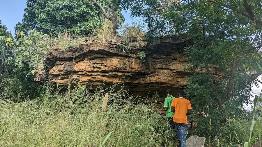
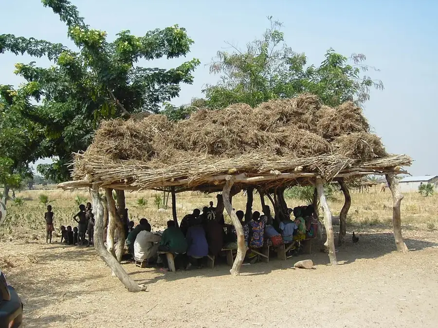
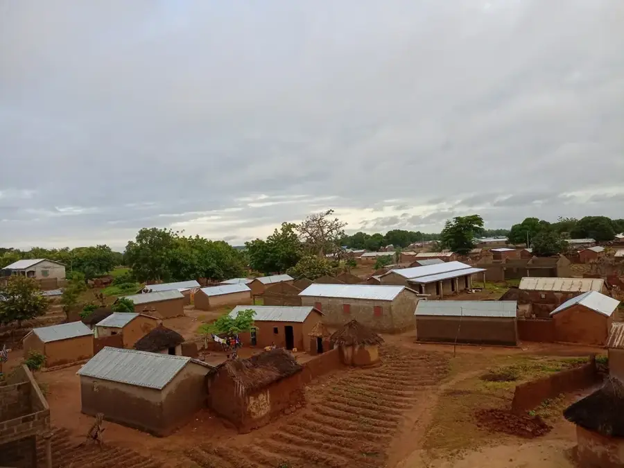
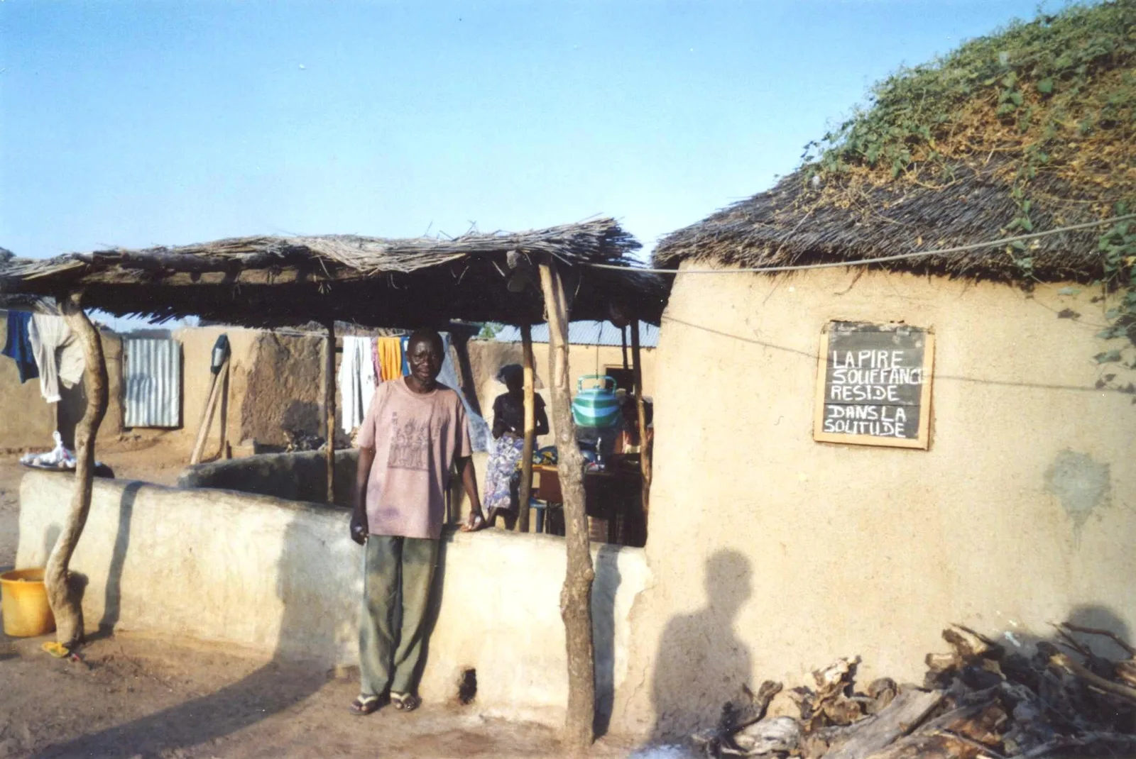
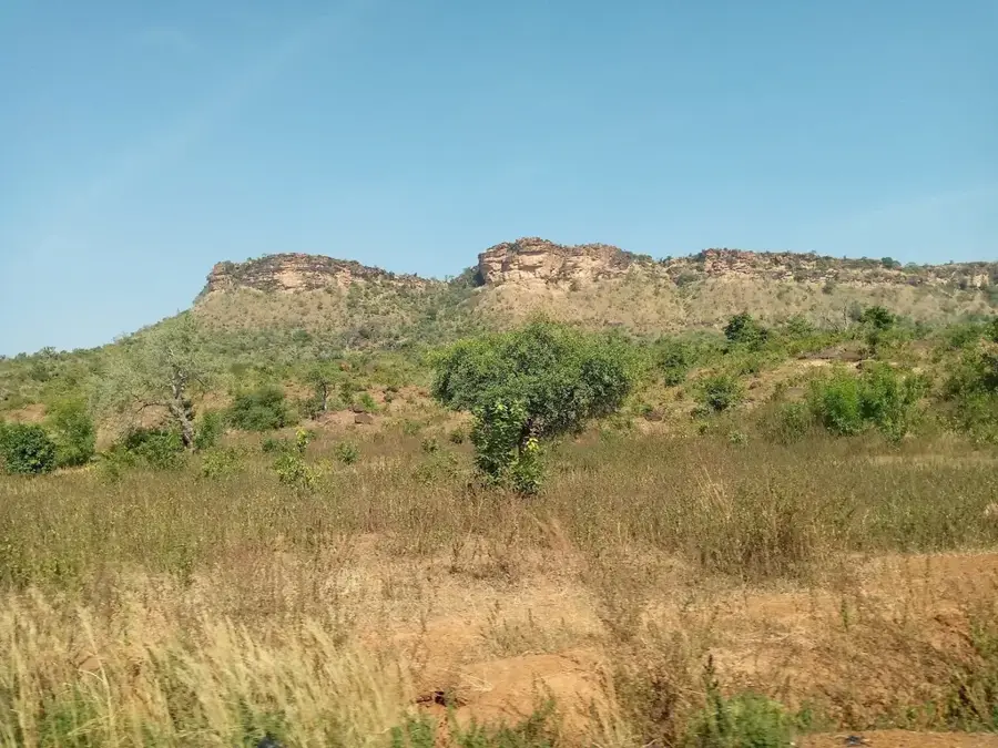
Bogou lies in Kpendjal Prefecture in the Savanes Region, set within an extraordinary landscape of table mountains, rock canyons and cave systems that stands in vivid contrast to the otherwise flat savannas of northern Togo. The striking sandstone formations around Bogou form one of the country's most spectacular natural panoramas and harbour numerous caves in which rock paintings and prehistoric tool finds have been preserved for centuries. The paintings depict animals, hunters and geometric symbols, and are still the subject of ongoing archaeological research. Bogou is therefore an important site both for the geography and the prehistory of West Africa. The population is predominantly Moba and Gourmantché and traditionally lives from millet, sorghum and livestock raising. Conservation and tourism projects have in recent years promoted the town as an ecotourism destination, complete with guided hikes.
- Location: Togo
- Nearby: Bombouaka (17 km)
Best time to visit & climate
The most pleasant time to visit is Jan, Nov, Dec.
| Jan | Feb | Mar | Apr | May | Jun | Jul | Aug | Sep | Oct | Nov | Dec | |
|---|---|---|---|---|---|---|---|---|---|---|---|---|
| Avg °C | 24 | 28 | 31 | 31 | 30 | 28 | 26 | 26 | 26 | 27 | 26 | 24 |
| Rain mm | 1 | 4 | 11 | 56 | 104 | 155 | 216 | 265 | 200 | 89 | 6 | 0 |
Geography
Facts
- Bogou is well known for its impressive sandstone rocks and cliffs.
- The Nano caves, which once served as a refuge, are located nearby.
- The region is part of the Bombouaka mountain range.
- The Moba dialect is the primary language spoken by the inhabitants of Bogou.
- Agriculture is heavily dependent on seasonal rainfall patterns.
- The Dapaong Plateau offers expansive views reaching as far as Burkina Faso.
Explore nearby
Notable places around
Route planner — Car & Motorhome
Where do you start? We build the route here, with stops and country notes along the way.
© OpenStreetMap contributors · OpenRouteService
Frequently asked questions
How to reach Bogou?
Is it a tourist destination?
What is the accommodation like?
Is there a clinic?
What is the currency?
Bogou: where is it located?
Bogou: when is the best time to visit?
Bogou: why is it worth visiting?

Nearby cities
More places