Plizio Visual Lab
Blüemlisalp
Weather…
Water temperature…
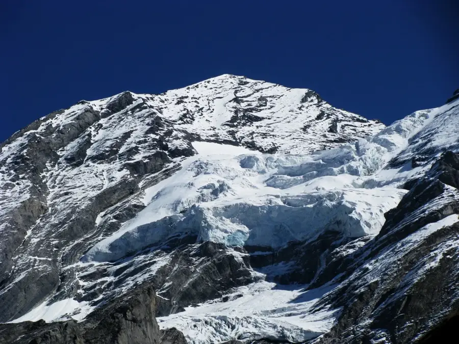
The Blüemlisalp is an imposing, heavily glaciated mountain massif in the Bernese Alps, reaching an elevation of 3,661 meters at the Blüemlisalphorn. The massif consists of three prominent peaks: the Blüemlisalphorn, the Wyssi Frau, and the Morgenhorn, which together form a striking ice wall overlooking Lake Oeschinen. The first ascent of the main summit was achieved in 1860 by Melchior Anderegg and his companions. Geographically, the massif marks the boundary between the Kandertal and Kiental valleys. Blüemlisalp is deeply rooted in Swiss folklore, with the most famous legend telling of a rich but cold-hearted dairymaid whose lush pasture was turned to ice as a punishment. For mountaineers, traversing the massif is a classic alpine high-altitude tour that demands technical skills on both ice and rock. The Blüemlisalp Hut (SAC) at 2,840 meters serves as a vital starting point and features spectacular views of the formidable north faces.
- Location: Switzerland
- Top sights: Fründenhorn · Bundstock · Morgenhorn
- Nearby: Kandersteg (7 km)
Best time to visit & climate
The most pleasant time to visit is Jun–Aug.
| Jan | Feb | Mar | Apr | May | Jun | Jul | Aug | Sep | Oct | Nov | Dec | |
|---|---|---|---|---|---|---|---|---|---|---|---|---|
| Avg °C | -8 | -8 | -4 | 1 | 6 | 10 | 12 | 12 | 8 | 4 | -2 | -7 |
| Rain mm | 81 | 69 | 89 | 103 | 154 | 151 | 148 | 165 | 106 | 107 | 114 | 92 |
📋 Practical info
Geography
Facts
- The elevation of the highest peak, Blüemlisalphorn, is 3,661 meters.
- The first recorded ascent was made on August 27, 1860.
- The massif features three main summits: Horn, Wyssi Frau, and Morgenhorn.
- It is located in the Bernese Oberland region of Switzerland.
- The Blüemlisalp Glacier is a prominent feature on its northern side.
- The area is a popular starting point for the crossing to the Lötschen Pass.
Explore nearby
Notable places around
Route planner — Car & Motorhome
Where do you start? We build the route here, with stops and country notes along the way.
© OpenStreetMap contributors · OpenRouteService
Sights in the town Blüemlisalp (3)
Sights nearby
Frequently asked questions
What is Blüemlisalp?
How high is the highest peak?
Can you hike there?
Are there legends about Blüemlisalp?
How is the accessibility?
Blüemlisalp: where is it located?
Blüemlisalp: what is there to see?
Blüemlisalp: when is the best time to visit?
Blüemlisalp: why is it worth visiting?

Nearby cities