Plizio Visual Lab
Aneto
Weather…
Water temperature…
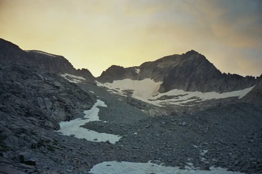
Towering at an elevation of 3,404 meters, Aneto is the highest peak in the Pyrenees mountain range, located in the Spanish province of Huesca within the Posets-Maladeta Natural Park. The mountain's northern flank is home to the Aneto Glacier, which, despite rapid retreat due to global warming, still stands as the largest glacier in Spain. Ascending Aneto is a classic mountaineering challenge that requires crossing the crevassed ice field using crampons and ice axes, culminating in the traversal of the notorious Paso de Mahoma (Muhammad's Step), a narrow, highly exposed ridge of rock just before the summit. Climbers who reach the top are rewarded with dramatic panoramic views spanning the rugged peaks of both the Spanish and French Pyrenees. The extreme alpine ecosystem surrounding the peak is defined by sheer granite walls, deep glacial tarns, and sparse, highly adapted high-altitude vegetation.
- Location: Galicia, Spain
- Top sights: Pico Maldito · Tuca de Corones · Tuca de la Maladeta
- Nearby: Cerler (10 km)
Best time to visit & climate
The most pleasant time to visit is Jun–Aug.
| Jan | Feb | Mar | Apr | May | Jun | Jul | Aug | Sep | Oct | Nov | Dec | |
|---|---|---|---|---|---|---|---|---|---|---|---|---|
| Avg °C | -1 | -1 | 2 | 5 | 9 | 14 | 16 | 16 | 12 | 8 | 3 | 0 |
| Rain mm | 60 | 48 | 58 | 72 | 76 | 51 | 42 | 42 | 50 | 61 | 70 | 50 |
📋 Practical info
Geography
Explore nearby
Notable places around
Route planner — Car & Motorhome
Where do you start? We build the route here, with stops and country notes along the way.
© OpenStreetMap contributors · OpenRouteService
Sights in the town Aneto (3)
Sights nearby
Frequently asked questions
What is Aneto?
Does Aneto have a glacier?
What is the 'Bridge of Mohammed' (Puente de Mahoma)?
Is equipment needed for the ascent?
Where does the normal route start?
Aneto: where is it located?
Aneto: what is there to see?
Aneto: when is the best time to visit?
Aneto: why is it worth visiting?

Nearby cities