Plizio Visual Lab
Komadougou Yobé
Weather…
Water temperature…
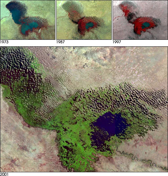
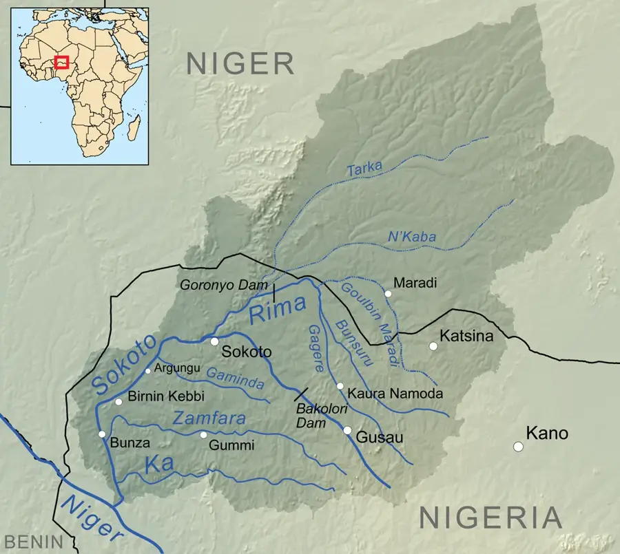
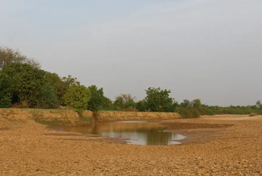
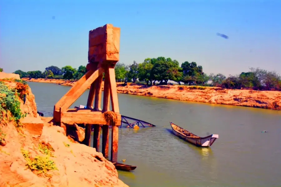
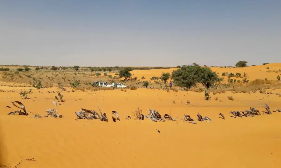
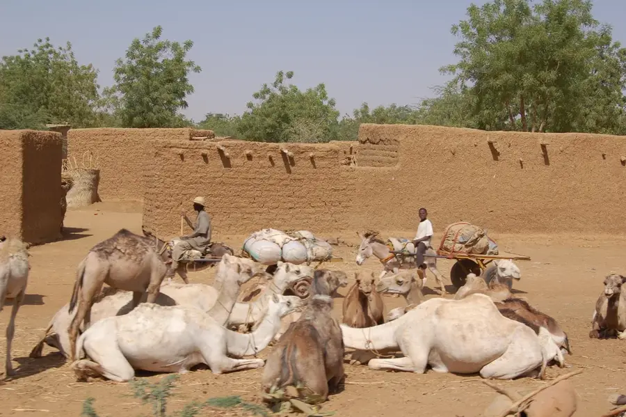
The Komadougou Yobé is a significant river in West Africa, flowing through eastern Niger and northern Nigeria before ultimately emptying into the Lake Chad basin. It forms the natural international border between these two nations for a stretch of approximately 150 kilometers. The river basin is vital for agriculture and livestock farming in an otherwise arid and challenging geographical region. Its flow is highly seasonal, meaning that during the height of the dry season, extensive sections of the riverbed can dry up completely. Historically, the valley served as a major settlement area for the Kanuri people and other ethnic groups in the region. Ecologically, the river provides an essential habitat for numerous migratory birds and a variety of local fish species. The riparian zones are intensively used for growing rice, peppers, and onions, ensuring food security for thousands of people living in the Sahel belt.
- Location: Niger
- Nearby: Maïné-Soroa (32 km)
Best time to visit & climate
The most pleasant time to visit is Jan, Feb, Dec.
| Jan | Feb | Mar | Apr | May | Jun | Jul | Aug | Sep | Oct | Nov | Dec | |
|---|---|---|---|---|---|---|---|---|---|---|---|---|
| Avg °C | 21 | 24 | 28 | 32 | 34 | 33 | 31 | 28 | 29 | 29 | 25 | 22 |
| Rain mm | 0 | 0 | 1 | 1 | 10 | 38 | 96 | 165 | 59 | 8 | 0 | 0 |
📋 Practical info
Geography
Facts
- Total length of approximately 1,200 km from sources in Nigeria to Lake Chad
- Forms 150 km of the international border between Niger and Nigeria
- Empties into Lake Chad, a large endorheic basin in Central Africa
- Water flow is highly seasonal, primarily from June to January
- Main economic driver for the Diffa (Niger) and Yobe (Nigeria) regions
- Significant refuge for the African manatee during the high-water season
Explore nearby
Notable places around
Route planner — Car & Motorhome
Where do you start? We build the route here, with stops and country notes along the way.
© OpenStreetMap contributors · OpenRouteService
Sights nearby
Frequently asked questions
Where does the Komadougou Yobé flow?
Can you go bird watching?
How is the accessibility?
Are there tourist centers?
What should I keep in mind?
Komadougou Yobé: where is it located?
Komadougou Yobé: when is the best time to visit?
Komadougou Yobé: why is it worth visiting?

Nearby cities
Nature