Plizio Visual Lab
Komadougou Yobé Lowlands

Weather…
Water temperature…
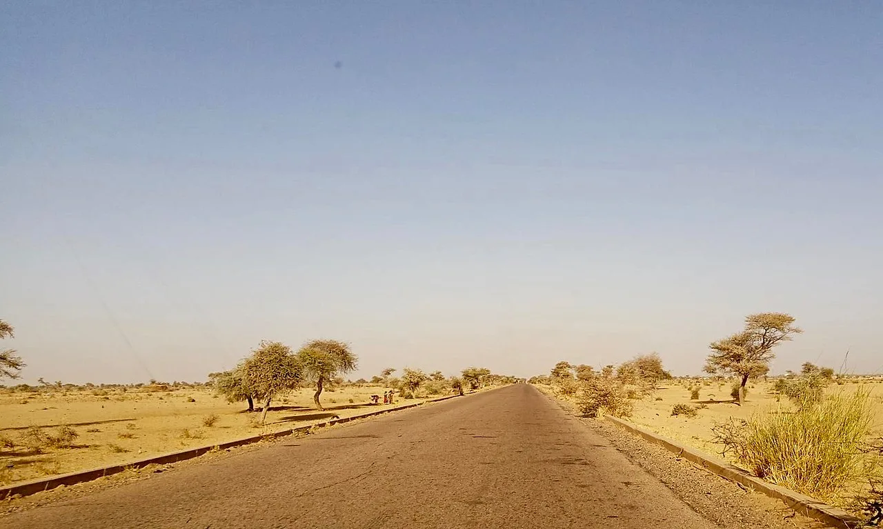
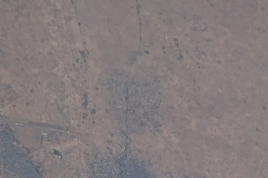
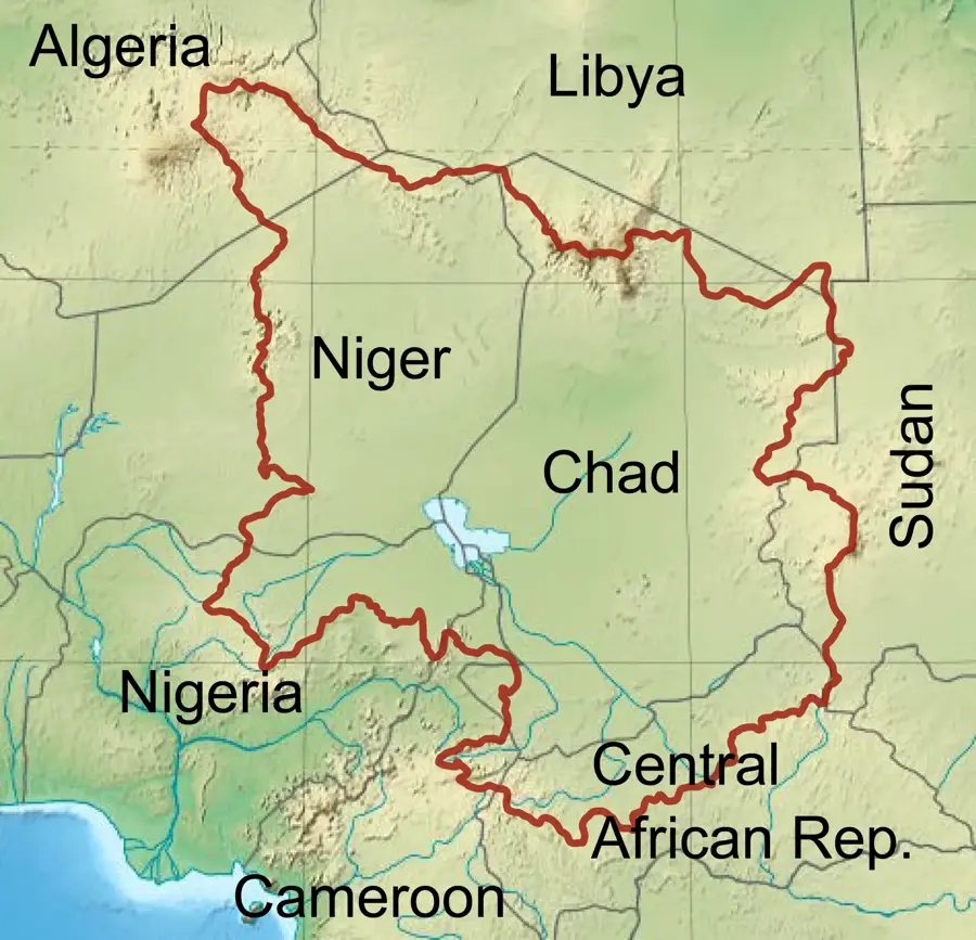
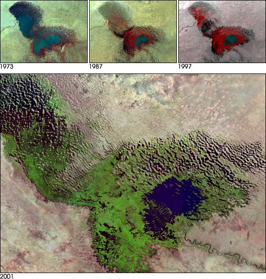
The Komadougou Yobé is a major river system that forms the international border between Niger and Nigeria, ultimately discharging into Lake Chad. It is a seasonal watercourse formed by the confluence of the Hadejia and Jama'are rivers. The lowlands along the river are characterized by extensive floodplains and seasonal wetlands that are vital to the regional economy. Despite increasing aridity and the diversion of water by upstream dams, the valley remains a critical center for fishing and irrigated agriculture. Geologically, the area is composed of Quaternary lacustrine sediments dating back to a time when Lake Chad was significantly larger. Historically, the valley was part of the Kanem-Bornu Empire's sphere of influence and served as a major trade route. The ecological richness of the valley is evidenced by the numerous species of waterfowl that use the wetlands as stopovers during migration. However, the ongoing shrinking of Lake Chad poses a severe threat to the entire ecosystem of these lowlands.
- Location: Niger
- Nearby: Diffa (48 km)
Best time to visit & climate
The most pleasant time to visit is Jan, Feb, Dec.
| Jan | Feb | Mar | Apr | May | Jun | Jul | Aug | Sep | Oct | Nov | Dec | |
|---|---|---|---|---|---|---|---|---|---|---|---|---|
| Avg °C | 22 | 26 | 30 | 34 | 35 | 34 | 31 | 29 | 30 | 30 | 27 | 23 |
| Rain mm | 0 | 0 | 0 | 1 | 8 | 30 | 96 | 140 | 54 | 13 | 0 | 0 |
📋 Practical info
Geography
Facts
- The river defines the border with Nigeria for approximately 150 kilometers.
- It provides up to 95% of the surface water inflow to the Nigerien portion of Lake Chad.
- The total drainage basin covers roughly 148,000 square kilometers.
- Historically, it was a central area for the Sayfawa dynasty of the Bornu Empire.
- Annual discharge rates have decreased significantly since the 1970s.
- The area is an important habitat for the endangered African lungfish.
Explore nearby
Notable places around
Route planner — Car & Motorhome
Where do you start? We build the route here, with stops and country notes along the way.
© OpenStreetMap contributors · OpenRouteService
Sights nearby
Frequently asked questions
What is the Komadougou-Yobe lowlands?
Is the region safe for tourists?
Can you see the river?
Is there wildlife to observe there?
Is the water clean?
Komadougou Yobé Lowlands: where is it located?
Komadougou Yobé Lowlands: when is the best time to visit?
Komadougou Yobé Lowlands: why is it worth visiting?

Nature

More places