Plizio Visual Lab
Nouadhibou Port
Weather…
Water temperature…
The Port of Nouadhibou is Mauritania's largest and busiest seaport, located on the Ras Nouadhibou peninsula. It serves as the primary export hub for iron ore shipped by rail from the Zouérat mines, and also handles significant volumes of fish, livestock, and general cargo. The port comprises three main sections: the ore terminal, the fishing port, and the commercial harbor. With a water depth of up to 14 meters, it can accommodate Panamax-class vessels. Annual throughput exceeds 10 million metric tons. Recent upgrades include new container cranes and expanded cold storage facilities. The port is managed by the Port Authority of Nouadhibou and plays a critical role in Mauritania's economy, accounting for over 30% of national trade.
Best time to visit & climate
The most pleasant time to visit is Mar–May.
| Jan | Feb | Mar | Apr | May | Jun | Jul | Aug | Sep | Oct | Nov | Dec | |
|---|---|---|---|---|---|---|---|---|---|---|---|---|
| Avg °C | 19 | 19 | 21 | 21 | 22 | 23 | 25 | 26 | 27 | 25 | 22 | 20 |
| Rain mm | 2 | 1 | 1 | 1 | 1 | 0 | 1 | 5 | 8 | 16 | 3 | 2 |
📋 Practical info
Geography
Facts
- Annual cargo throughput: over 12 million metric tons
- Water depth: up to 14 meters
- Number of berths: 12 (including 3 ore berths)
- Ore terminal opened in 1963
- Length of ore loading pier: 1,200 meters
- Annual container traffic: approximately 80,000 TEUs
Explore nearby
Notable places around
Route planner — Car & Motorhome
Where do you start? We build the route here, with stops and country notes along the way.
© OpenStreetMap contributors · OpenRouteService
Sights in the town Nouadhibou Port (1)
Sights nearby
Frequently asked questions
What is Hafen Nouadhibou?
Is the port accessible to tourists?
What is the port known for?
When is the best time to visit the area?
What is near the port?
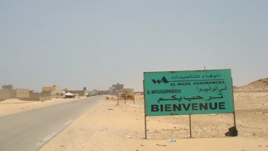
Nouadhibou Port: where is it located?
Nouadhibou Port: when is the best time to visit?
Nouadhibou Port: why is it worth visiting?

Nearby cities


History & landmarks

More places