Plizio Visual Lab
Tilemsi Valley

Weather…
Water temperature…
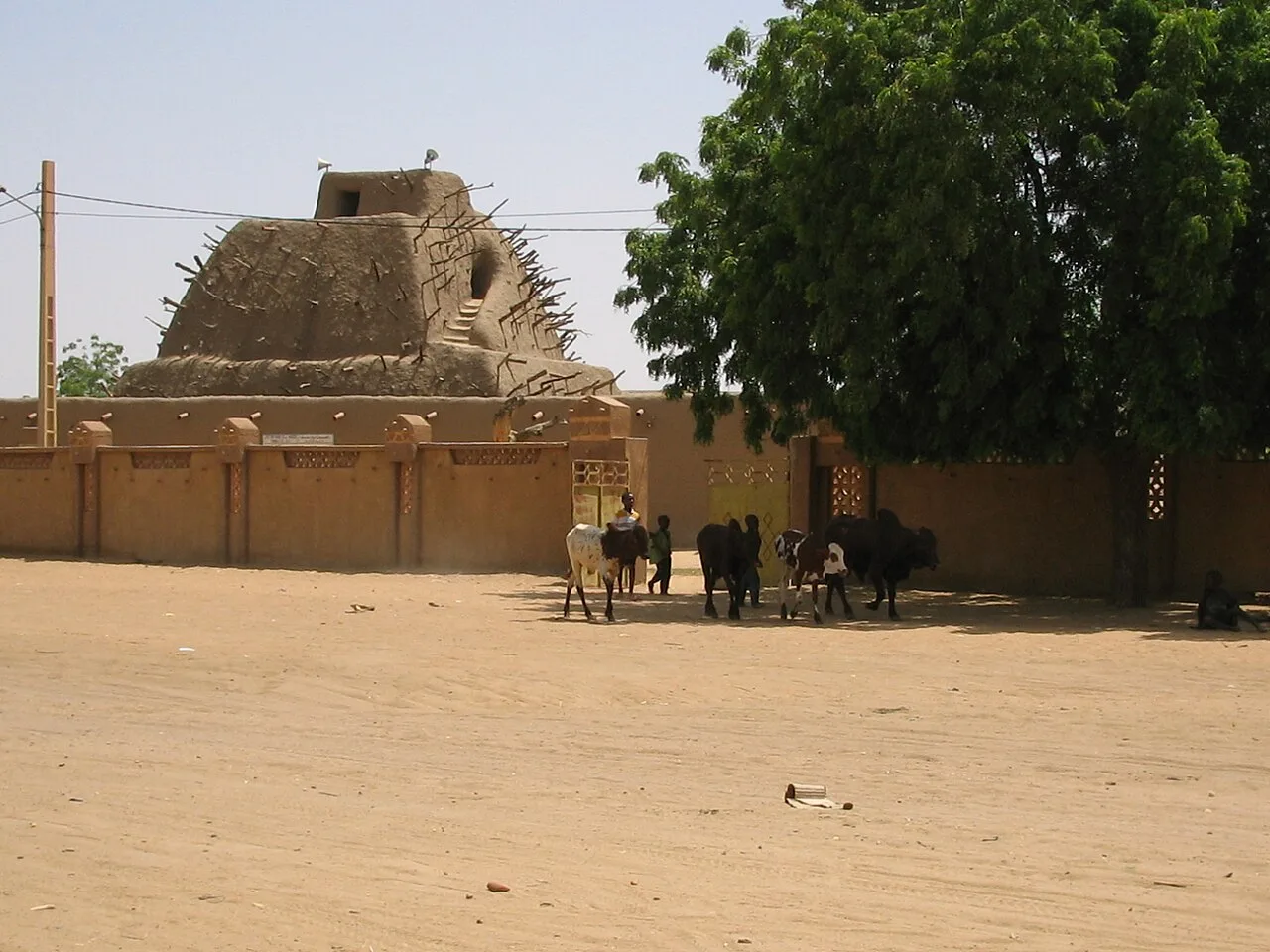
The Tilemsi Valley is a massive fossil river valley in eastern Mali, stretching over 800 kilometers from the Adrar des Ifoghas mountains to the Niger River near Gao. In prehistoric times, when the Sahara was a more humid region, it hosted a powerful tributary of the Niger, which today only carries water seasonally after rare heavy rains. Geographically, the valley forms a natural depression where sediments and valuable phosphates have deposited, which are now economically exploited. Historically, the Tilemsi Valley was a crucial migration and trade route connecting the heart of the Sahara with the Niger Bend. Archaeological excavations have unearthed significant Neolithic settlement remains here, including the famous 'Asselar man'. The sparse vegetation consists of desert grasses and acacias that manage to survive in the deeper parts of the valley. Today, the valley serves as the most important transport corridor for caravans and vehicles traveling between Gao and the Algerian border.
Best time to visit & climate
The most pleasant time to visit is Jan, Feb, Dec.
| Jan | Feb | Mar | Apr | May | Jun | Jul | Aug | Sep | Oct | Nov | Dec | |
|---|---|---|---|---|---|---|---|---|---|---|---|---|
| Avg °C | 20 | 23 | 27 | 32 | 35 | 36 | 34 | 32 | 32 | 31 | 26 | 21 |
| Rain mm | 0 | 0 | 0 | 0 | 1 | 11 | 31 | 71 | 19 | 3 | 0 | 0 |
📋 Practical info
Geography
Facts
- The valley is one of the world's most significant sources of natural phosphates.
- The 'Asselar man', a 6,400-year-old skeleton, was discovered in the Tilemsi Valley in 1927.
- The width of the valley varies significantly, ranging between 10 and 50 kilometers.
- Temporary lakes, known as 'mares', form on the valley floor during the rainy season.
- Geologically, the valley is part of the crystalline zone of the Adrar des Ifoghas.
- The valley serves as the boundary between the Tamesna Plain to the east and the Gourma region to the west.
Explore nearby
Notable places around
Route planner — Car & Motorhome
Where do you start? We build the route here, with stops and country notes along the way.
© OpenStreetMap contributors · OpenRouteService
Sights nearby
Frequently asked questions
How do you reach Tilemsi-Tal?
Is the area dangerous?
Are there water sources?
What is the best time to visit?
Is it a tourist destination?
Tilemsi Valley: where is it located?
Tilemsi Valley: when is the best time to visit?
Tilemsi Valley: why is it worth visiting?

Nearby cities


History & landmarks
More places