Plizio Visual Lab
Gao Plain

Weather…
Water temperature…
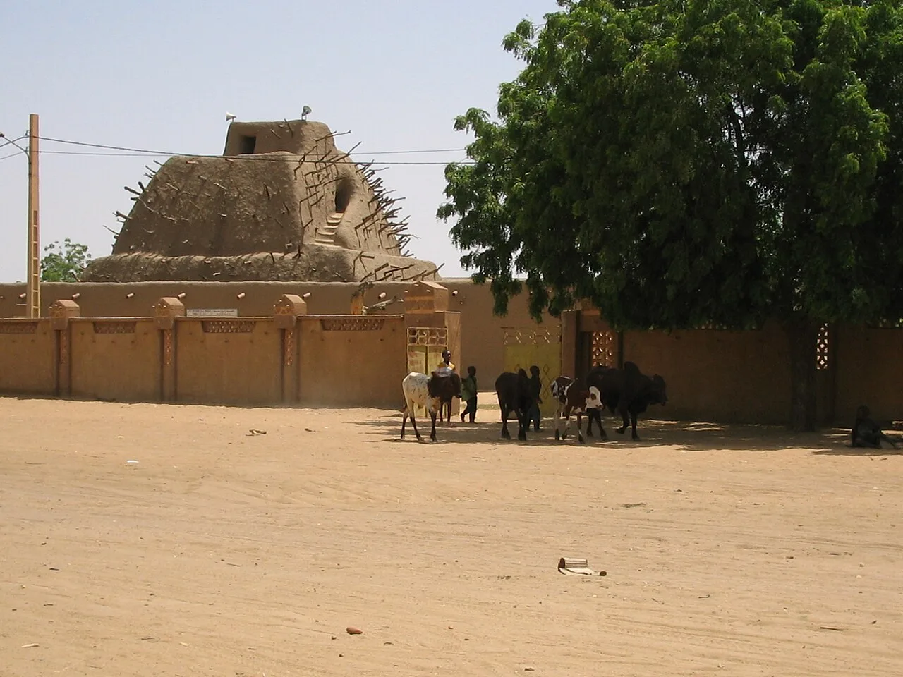
The Gao Plain extends across eastern Mali along the Niger River, forming a strategic transition zone between the Sahara Desert and the Sahelian belt. Geographically, the plain is characterized by flat, sandy expanses and the wide valley of the Niger, which serves as the lifeblood of the entire region. Historically, this area was the core of the powerful Songhai Empire, with the city of Gao standing as one of West Africa's most prominent commercial centers during the 15th and 16th centuries. The climate is hyper-arid, featuring very low rainfall and extreme temperatures, which restricts agricultural activities to the immediate riverbanks. Geologically, the plain is composed of Quaternary sediments and the dry valley of the Tilemsi, a prehistoric river system that now flows only occasionally. The region is a cultural crossroads where Songhai, Tuareg, and Fulani communities have lived and traded for centuries. Despite harsh environmental conditions, the Gao Plain remains a vital hub for trans-Saharan trade routes and regional connectivity.
- Location: Mali
- Nearby: Gao (26 km)
Best time to visit & climate
The most pleasant time to visit is Jan, Feb, Dec.
| Jan | Feb | Mar | Apr | May | Jun | Jul | Aug | Sep | Oct | Nov | Dec | |
|---|---|---|---|---|---|---|---|---|---|---|---|---|
| Avg °C | 21 | 25 | 29 | 33 | 36 | 36 | 34 | 31 | 32 | 31 | 27 | 22 |
| Rain mm | 0 | 0 | 0 | 1 | 4 | 21 | 68 | 120 | 39 | 5 | 0 | 0 |
📋 Practical info
Geography
Facts
- Gao served as the capital of the Songhai Empire at its peak in the 16th century.
- The Tilemsi Valley north of the plain is a well-known area for fossil findings.
- The average annual rainfall in the Gao region is less than 250 mm.
- Gao is home to the Tomb of Askia, a UNESCO World Heritage site.
- The Niger River is the only permanent source of water in the entire region.
- The plain sits at an average elevation of 250 to 300 meters above sea level.
Explore nearby
Notable places around
Route planner — Car & Motorhome
Where do you start? We build the route here, with stops and country notes along the way.
© OpenStreetMap contributors · OpenRouteService
Sights nearby
Frequently asked questions
What makes the Gao-plain landscape so special?
Is the area suitable for photographers?
Is there a security risk when visiting?
Are there marked hiking trails?
What means of transport is best for the region?
Gao Plain: where is it located?
Gao Plain: when is the best time to visit?
Gao Plain: why is it worth visiting?

Nearby cities


History & landmarks
More places