Plizio Visual Lab
Mokhotlong

ℹ️Practical info — Mokhotlong
▾
🌤 Weather — 5 days
📍 Nearby
Sights nearby
💡 Tips
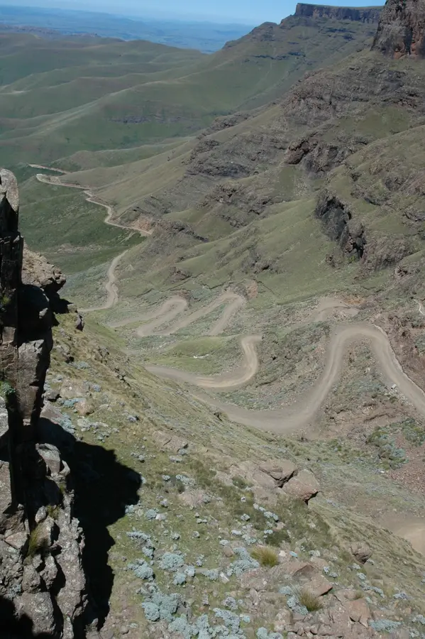
- The Sani Pass absolutely requires a 4x4 vehicle; do not attempt the route in a standard 2WD car.
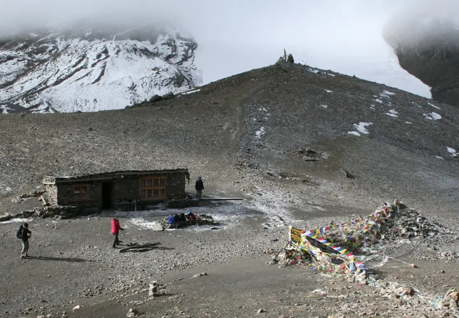
- Drink plenty of water and ascend slowly to avoid altitude sickness in this high region.
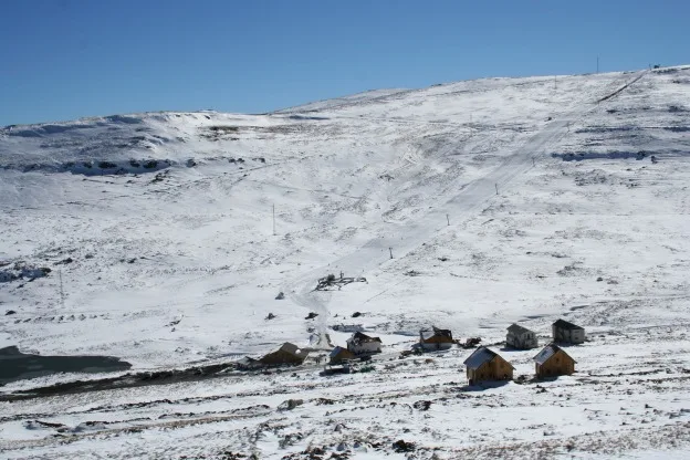
- Pack extreme winter clothing if traveling between June and August, as snow and severe frost are common.
- Respect local herders and their flocks on the winding mountain roads and drive with caution.
🍽 Food
A hearty local dish made from locally sourced sheep, available at simple eateries in the town center.
A warming and filling standard meal that provides necessary energy for the cold climate.
Enjoy this crisp local beer at a mountain lodge or tavern after a long day of driving.
🛍 Shopping · 🧘 Quiet spots
Buy authentic, warm wool blankets from the general dealers in the center of town.
As this is a hub for the wool industry, you can find high-quality, locally produced mohair items.
Join a trek to experience the absolute silence and vastness of southern Africa's highest peak.
Walk along the quiet streams just outside of town for a peaceful moment in nature.
Water temperature…
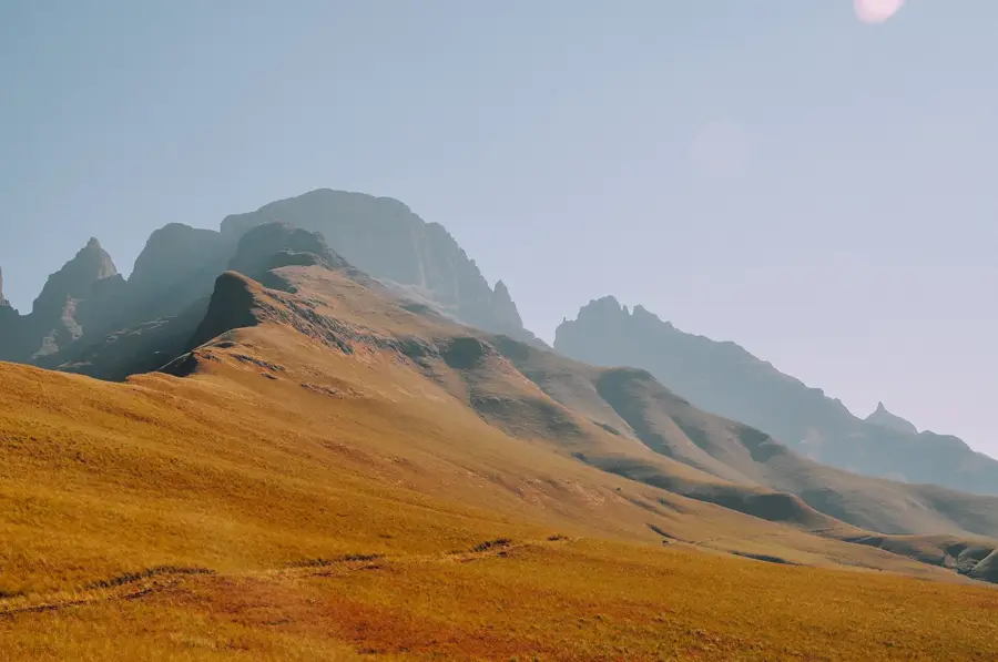
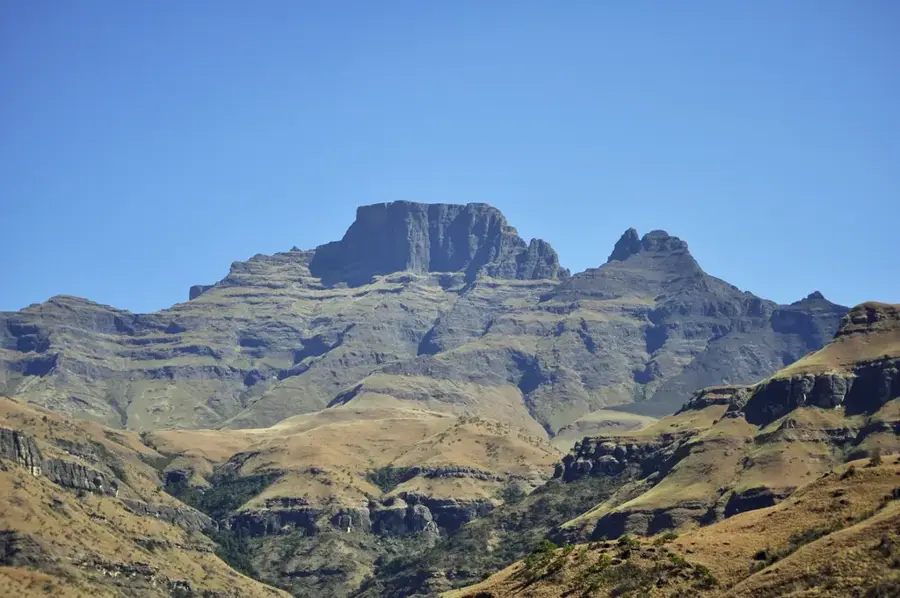
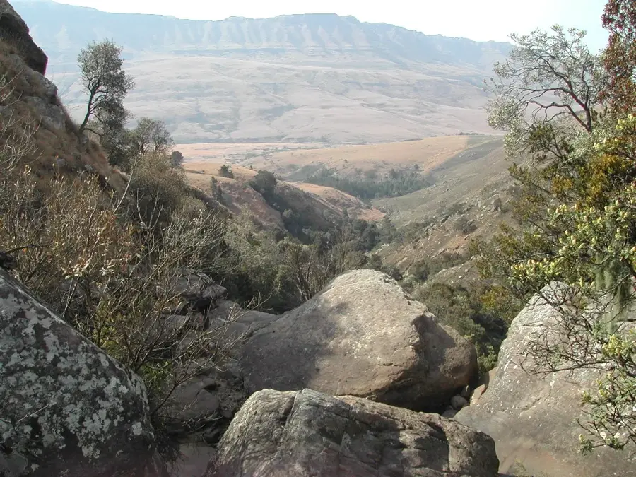
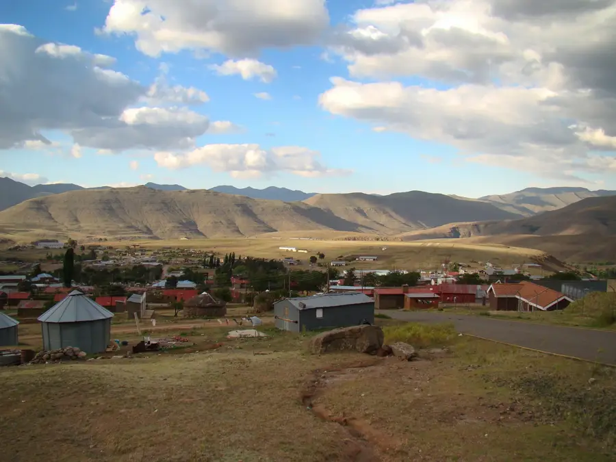
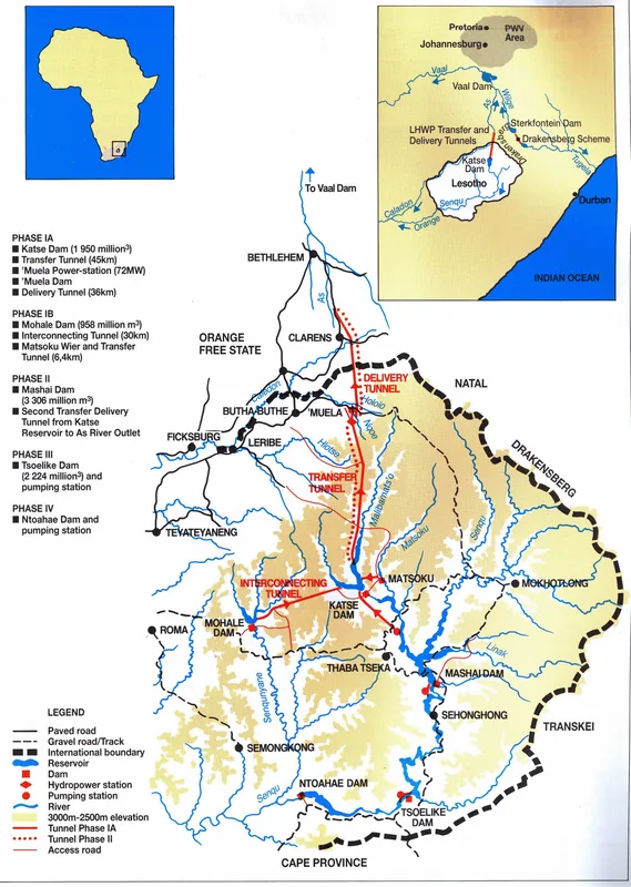
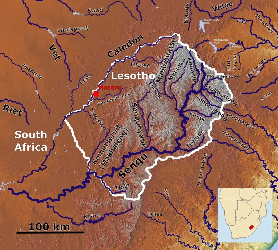
Mokhotlong is situated in eastern Lesotho at an elevation of approximately 2200 meters, serving as the primary administrative capital of its namesake district. Originally established in 1905 as a remote police outpost to curb cross-border smuggling, the settlement eventually evolved into a significant commercial hub for the region's high-quality wool and mohair industries. Geographically, the town is characterized by its proximity to the iconic Sani Pass and Thabana Ntlenyana, the highest peak in Southern Africa. Its name, derived from Sesotho, means "Place of the Bald Ibis," referencing the distinct birdlife found within the wetlands of the nearby Senqu River. Due to its extreme isolation, Mokhotlong was historically accessible only by pack animals or light aircraft until the first motorable tracks were developed in the 1940s. Today, it functions as a gateway for adventurers exploring the Maloti Mountains and remains a critical service center for the surrounding high-altitude pastoral communities.
- Location: Lesotho
- Nearby: Linakaneng (14 km)
- Population: ~14.461 (2026)
Best time to visit & climate
The most pleasant time to visit is Sep–Nov.
| Jan | Feb | Mar | Apr | May | Jun | Jul | Aug | Sep | Oct | Nov | Dec | |
|---|---|---|---|---|---|---|---|---|---|---|---|---|
| Avg °C | 15 | 15 | 13 | 9 | 6 | 3 | 3 | 5 | 9 | 12 | 14 | 15 |
| Rain mm | 216 | 182 | 119 | 67 | 17 | 12 | 12 | 22 | 30 | 81 | 115 | 176 |
Geography
Facts
- Founded in 1905
- Elevation of 2200 meters
- Major wool and mohair hub
- Near the Sani Pass border
- Name means Place of the Ibis
- District administrative capital
Explore nearby
Notable places around
Route planner — Car & Motorhome
Where do you start? We build the route here, with stops and country notes along the way.
© OpenStreetMap contributors · OpenRouteService
Frequently asked questions
How high is Mokhotlong?
How far is it to Sani Pass?
Does it snow there in winter?
Is there internet access?
What activities are offered?
Mokhotlong: where is it located?
Mokhotlong: when is the best time to visit?
Mokhotlong: why is it worth visiting?

Nearby cities

History & landmarks
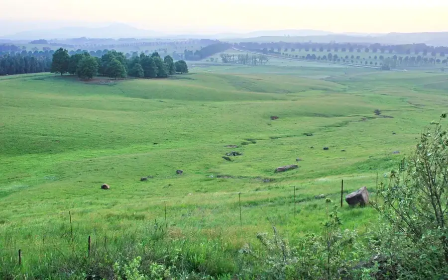
Nature
More places