Plizio Visual Lab
Kakshaal Too
Weather…
Water temperature…
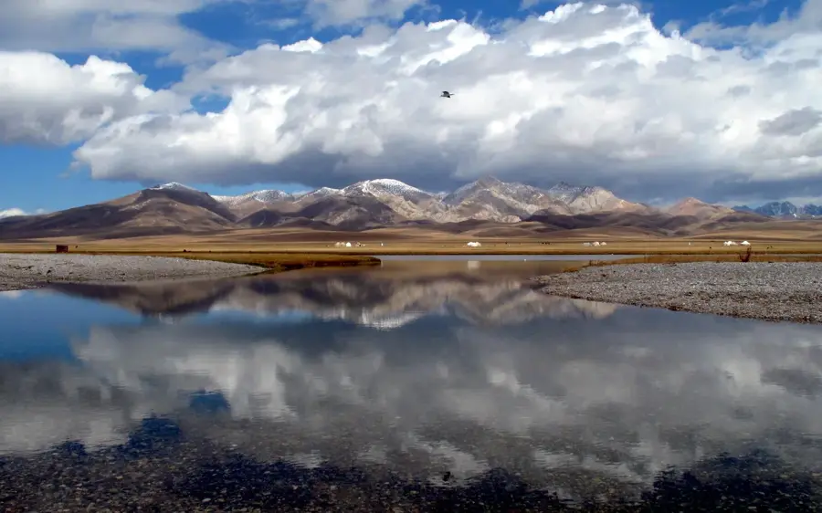
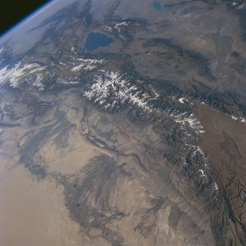
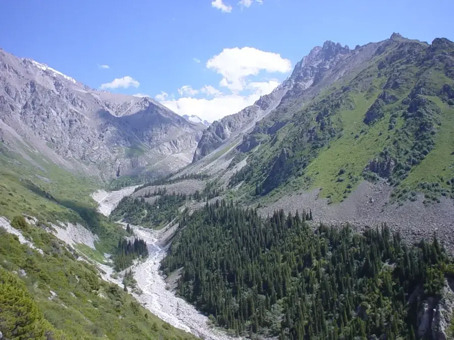
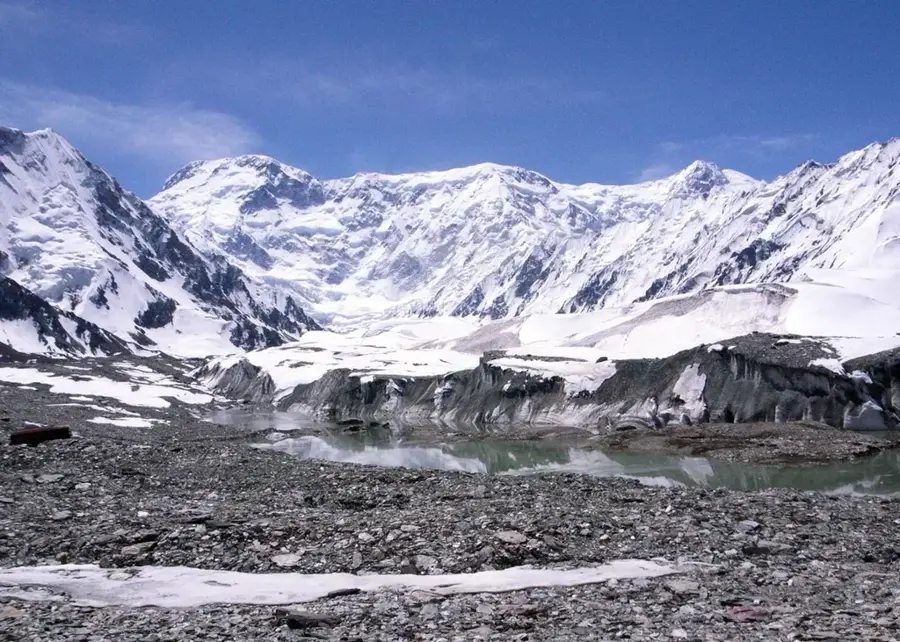
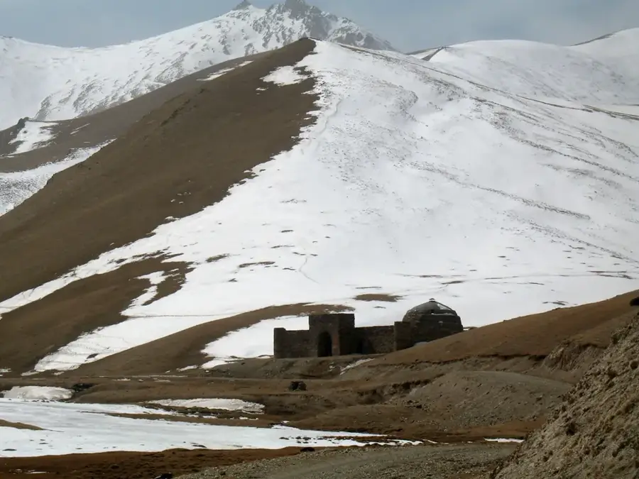
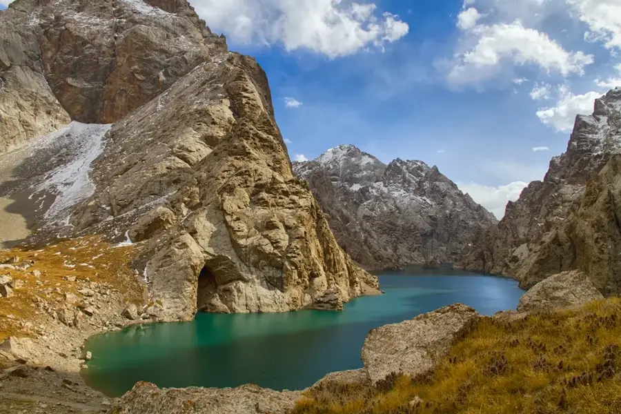
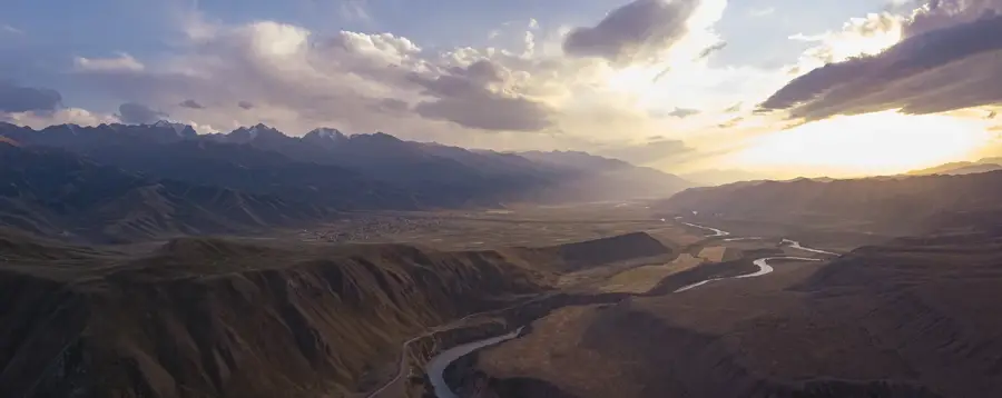
The Kokshaal-Too is an extremely massive, rugged, and heavily glaciated mountain range that serves as the virtually impenetrable natural border between southeastern Kyrgyzstan and the Xinjiang region of China. With an imposing average elevation hovering between 4,500 and 5,000 meters, it stands as the longest and one of the absolute highest chains within the entire Tian Shan mountain system. The highest distinct point in this highly isolated range is Dankova Peak, which soars to 5,982 meters, closely followed by Peak Kosmos. To the west, the range merges seamlessly into the colossal massif of Jengish Chokusu. The landscape of Kokshaal-Too is overwhelmingly dominated by gigantic glacier systems, deep inaccessible valleys, violently rushing meltwater rivers, and an unforgiving, Arctic-like climate. The region is so extraordinarily remote and logistically challenging to access that, even today, numerous high peaks and glacial valleys remain completely unexplored and unclimbed. Only a mere handful of highly professional, exceptionally equipped mountaineers dare to venture into this pristine, hostile wilderness on the edge of Central Asia.
- Location: Kyrgyzstan
- Nearby: Bokonbayevo (28 km)
Best time to visit & climate
The most pleasant time to visit is Jun–Aug.
| Jan | Feb | Mar | Apr | May | Jun | Jul | Aug | Sep | Oct | Nov | Dec | |
|---|---|---|---|---|---|---|---|---|---|---|---|---|
| Avg °C | -16 | -14 | -8 | -2 | 2 | 6 | 8 | 7 | 3 | -3 | -9 | -14 |
| Rain mm | 5 | 10 | 14 | 25 | 39 | 44 | 41 | 40 | 28 | 13 | 10 | 8 |
📋 Practical info
Geography
Facts
- Forms the massive, virtually impenetrable international border with China.
- It is by far the longest continuous mountain chain in the entire Tian Shan system.
- The average crest elevation sits at an extreme 4,500 to 5,000 meters.
- The absolute highest distinct peak in the range is Dankova Peak (5,982 m).
- Numerous icy summits and remote glacial valleys remain completely unexplored.
- Dominated visually by gigantic glacier systems and an unforgiving Arctic climate.
Explore nearby
Notable places around
Route planner — Car & Motorhome
Where do you start? We build the route here, with stops and country notes along the way.
© OpenStreetMap contributors · OpenRouteService
Sights nearby
Frequently asked questions
Where is the Kakschaal-Too mountain range?
What is the highest peak in this range?
Is the area developed for tourism?
Are border permits needed here?
What is the terrain like?
Kakshaal Too: where is it located?
Kakshaal Too: when is the best time to visit?
Kakshaal Too: why is it worth visiting?

Nearby cities
History & landmarks
Nature
More places