Plizio Visual Lab
Szandavar Hill
Plizio editorial teamData Sources
Mountain

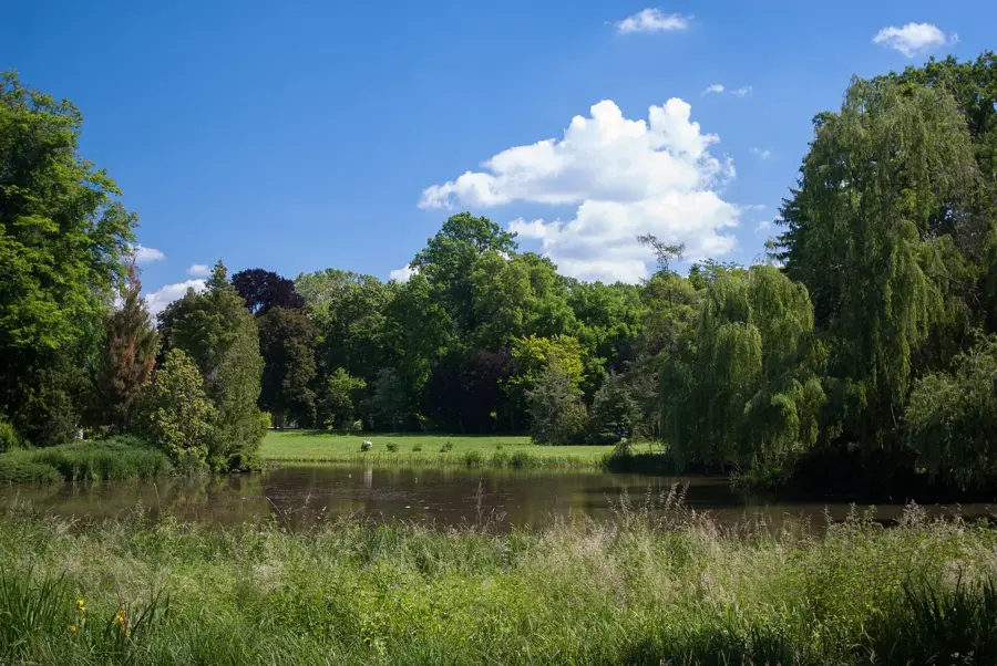
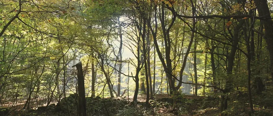
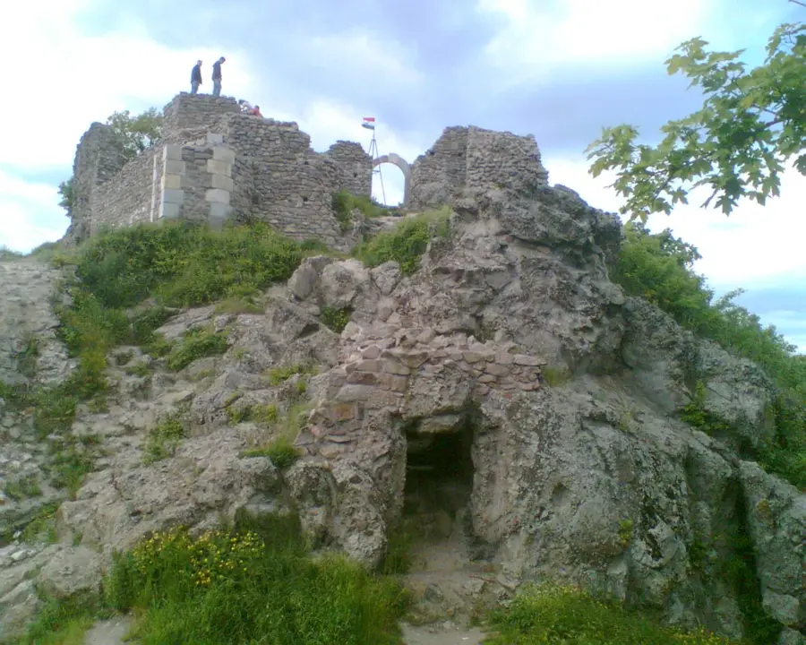
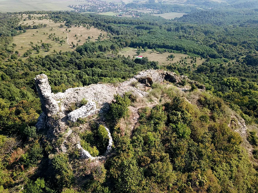
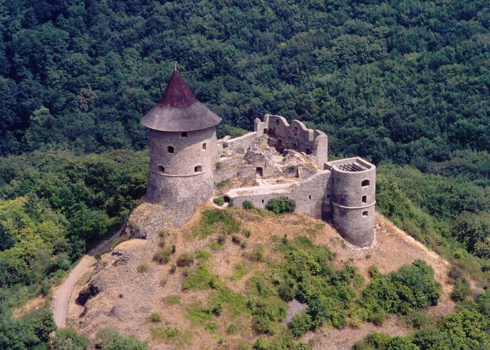
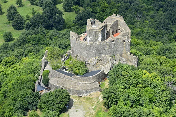
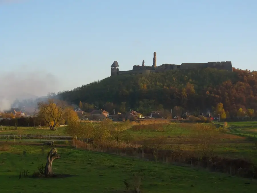
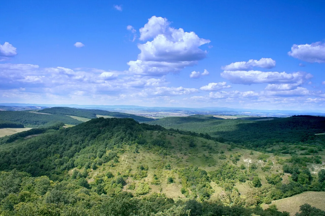
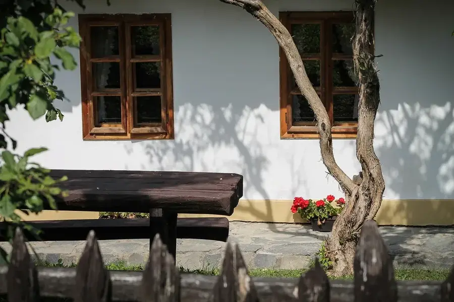
Szandavár Hill, rising to 527 meters in the Cserhát Mountains, is a prominent volcanic peak noted for its dramatic geology and medieval ruins. At its summit lie the remains of Szanda Castle, established in the 13th century, which played a crucial role as a border fortress during the Ottoman-Hungarian wars. Geologically, the hill is famous for its remarkable columnar andesite formations, created by slow-cooling lava that formed vertical pillars visible along the cliff faces. The climb to the top has hikers one of the finest vantage points in northern Hungary, with views stretching across the Cserhát hills to the distant High Tatras. The hill's rocky meadows are home to rare and protected flora, including the Pasqueflower and several endemic species. Though the castle was largely destroyed by the late 16th century, its stone ruins still provide a tangible connection to the region's turbulent past. Currently, Szandavár is a key site within the Novohrad-Nógrád Geopark, attracting visitors interested in both the natural sciences and national history.
- Location: Hungary
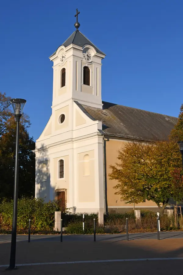
- Top sights: Szanda vára · Kállay-kastély · Bodor-kastély
- Nearby: Pásztó (21 km)
Best time to visit & climate
The most pleasant time to visit is Jun–Aug.
| Jan | Feb | Mar | Apr | May | Jun | Jul | Aug | Sep | Oct | Nov | Dec | |
|---|---|---|---|---|---|---|---|---|---|---|---|---|
| Avg °C | -3 | -1 | 4 | 11 | 16 | 20 | 22 | 22 | 16 | 10 | 4 | -1 |
| Rain mm | 42 | 42 | 43 | 40 | 72 | 76 | 78 | 68 | 57 | 54 | 47 | 46 |
📋 Practical info
Getting there
The easiest way to approach this distinctive hill is usually from the nearby small village of Szanda, where established trailheads commence. While local buses might reach the area, driving there is generally significantly more convenient and saves time.
Best season
Late spring and early autumn are generally regarded as the most pleasant times for completing the ascent in comfortable temperatures. Summer hikes are perfectly possible but can quickly become quite sweaty, as the final rocky approach is heavily exposed to direct sun.
Terrain & paths
The path usually starts as a fairly relaxed walk through lovely surrounding woodlands before noticeably steepening towards the rocky summit. The final stretch to reach the castle ruins normally requires stepping over loose rocks and negotiating somewhat uneven, challenging ground.
What to bring
Wearing proper trail shoes with decent tread is highly recommended to prevent slipping on the final, rockier parts of the trail. Since there are rarely any facilities on the hill itself, visitors must generally carry all the water and snacks they anticipate needing.
Parking
Parking is usually informal, with visitors typically leaving their cars safely near the center or edges of Szanda village before setting off on foot. Spaces are rarely full, but guests should always ensure they do not accidentally block local residential driveways or narrow streets.
Safety
The primary safety consideration is the potentially slippery and loose rock formations near the very top, demanding careful footing from hikers. When exploring the scattered ruins, it is generally wise not to climb directly on the remaining old, unstable stone structures.
Time needed
A complete round trip hike from the village, including spending a reasonable amount of time admiring the panoramic views from the ruins, typically takes around two to three hours. It forms an excellent half-day activity for those exploring this specific historical region.
Geography
Facts
- The summit of Szandavár stands at an elevation of 527 meters.
- The castle was first mentioned in official documents in 1301.
- The fortress was captured by the Ottoman Empire in 1546.
- The hill is composed of unique columnar andesite rock formations.
- On clear days, the High Tatras are visible on the horizon.
- In 1551, the castle was recaptured by Hungarians and subsequently blown up.
Explore nearby
Notable places around
Route planner — Car & Motorhome
Where do you start? We build the route here, with stops and country notes along the way.
Vehicle
Only stops with (optional):
© OpenStreetMap contributors · OpenRouteService
Sights in the town Szandavar Hill (6)
Sights nearby
Frequently asked questions
How difficult is the hike?
Moderately difficult, with a steeper section just before the summit.
What can we see at the summit?
The ruins of Szandavár castle and impressive basalt formations.
Is there drinking water on the mountain?
No, take enough water with you for the entire hike.
Is the view good?
Yes, there is a magnificent panorama over the Cserhát hills.
Where can you park?
It is best to park in the village of Szandaváralja at the foot of the mountain.
Szandavar Hill: where is it located?
Szandavar Hill is located in Hungary.
Szandavar Hill: what is there to see?
Highlights include Szanda vára, Kállay-kastély, Bodor-kastély.
Szandavar Hill: when is the best time to visit?
The most pleasant time to visit is Jun, Aug.
Szandavar Hill: why is it worth visiting?
Szandavár Hill, rising to 527 meters in the Cserhát Mountains, is a prominent volcanic peak noted for its dramatic geology and medieval ruins.

Explore with Plizio
Discover more places in Europe
More places in Hungary →
Nearby cities
Pásztó
A historic small town at the foot of the Cserhát and Mátra mountains.
Balassagyarmat
Border town with Slovakia, known as the 'Bravest City'.
Szécsény
Historic town in northern Hungary, known for the Baroque Forgách Castle.
Vác
Historic city at the Danube Bend with Baroque architecture.

Tar
Village at the foot of the Mátra, known for its Buddhist stupa.
Vácrátót
Vácrátót is a serene village in Pest County, located about 30 kilometers north of Budapest, renowned for being home to the National Botan…
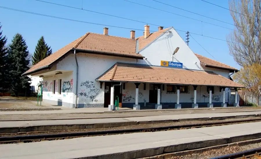
Őrbottyán
Őrbottyán is a Hungarian settlement in Vác District County, with approximately 8.341 inhabitants.
Mátraverebély
Mátraverebély is a historic village in Nógrád County, situated at the meeting point of the Mátra and Cserhát mountains.
Erdőkertes
Erdőkertes is a Hungarian settlement in Gödöllő District County, with approximately 10.026 inhabitants.
Lőrinci
Lőrinci is a Hungarian settlement in Szirák District County, with approximately 5.365 inhabitants.

Kartal
Kartal is a Hungarian settlement in Aszód District County, with approximately 5.985 inhabitants.
Aszód
Aszód is a Hungarian settlement in Aszód District County, with approximately 6.096 inhabitants.

Veresegyház
Veresegyház is a Hungarian settlement in Gödöllő District County, with approximately 21.129 inhabitants.
Tahitótfalu
Tahitótfalu is a Hungarian settlement in Szentendre District County, with approximately 6.358 inhabitants.
Drégelypalánk
Drégelypalánk is a historic village in Nógrád County, nestled in the scenic Ipoly Valley at the northern edge of the Börzsöny Mountains.
History & landmarks

Nature
More places
🗺️
Cserhat Forest
Quiet forests among the Cserhát hills, far from mass tourism.
Holloko Castle
A medieval castle ruin watching over the UNESCO World Heritage village of Hollókő.
Nograd Wildlife Park
A spacious area where red deer, fallow deer, and mouflons can be observed.
🗺️
Dregely Castle
A symbol of heroism, where Szondi and his warriors fought against the Ottoman army.

Salgotarjan Glass Factory
A long-standing factory famous for its high-quality glass and crystal products.

Ipolytarnoc Fossils
A 'Prehistoric Pompeii' featuring fossilized footprints and prehistoric plants.
Medves Plateau
Central Europe's largest basalt plateau on the state border.
Hollókő Old Village
An intact Palóc village and UNESCO World Heritage site.