Plizio Visual Lab
Kumaka
ℹ️Practical info — Kumaka
▾
🌤 Weather — 5 days
📍 Nearby
Sights nearby
💡 Tips
- Travel by riverboat is common; always check departure times locally.
- The market is spirited, keep your belongings secure and watch out for pickpockets.
- Carry small denominations of Guyanese dollars.
- Mosquito repellent is a must, especially during the wet season.
🍽 Food
A rich meat stew flavored with cassareep, often served with bread.
A traditional indigenous flatbread made from cassava root, available at the market.
Freshly caught fish from the river, served at local food stalls.
🛍 Shopping · 🧘 Quiet spots
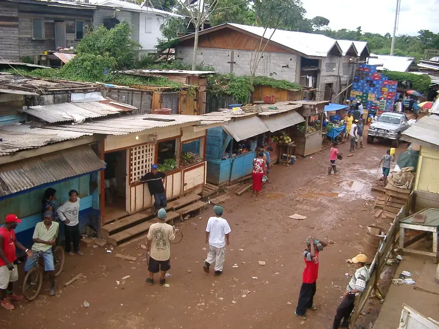
The bustling hub for fresh river fish and indigenous crafts.
Look for woven baskets made by the Amerindian communities.
Find a quiet spot along the riverbank to watch the boats pass.
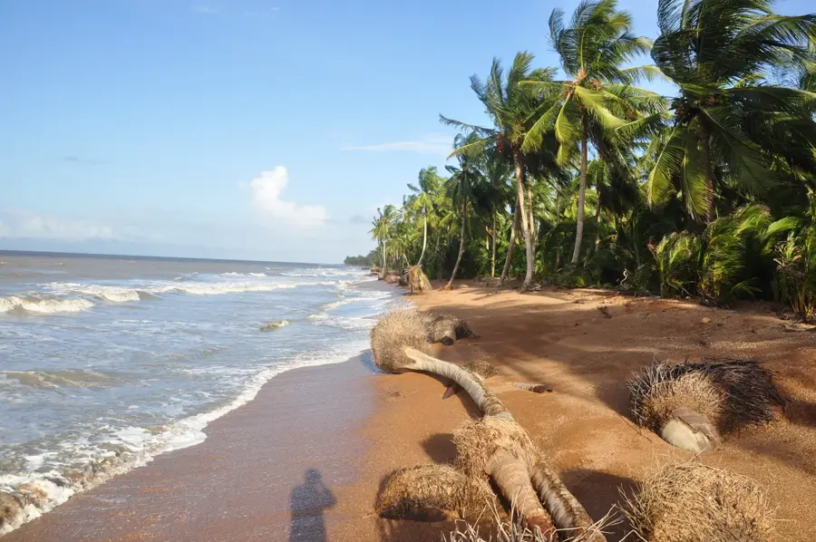
Though a boat ride away, it's a remarkably serene stretch of nature.
Water temperature…
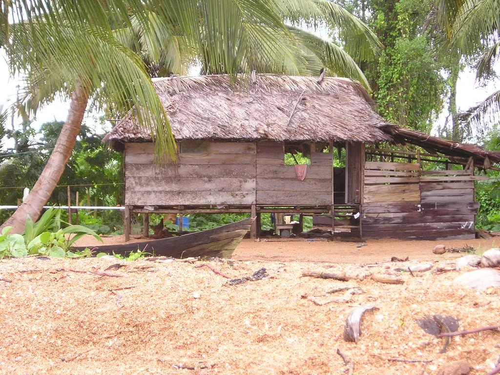
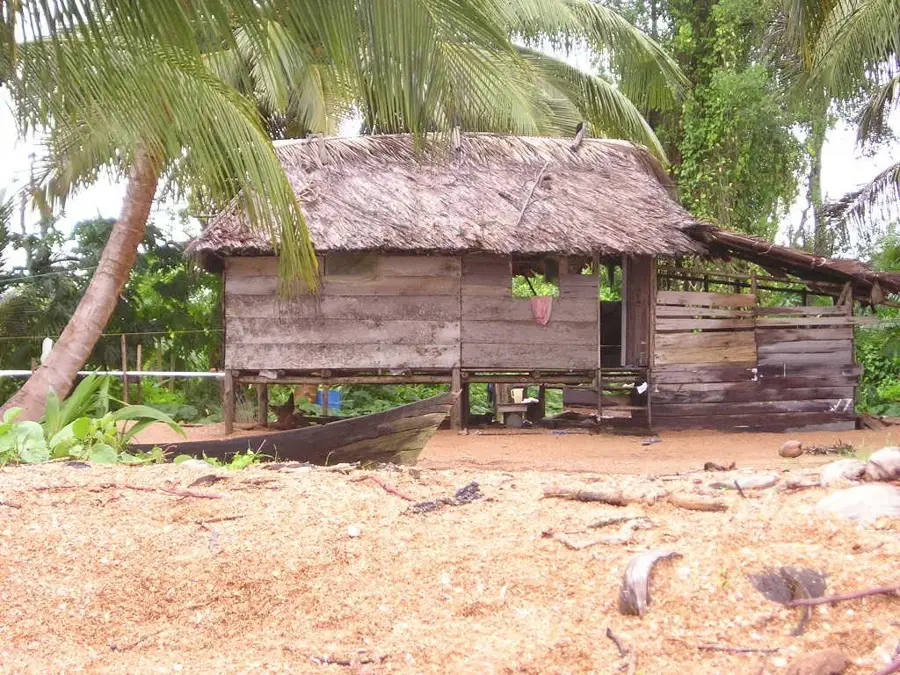
Kumaka is the animated commercial heartbeat of the Moruca sub-district in the Barima-Waini region of northwestern Guyana. Located on the banks of the Moruca River, the settlement is characterized by its amphibious geography, which transforms the surrounding area into a labyrinth of waterways during the rainy season. Kumaka serves as the primary marketplace and supply hub for the surrounding indigenous communities, most notably Santa Rosa, Guyana's largest indigenous mission. The local economy is driven by the trade of rainforest produce, handcrafted indigenous arts, and the distribution of goods brought in by boat from Charity. The architecture features traditional wooden structures on stilts and simple storefronts. Kumaka holds significant cultural weight as a place where the traditions of the Arawak people continue to thrive. It also acts as a critical transit point for those traveling to the Shell Beach Protected Area. Despite the challenges posed by seasonal flooding, Kumaka remains the indispensable logistical and social center for the people of the Moruca region.
- Location: Guyana
- Nearby: Morawhanna (6 km)
- Population: ~6.366 (2026)
Best time to visit & climate
The most pleasant time to visit is Feb, Mar, Sep.
| Jan | Feb | Mar | Apr | May | Jun | Jul | Aug | Sep | Oct | Nov | Dec | |
|---|---|---|---|---|---|---|---|---|---|---|---|---|
| Avg °C | 25 | 25 | 26 | 27 | 26 | 26 | 25 | 26 | 26 | 26 | 26 | 25 |
| Rain mm | 132 | 86 | 63 | 95 | 229 | 254 | 238 | 174 | 102 | 112 | 174 | 207 |
Geography
Facts
- Kumaka Waterfront is the busiest trading zone in the entire Northwest District.
- The settlement is a key center for the production of crabwood oil.
- It serves as the main entry point for the Santa Rosa indigenous community.
- During high water, 'floating' markets are common along the Moruca River.
- The town is a strategic hub for the distribution of solar energy equipment to remote villages.
- It features the regional Moruca Cottage Hospital.
Explore nearby
Notable places around
Route planner — Car & Motorhome
Where do you start? We build the route here, with stops and country notes along the way.
© OpenStreetMap contributors · OpenRouteService
Sights in the town Kumaka (1)
Frequently asked questions
What is the function of Kumaka?
When is market day?
How is the infrastructure?
How to reach Kumaka?
What are typical products?
Kumaka: where is it located?
Kumaka: when is the best time to visit?
Kumaka: why is it worth visiting?

Nearby cities

Nature
More places