Plizio Visual Lab
Karta

ℹ️Practical info — Karta
▾
🌤 Weather — 5 days
📍 Nearby
Sights nearby
💡 Tips
- Located near Arta, Karta enjoys a slightly cooler climate than the coastal capital.
- A 4x4 vehicle is highly recommended for navigating the rougher roads in this rural area.
- Local amenities are limited, so bring enough water and cash from a larger town.
- Dress modestly and respect local customs when interacting with the village community.
🍽 Food
A fragrant Djiboutian rice and meat dish, sometimes prepared by local families.
A spongy, pancake-like bread often served with stews or honey.
Spiced black tea with milk, first-rate for a relaxing afternoon break.
🛍 Shopping · 🧘 Quiet spots
Small stalls selling basic necessities and occasional local crafts.
Head to the larger town of Arta for a wider selection of goods and produce.
The surrounding hills provide a tranquil backdrop and great hiking opportunities.
Walk along the edges of the village to enjoy the quiet, arid landscape.
Water temperature…
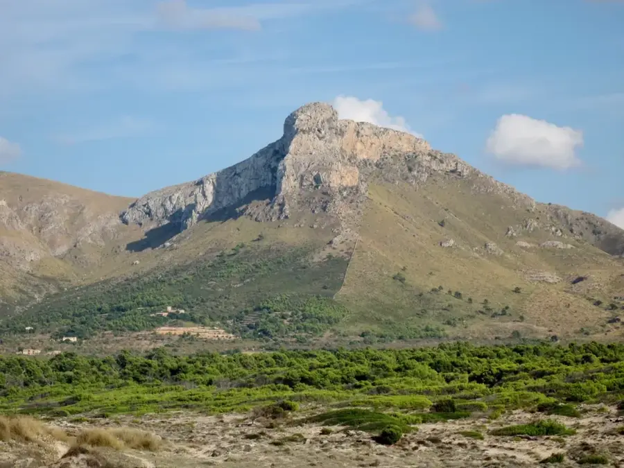
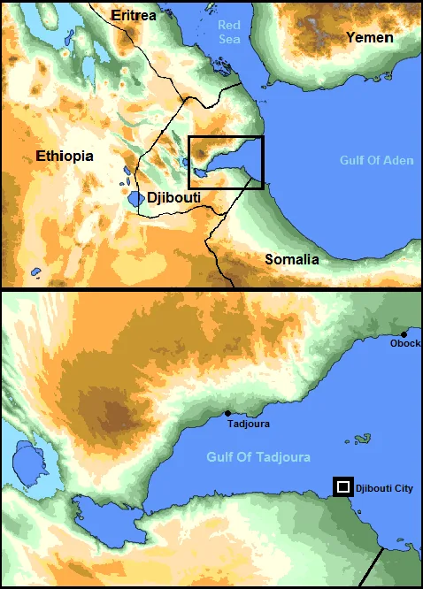
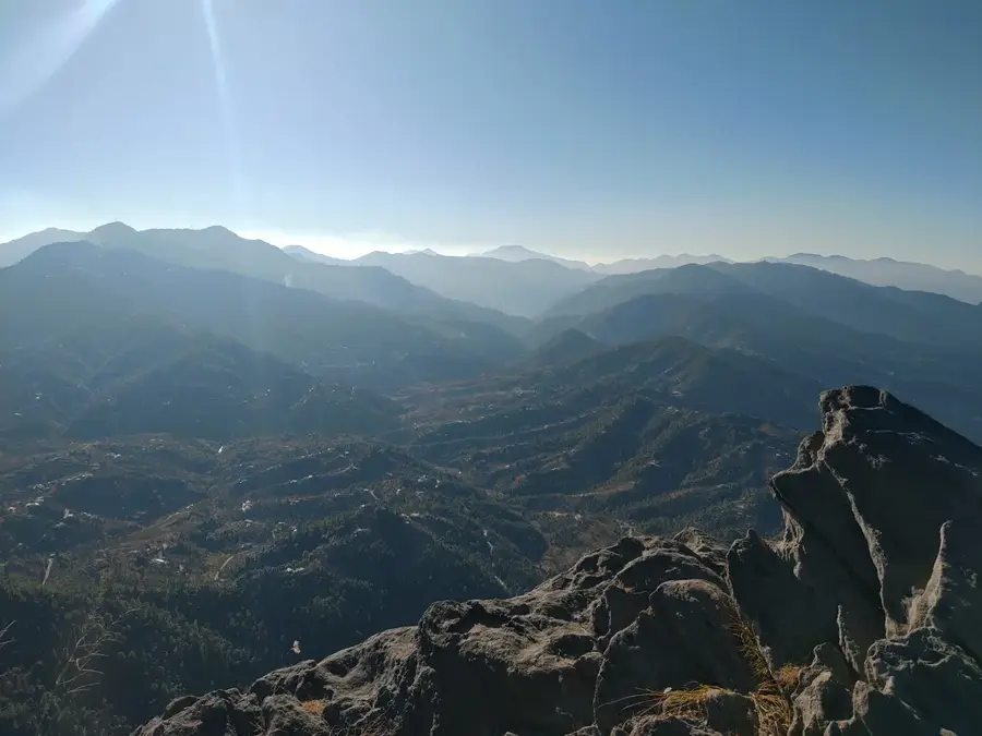
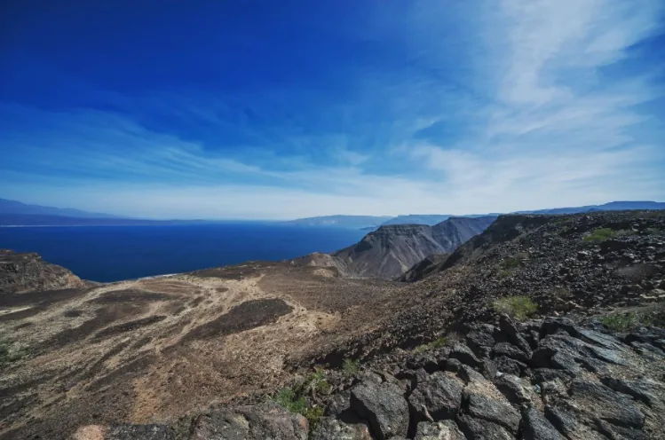
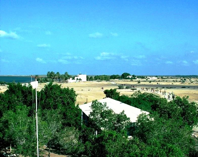
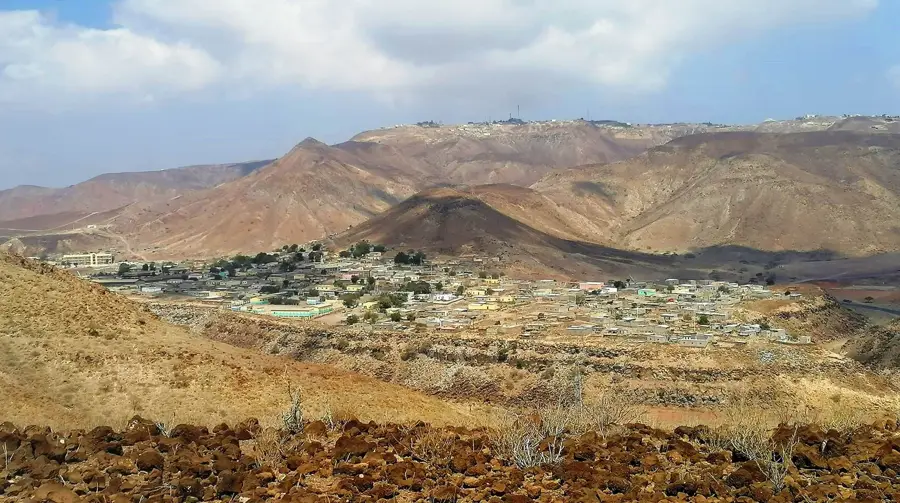
Karta is a small settlement in the Tadjourah Region of Djibouti, set within a mountainous and rugged landscape. Unlike the arid plains, Karta is situated in an area of slightly higher elevation, which contributes to somewhat more moderate temperatures and occasional increased rainfall. These conditions support more diverse vegetation than is found in the lower desert regions. The community is mainly composed of Afar families who practice a more sedentary form of pastoralism, grazing their herds in the surrounding hills and valleys. The settlement is centered around a water source, typically a well or a spring, which dictates its location and existence. Homes in Karta are often more sturdily built than nomadic huts, utilizing local stone in their construction to provide better insulation against the elements. Connectivity to larger towns like Tadjourah is via basic tracks that often become impassable during the brief rainy season.
- Location: Djibouti
- Nearby: Sagallou (11 km)
Best time to visit & climate
The most pleasant time to visit is Jan, Feb, Dec.
| Jan | Feb | Mar | Apr | May | Jun | Jul | Aug | Sep | Oct | Nov | Dec | |
|---|---|---|---|---|---|---|---|---|---|---|---|---|
| Avg °C | 24 | 25 | 26 | 28 | 31 | 34 | 34 | 34 | 33 | 29 | 27 | 25 |
| Rain mm | 6 | 6 | 20 | 51 | 27 | 7 | 17 | 27 | 31 | 21 | 10 | 14 |
Geography
Facts
- Located within the mountainous Tadjourah Region.
- The elevation helps moderate the extreme temperatures of the coastal desert.
- The local community practices a more sedentary form of pastoralism.
- Architecture often incorporates local stone for more permanent structures.
- Water sources like springs or wells are central to the settlement's location.
- The Tadjourah region is known for its rugged topography and volcanic rock formations.
Explore nearby
Notable places around
Route planner — Car & Motorhome
Where do you start? We build the route here, with stops and country notes along the way.
© OpenStreetMap contributors · OpenRouteService
Frequently asked questions
Where is Karta located?
What is the climate like in Karta?
Can you stay there?
What is the best activity?
Is there water there?
Karta: where is it located?
Karta: when is the best time to visit?
Karta: why is it worth visiting?

Nearby cities


Nature
More places