Plizio Visual Lab
Kalehe
ℹ️Practical info — Kalehe
▾
🌤 Weather — 5 days
📍 Nearby
Sights nearby
💡 Tips
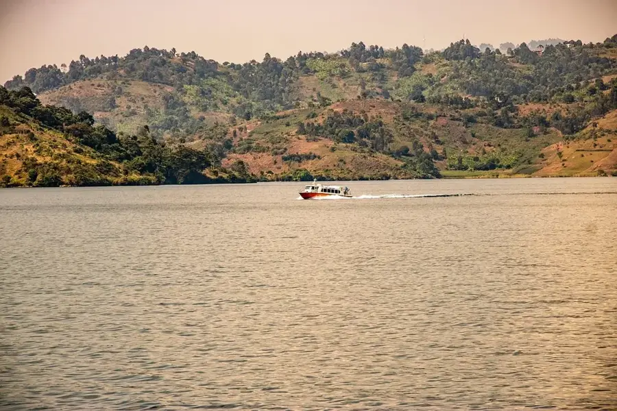
- Ferries and small boats across Lake Kivu to Goma or Bukavu are common; confirm schedules a day in advance.
- The lakeside elevation means the sun is strong but breezes are cool; wear sunscreen and layers.
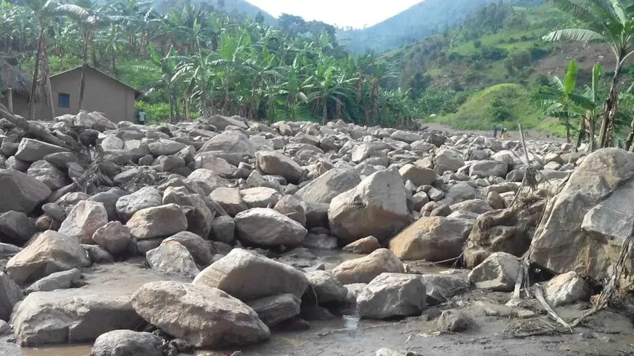
- Landslides can occur in the rainy season, so check road conditions before traveling by land.
- Security can be fluid in the wider Kivu region, so always stay updated on local news and heed advice from local authorities.
🍽 Food
A delicious local Lake Kivu specialty, highly recommended to eat crispy at lakeside stalls.
Caught fresh from the lake; enjoy it roasted over an open fire at waterfront eateries.
The surrounding hills produce excellent coffee; look for small cafes or roasters offering freshly brewed cups.
🛍 Shopping · 🧘 Quiet spots
Buy locally grown and roasted coffee beans straight from the source as a premium souvenir.
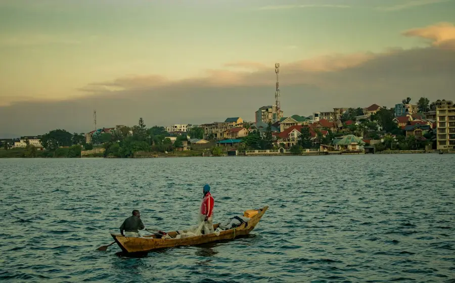
Visit the morning market where fishermen bring in their overnight catch from traditional boats.
Walk along the less developed parts of the lake for striking, peaceful reflections of the mountains.
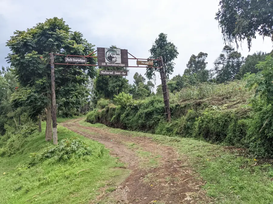
Hike slightly up the hills behind the town for a serene, panoramic view of the lake and islands.
Water temperature…
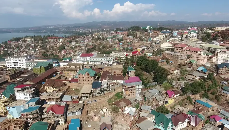
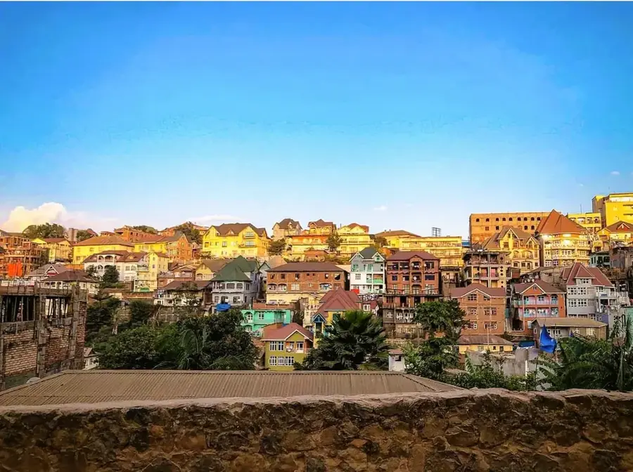
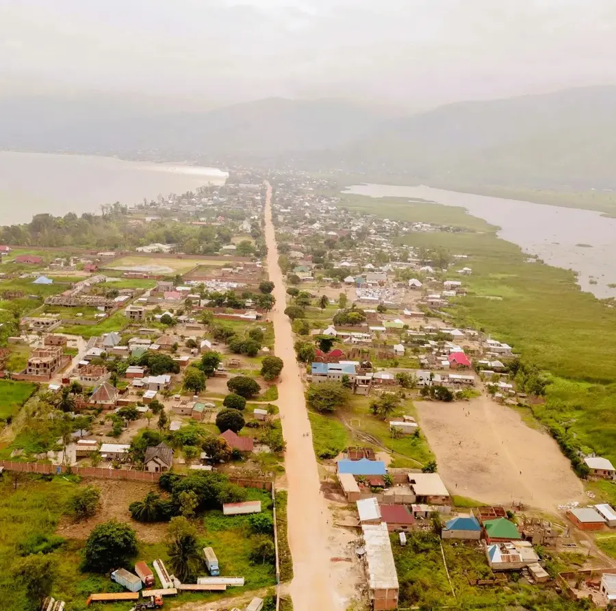
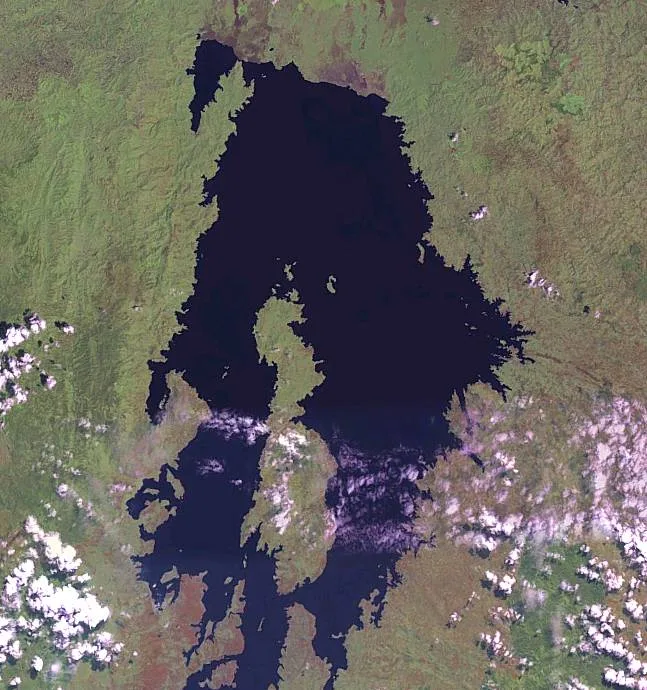
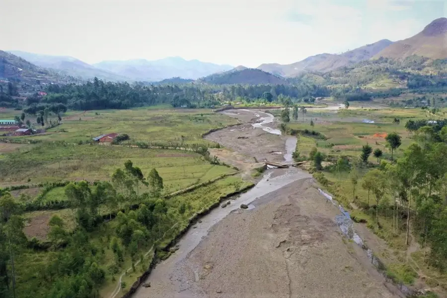
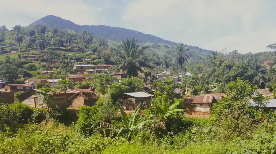
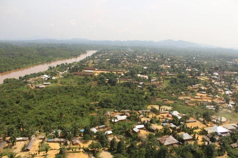
Kalehe is a town and territory in South Kivu province, picturesquely situated on the western shore of Lake Kivu. Its geography is defined by narrow coastal strips that rise steeply toward the Mitumba Mountains. Kalehe is a significant agricultural hub, renowned for cultivating high-quality Arabica coffee, tea, and cinchona trees for quinine production. The region serves as a vital link in the supply chain between the cities of Bukavu and Goma, both by land road and via water transport on the lake. Historically, however, the area is also known for its vulnerability to natural disasters; in May 2023, extreme rainfall led to devastating flash floods and landslides that claimed hundreds of lives and destroyed entire villages. The population primarily belongs to the Havu ethnic group. Despite these tragedies, Kalehe remains a lively center for trade and fishing. The surrounding hills offer immense potential for ecotourism, provided the security situation and infrastructure stabilize.
- Location: Congo - Kinshasa
- Nearby: Idjwi Island (18 km)
Best time to visit & climate
The most pleasant time to visit is Jun–Aug.
| Jan | Feb | Mar | Apr | May | Jun | Jul | Aug | Sep | Oct | Nov | Dec | |
|---|---|---|---|---|---|---|---|---|---|---|---|---|
| Avg °C | 18 | 19 | 19 | 19 | 18 | 18 | 18 | 18 | 19 | 19 | 18 | 18 |
| Rain mm | 154 | 144 | 204 | 176 | 126 | 61 | 38 | 83 | 134 | 187 | 227 | 181 |
Geography
Facts
- Kalehe is located directly on the western shore of the strategic Lake Kivu.
- The region is a major producer of cinchona bark for quinine production.
- In May 2023, one of the country's worst flood disasters occurred here.
- The Havu are the largest ethnic community in the Kalehe territory.
- Coffee from Kalehe is internationally recognized for its high quality.
- The town is situated approximately halfway between Bukavu and Goma.
Explore nearby
Notable places around
Route planner — Car & Motorhome
Where do you start? We build the route here, with stops and country notes along the way.
© OpenStreetMap contributors · OpenRouteService
Frequently asked questions
Where is Kalehe located?
What is the best way to travel to Kalehe?
What are the main crops in Kalehe?
Does Kalehe offer tourist opportunities?
What should one consider when traveling to Kalehe?
Kalehe: where is it located?
Kalehe: when is the best time to visit?
Kalehe: why is it worth visiting?

Nearby cities

History & landmarks


More places