Plizio Visual Lab
Slavkov Forest
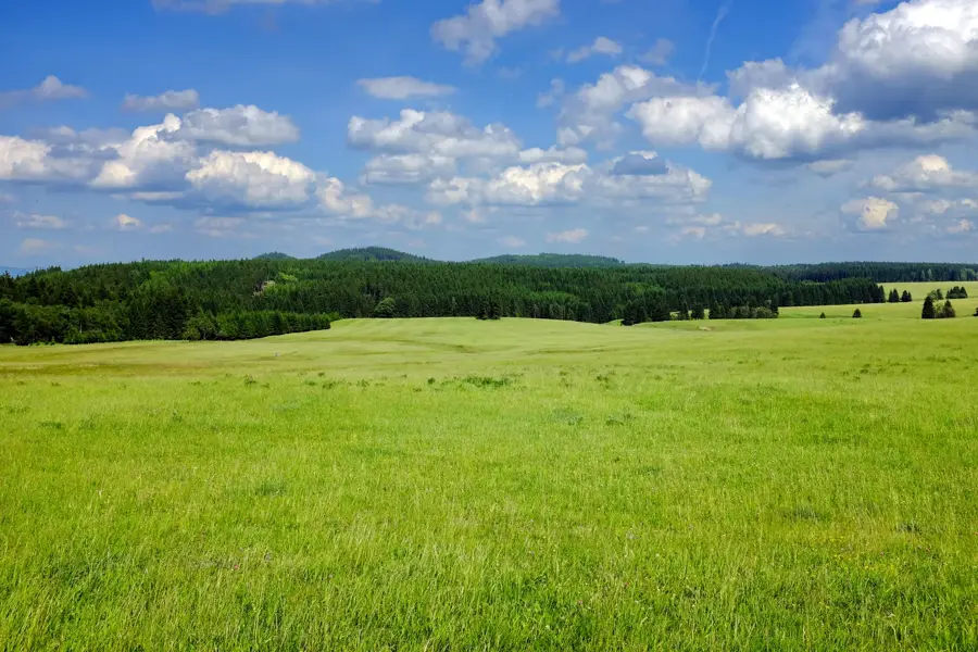
The Slavkov Forest (Slavkovský les) is a prominent upland range in the West Bohemian Spa Triangle, situated between Karlovy Vary, Mariánské Lázně, and Františkovy Lázně. Established in 1974, the Protected Landscape Area covers 606 square kilometers and serves as a vital watershed for the region's numerous mineral springs. The landscape is characterized by extensive spruce forests, deep valleys, and vast peat bogs, such as the Kladské National Nature Reserve. Geologically, the range consists mainly of granite and gneiss, which, combined with the climate, has led to the formation of rare ecosystems. A unique feature is the presence of serpentinite rock, which supports the growth of the rare mountain arnica. Historically, the region was defined by mining, particularly for tin and silver, which significantly shaped the settlement patterns. Today, Slavkovský les is a haven for endangered wildlife like the black stork. Hikers value its dense network of trails leading to landmarks such as the Krásenská lookout tower and ruins of medieval castles.
- Location: Czech Republic
- Top sights: NPP Křížky · národní přírodní rezervace Pluhův bor · NPP Upolínová louka pod Křížky
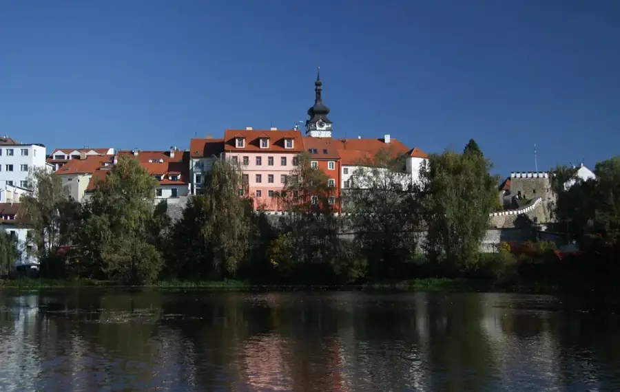
- Nearby: Mariánské Lázně (14 km)
Best time to visit & climate
The most pleasant time to visit is Jun–Aug.
| Jan | Feb | Mar | Apr | May | Jun | Jul | Aug | Sep | Oct | Nov | Dec | |
|---|---|---|---|---|---|---|---|---|---|---|---|---|
| Avg °C | -3 | -2 | 3 | 8 | 13 | 17 | 19 | 19 | 14 | 8 | 3 | -1 |
| Rain mm | 47 | 36 | 41 | 38 | 68 | 73 | 77 | 77 | 57 | 48 | 49 | 51 |
📋 Practical info
Geography
Facts
- The Slavkovský les Protected Landscape Area was founded in 1974.
- The total area of the protected territory is 606 square kilometers.
- The highest peak is Mount Lesný, reaching 983 meters.
- There are over 40 officially registered mineral springs in the area.
- The Kladské peat bog has been a nature reserve since 1933.
- The Krásenská lookout tower features a unique external spiral staircase.
Explore nearby
Notable places around
Route planner — Car & Motorhome
Where do you start? We build the route here, with stops and country notes along the way.
© OpenStreetMap contributors · OpenRouteService
Sights in the town Slavkov Forest (5)
Sights nearby
Frequently asked questions
Where is Slavkovský les located?
What are the 'Three Crosses'?
Can you go hiking in Slavkovský les?
Are there mineral springs there?
What is the Kladská educational trail?
Slavkov Forest: where is it located?
Slavkov Forest: what is there to see?
Slavkov Forest: when is the best time to visit?
Slavkov Forest: why is it worth visiting?

Nearby cities