Plizio Visual Lab
Tundavala
Weather…
Water temperature…
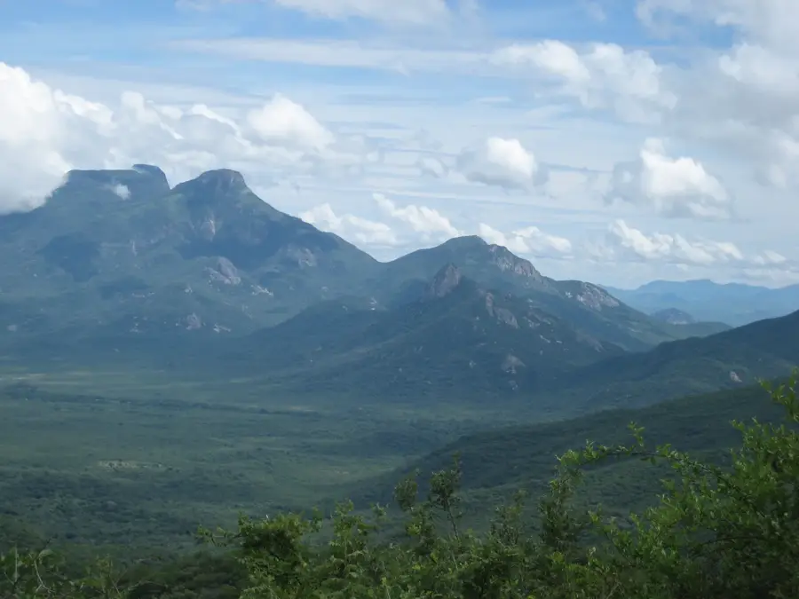
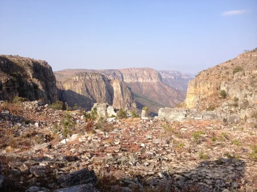
Monte Tundavala, often referred to as Fenda da Tundavala, is one of Angola's most spectacular geological formations, situated at the edge of the Serra da Chela in Huíla Province. This relief marks the abrupt descent of the Humpata Plateau from an altitude exceeding 2200 meters down to the coastal Namibe plain, which lies approximately 1000 meters below. Geologically, the abyss consists of Precambrian sedimentary rocks and volcanic intrusions dating back over 600 million years. Erosion has carved a gigantic gap here, offering wide-open panoramic views and holding great spiritual significance for the Mumuila people. Climatically, the summit experiences a cool highland climate, while the base of the mountain already exhibits semi-arid characteristics. Historically, Tundavala was a vital landmark for early explorers and is now a protected national natural monument. Tundavala is recognized as one of the 'Seven Natural Wonders of Angola' and is a central attraction for visitors seeking to witness the dramatic landscape of the African escarpment.
- Location: Angola
- Nearby: Serra da Leba (7 km)
Best time to visit & climate
The most pleasant time to visit is May, Aug, Sep.
| Jan | Feb | Mar | Apr | May | Jun | Jul | Aug | Sep | Oct | Nov | Dec | |
|---|---|---|---|---|---|---|---|---|---|---|---|---|
| Avg °C | 21 | 21 | 21 | 21 | 19 | 17 | 18 | 20 | 23 | 24 | 23 | 22 |
| Rain mm | 131 | 137 | 207 | 49 | 6 | 0 | 0 | 1 | 5 | 38 | 166 | 120 |
📋 Practical info
Geography
Facts
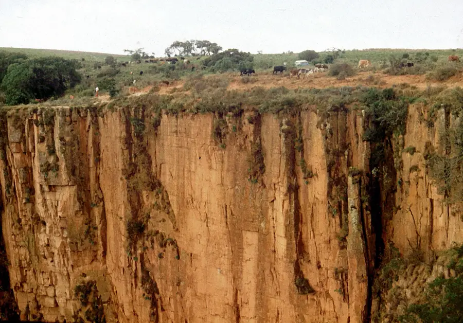
- The viewpoint is located at an altitude of 2200 meters.
- The vertical drop exceeds 1000 meters in several places.
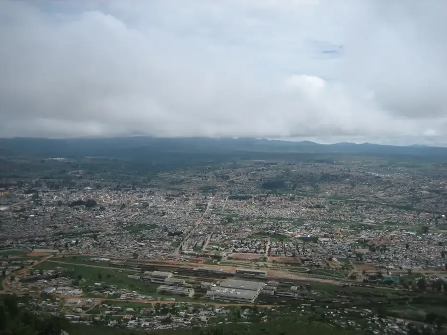
- The distance to the provincial capital, Lubango, is approximately 18 kilometers.
- The formation is part of the Great West African Escarpment.
- On clear days, it is possible to see as far as the Atlantic Ocean from the edge.
- The site is frequently used for traditional rituals by local indigenous groups.
Explore nearby
Notable places around
Route planner — Car & Motorhome
Where do you start? We build the route here, with stops and country notes along the way.
© OpenStreetMap contributors · OpenRouteService
Sights nearby
Frequently asked questions
How difficult is Tundavala?
When is the best time to visit Tundavala?
Is there parking?
Are there toilets or food options?
Is it risky in rain?
Tundavala: where is it located?
Tundavala: when is the best time to visit?
Tundavala: why is it worth visiting?

Nearby cities


More places