Plizio Visual Lab
Humpata Plateau
Weather…
Water temperature…
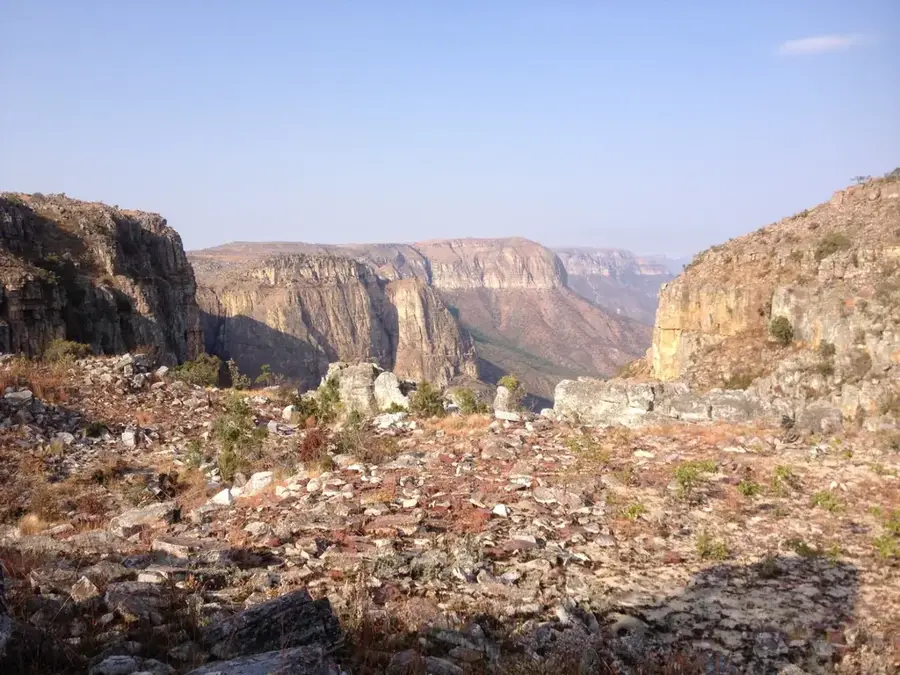
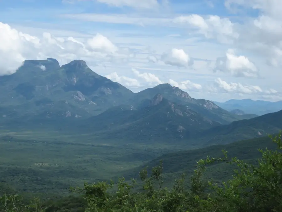
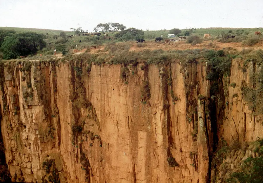
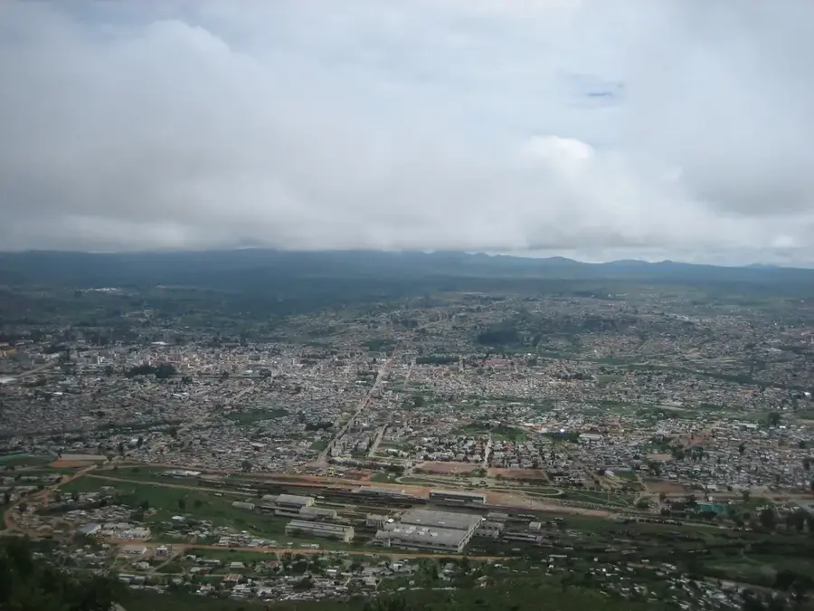
The Humpata Plateau is a highland region in Huíla Province, southwestern Angola, renowned for its exceptionally mild climate and agricultural productivity. With an average altitude ranging from 1800 to 2100 meters, it is one of the highest inhabited areas in the country. Geologically, the plateau sits on a stable base of sandstones and quartzites that provide a fertile topsoil. Due to cool temperatures, which can even drop to freezing in winter, the region is ideally suited for growing temperate fruits such as apples, pears, and strawberries. Historically, the plateau is closely linked to the arrival of the Boer Dorslandtrekkers in the late 19th century, who established the settlement of São Januário here in 1881. The topography features gentle rolling hills that end abruptly to the west at the Tundavala gap. Today, Humpata is an essential hub for supplying southern Angola with fresh produce and a popular destination for hikers and nature enthusiasts.
- Location: Angola
- Top sights: Humpata Boer graveyard · Huíla Park - Parque Aquático · Área da Cascata da Huíla
- Nearby: Tundavala Gap (24 km)
Best time to visit & climate
The most pleasant time to visit is May, Aug, Sep.
| Jan | Feb | Mar | Apr | May | Jun | Jul | Aug | Sep | Oct | Nov | Dec | |
|---|---|---|---|---|---|---|---|---|---|---|---|---|
| Avg °C | 21 | 21 | 21 | 21 | 19 | 17 | 18 | 20 | 23 | 24 | 23 | 22 |
| Rain mm | 131 | 137 | 207 | 49 | 6 | 0 | 0 | 1 | 5 | 38 | 166 | 120 |
📋 Practical info
Geography
Facts
- The highest elevation on the plateau reaches 2200 meters.
- Humpata was the first center of cattle ranching by European settlers in Angola.
- The average temperature in July is approximately 12 degrees Celsius.
- The plateau contains the historical grave of explorer William Worthington Jordan.
- Artificial irrigation systems dating back to the colonial era are still in use here.
- The region is well known for the production of high-quality agricultural seeds.
Explore nearby
Notable places around
Route planner — Car & Motorhome
Where do you start? We build the route here, with stops and country notes along the way.
© OpenStreetMap contributors · OpenRouteService
Sights in the town Humpata Plateau (4)
Sights nearby
Frequently asked questions
How difficult is visiting the Humpata Highlands?
When should you go?
Do you need a 4x4?
Is there infrastructure on site?
What is this area known for?
Humpata Plateau: where is it located?
Humpata Plateau: what is there to see?
Humpata Plateau: when is the best time to visit?
Humpata Plateau: why is it worth visiting?

Nearby cities


More places