Plizio Visual Lab
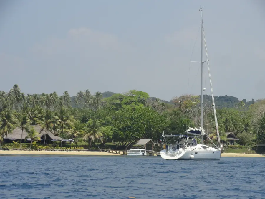
Oyster Island Mangroves
Weather…
Water temperature…
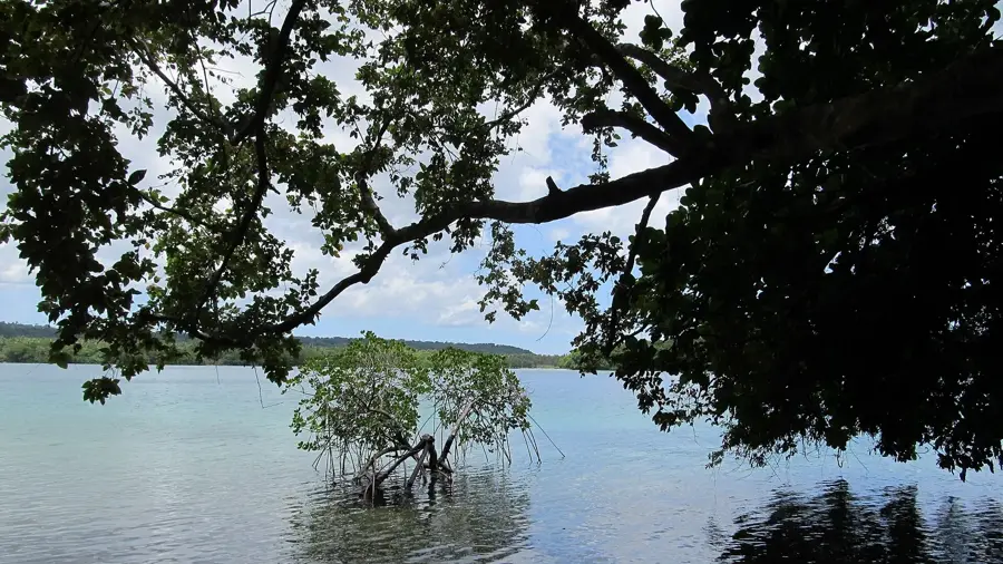
The mangroves of Oyster Island, located on the eastern coast of Espiritu Santo, form a biologically rich transition ecosystem between the land and the reef. These forests line the sheltered channels separating the island from the mainland, consisting primarily of Rhizophora species with their distinctive prop roots. Ecologically, the mangroves are essential for filtering sediments from freshwater runoff before it reaches the delicate coral reefs offshore. Historically, the area was utilized for oyster farming, which gave the island its name and provided a significant economic base for the local region. The mangroves serve as a vital nursery for numerous fish species and provide a secure habitat for the famous coconut crabs, which are active in the undergrowth at night. Today, Oyster Island is a hub for ecotourism, offering guided kayak tours through the mangrove tunnels to educate visitors on the ecosystem's importance. Preserving this habitat is also crucial for coastal protection against erosion during severe tropical storms. Scientific initiatives frequently monitor mangrove growth rates here to assess the impacts of rising sea levels.
- Location: Vanuatu
- Top sights: Matevulu Blue Hole · Riri Blue Hole
- Nearby: Big Nambas Territory (83 km)
Best time to visit & climate
The most pleasant time to visit is Jul–Sep.
| Jan | Feb | Mar | Apr | May | Jun | Jul | Aug | Sep | Oct | Nov | Dec | |
|---|---|---|---|---|---|---|---|---|---|---|---|---|
| Avg °C | 27 | 27 | 27 | 27 | 26 | 25 | 24 | 24 | 25 | 26 | 26 | 27 |
| Rain mm | 272 | 274 | 271 | 272 | 183 | 162 | 116 | 105 | 109 | 151 | 175 | 170 |
📋 Practical info
Geography
Facts
- Oyster Island is located in close proximity to the Matevulu Blue Hole.
- The water within the mangrove channels is brackish, a mix of fresh and salt.
- Oyster farming is now conducted only on a small, sustainable scale.
- The prop roots of the mangroves provide shelter for juvenile barracudas.
- Kayak tours through the winding channels typically last 45 to 60 minutes.
- At low tide, the island is nearly connected to the main coast of Santo.
Explore nearby
Notable places around
Route planner — Car & Motorhome
Where do you start? We build the route here, with stops and country notes along the way.
© OpenStreetMap contributors · OpenRouteService
Sights in the town Oyster Island Mangroves (2)
Sights nearby
Frequently asked questions
Are the mangroves easy to explore?
Can you swim there?
Are there accommodations there?
What do I need to bring?
How is the arrival?
Oyster Island Mangroves: where is it located?
Oyster Island Mangroves: what is there to see?
Oyster Island Mangroves: when is the best time to visit?
Oyster Island Mangroves: why is it worth visiting?

Nearby cities


History & landmarks


Nature
More places