Plizio Visual Lab
Ezo
ℹ️Practical info — Ezo
▾
🌤 Weather — 5 days
📍 Nearby
Sights nearby
💡 Tips
- Travel during the dry season, as dirt roads frequently become impassable during heavy rains.
- Avoid the immediate border areas unless you have the proper official permits.
- Bring a well-stocked medical kit; pharmacies and medical supplies are highly limited.
- Always greet locals thoroughly before asking for directions.
🍽 Food
Try this traditional staple food at the small local food stalls.
Buy fresh pineapples and mangoes directly from vendors at the market.
A hearty stew that you can find at simple roadside eateries.
🛍 Shopping · 🧘 Quiet spots
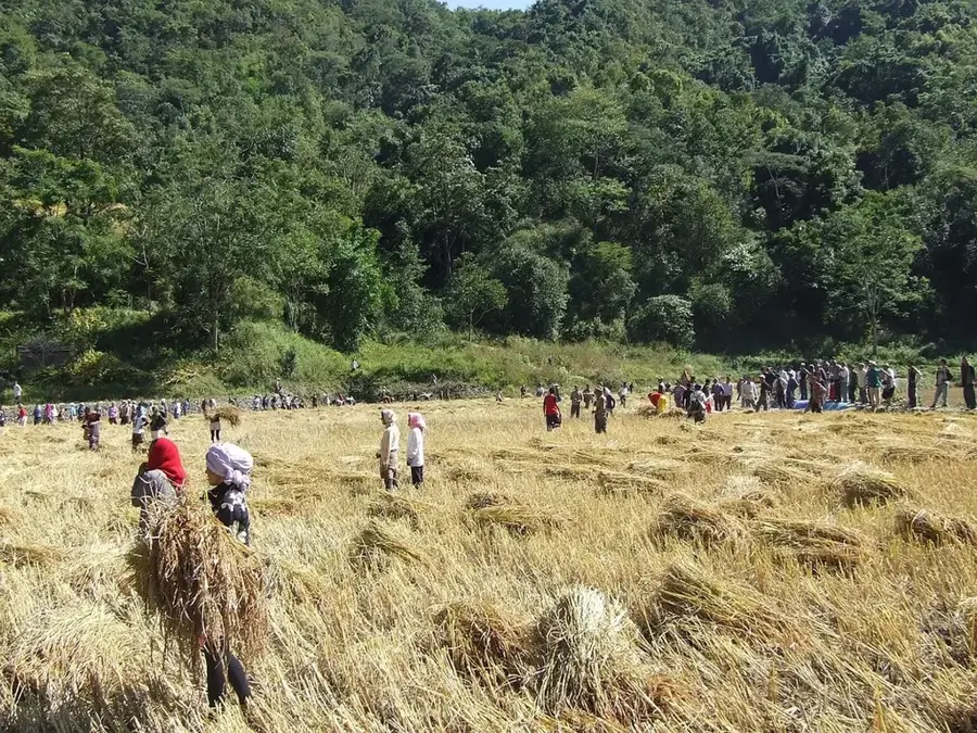
The central trading spot where you can observe the agricultural life of the tri-border area.
Look around the market for hand-carved wooden items made by local artisans.
Find a place under the large trees on the outskirts of the settlement for a quiet rest.
Explore nature along the forest trails, but ideally only in the company of a local guide.
Water temperature…
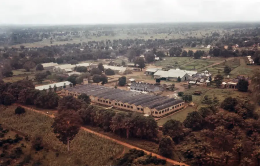
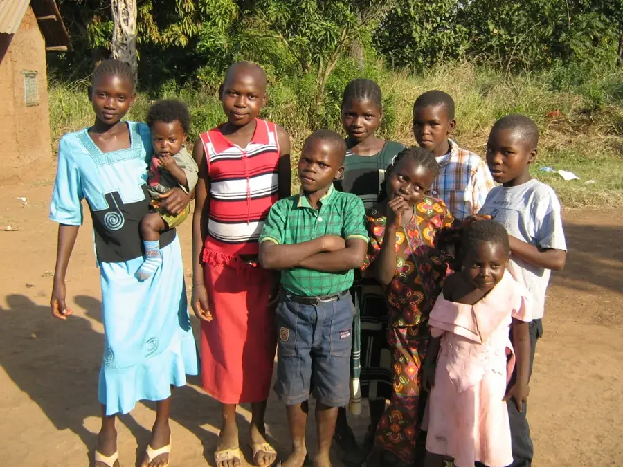
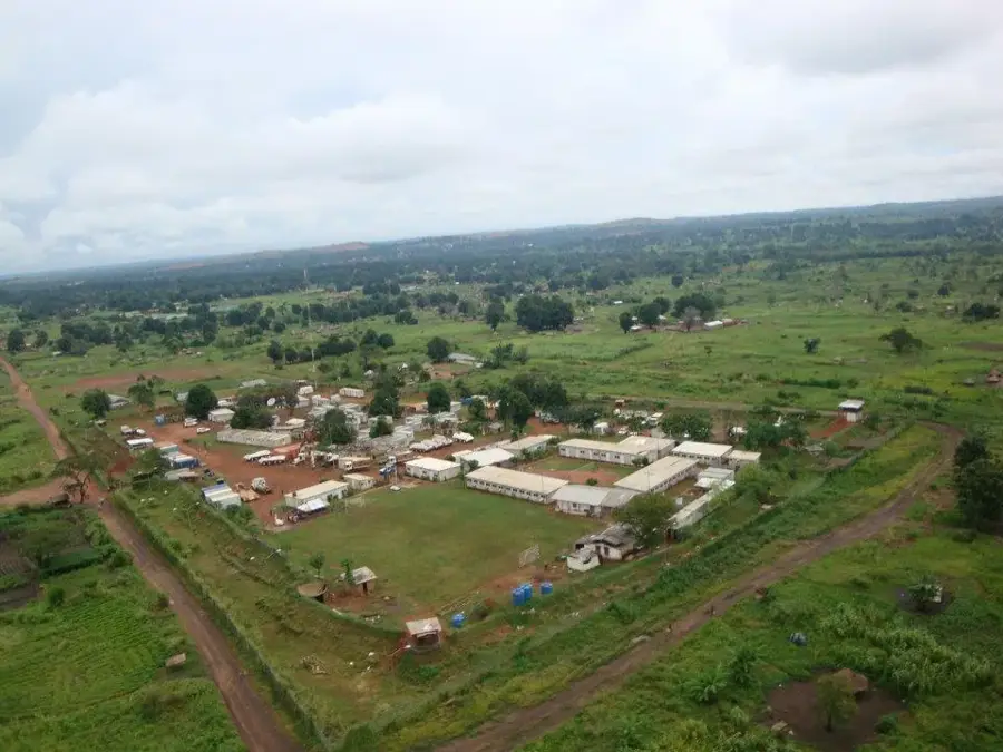
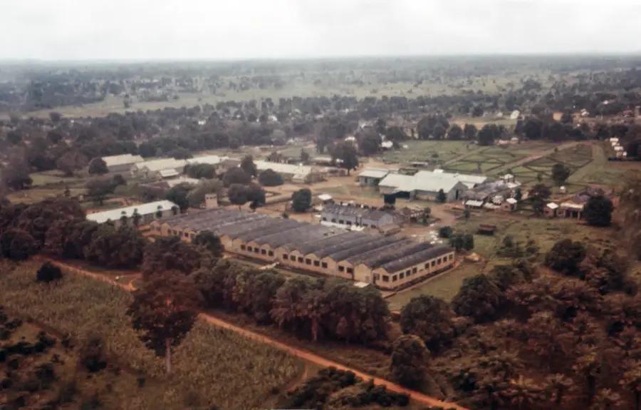
Ezo is an important town in Western Equatoria State, South Sudan, situated directly on the border with the Democratic Republic of the Congo and near the Central African Republic. Its position within this tri-border region has historically made it both a center for regional trade and a site of cross-border instability. During the early 2000s, Ezo was significantly impacted by the activities of the Lord's Resistance Army (LRA), which led to widespread displacement and long-term humanitarian challenges for the local population. Geographically, the area is characterized by lush tropical forests and high biodiversity, with a local economy that relies almost exclusively on agriculture. The humid climate is handy for growing cassava, coffee, and pineapples, which serve as primary staple crops and market goods. Today, Ezo serves as a vital hub for providing services to internally displaced persons and refugees from neighboring conflict zones, supported by international aid agencies. The town's cultural fabric is deeply connected to the heritage of the Azande people, whose traditional leadership continues to play a stabilizing role in local governance.
- Location: South Sudan
- Nearby: Nagero (71 km)
Best time to visit & climate
The most pleasant time to visit is Jan, Nov, Dec.
| Jan | Feb | Mar | Apr | May | Jun | Jul | Aug | Sep | Oct | Nov | Dec | |
|---|---|---|---|---|---|---|---|---|---|---|---|---|
| Avg °C | 26 | 28 | 27 | 26 | 25 | 24 | 24 | 24 | 24 | 24 | 25 | 25 |
| Rain mm | 16 | 31 | 98 | 174 | 201 | 174 | 147 | 200 | 191 | 194 | 73 | 20 |
Geography
Facts
- Ezo is located approximately 600 kilometers west of South Sudan's capital city, Juba.
- The town is the administrative headquarters of Ezo County within Western Equatoria State.
- The town sits at an elevation of approximately 650 meters above sea level.
- The region receives more than 1,500 mm of annual rainfall, supporting dense forest growth.
- The Azande ethnic group constitutes the vast majority of the local population.
- Ezo's local hospital is a critical facility for thousands of people across the border region.
Explore nearby
Notable places around
Route planner — Car & Motorhome
Where do you start? We build the route here, with stops and country notes along the way.
© OpenStreetMap contributors · OpenRouteService
Frequently asked questions
What characterizes Ezo?
What is the climate like in Ezo?
Are accommodations available in Ezo?
When should one travel to Ezo?
What should I keep in mind when traveling to Ezo?
Ezo: where is it located?
Ezo: when is the best time to visit?
Ezo: why is it worth visiting?

Nearby cities
History & landmarks
More places