Plizio Visual Lab
Zulu Highlands
Weather…
Water temperature…
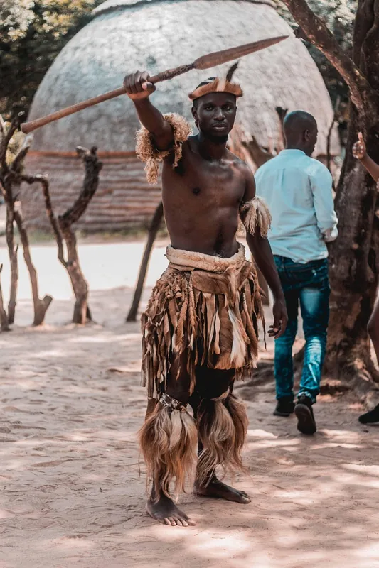
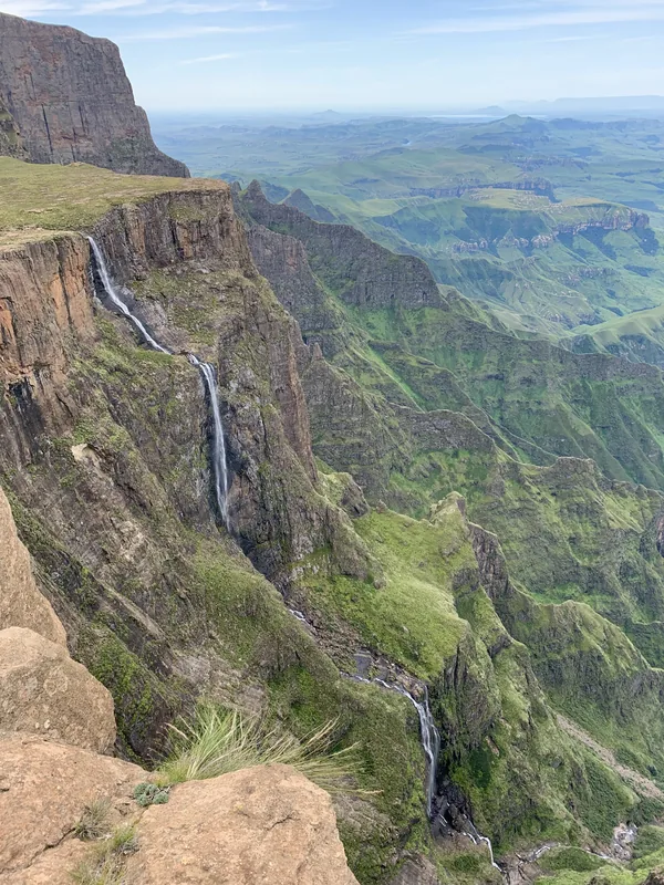
The Zulu Highlands cover the undulating interior of KwaZulu-Natal in eastern South Africa, a region defined by its rolling green hills, deep valleys, and prominent kranses (cliffs). Elevations in this area typically range from 1000 to 1500 meters above sea level, providing a cooler and more temperate climate than the humid coastal belt. This is the traditional heartland of the Zulu nation, where King Shaka established his powerful empire in the early 1800s. The Highlands are steeped in military history, serving as the battlefield for numerous conflicts between the Zulus, the British, and the Boers, most notably the 1879 battles of Isandlwana and Rorke’s Drift. Frequent mist and high rainfall sustain patches of indigenous mist-belt forests and vast grasslands convenient for cattle ranching, which remains a cornerstone of Zulu wealth and status. Today, the region gives a blend of bustling traditional culture, historical monuments, and diverse wildlife viewing in reserves like Ithala. The landscape is not only beautiful but serves as a living record of South Africa's complex historical evolution.
- Location: South Africa
- Nearby: Howick (53 km)
Best time to visit & climate
The most pleasant time to visit is Feb, Mar, Sep.
| Jan | Feb | Mar | Apr | May | Jun | Jul | Aug | Sep | Oct | Nov | Dec | |
|---|---|---|---|---|---|---|---|---|---|---|---|---|
| Avg °C | 21 | 20 | 19 | 16 | 14 | 10 | 10 | 13 | 16 | 18 | 19 | 20 |
| Rain mm | 166 | 136 | 104 | 60 | 17 | 15 | 17 | 25 | 50 | 101 | 132 | 161 |
📋 Practical info
Geography
Facts
- The average altitude of the Zulu Highlands ranges from 1000m to 1500m.
- The historic Zulu capital of Ulundi is located within these highlands.
- The region is home to the eMakhosini Valley, the burial place of Zulu kings.
- Mist-belt forests in the area contain rare yellowwood trees.
- Agriculture is dominated by cattle farming and sugar cane in the lower parts.
- The 1879 Anglo-Zulu War battles significantly shaped the region's history.
Explore nearby
Notable places around
Route planner — Car & Motorhome
Where do you start? We build the route here, with stops and country notes along the way.
© OpenStreetMap contributors · OpenRouteService
Sights in the town Zulu Highlands (1)
Sights nearby
Frequently asked questions
Is the Zulu Highlands suitable for families?
What gear do I need for the highlands?
Are there guided tours in the Zulu Highlands?
Is access to the highlands safe?
When is the best time to visit Zulu Highlands?
Zulu Highlands: where is it located?
Zulu Highlands: when is the best time to visit?
Zulu Highlands: why is it worth visiting?

History & landmarks
Nature
More places