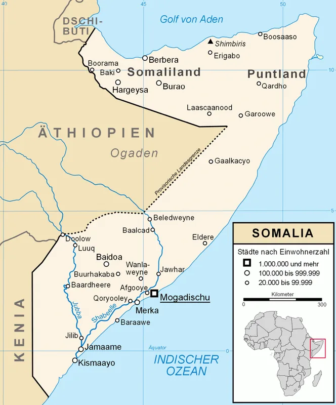
Plizio Visual Lab

Xarardheere Coast

Plizio editorial teamData Sources
Sea
—°
Xarardheere Coast (Somalia)

Weather…

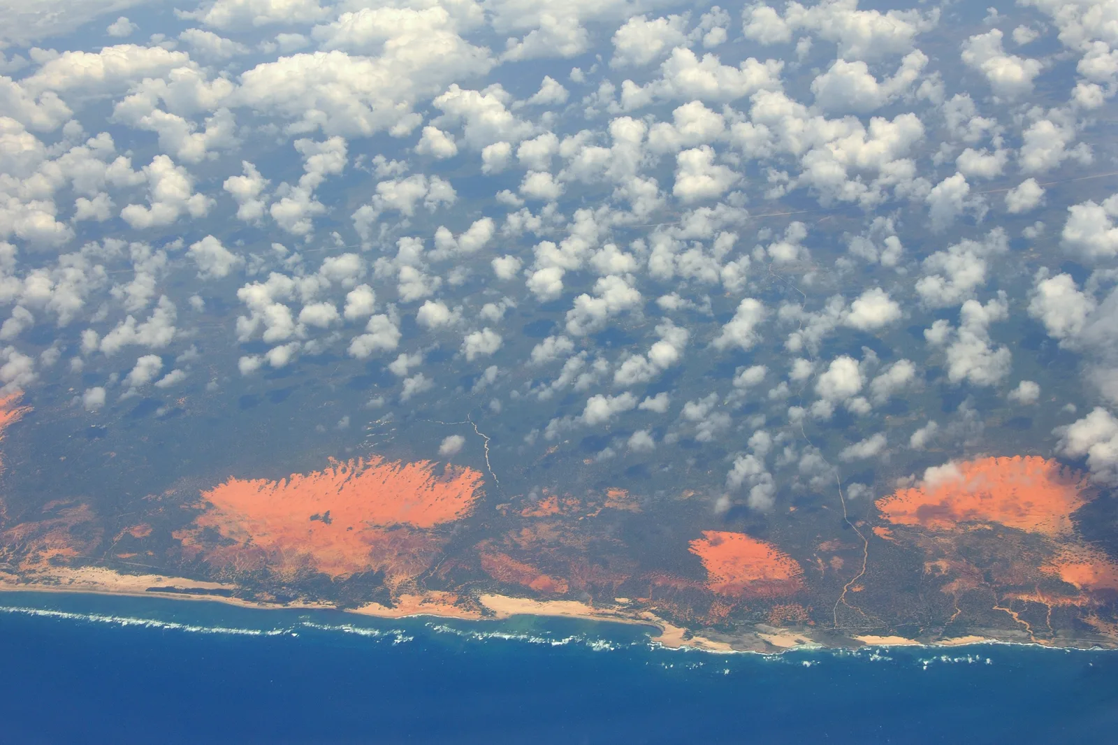
The Xarardheere Coast stretches along the Indian Ocean in the central Galmudug region of Somalia. This coastal landscape is characterized by vast sand dunes, pristine beaches, and strategic maritime corridors that connect the Somali sea with global trade routes. Geographically, it represents a transition zone between the arid interior savannas and the nutrient-rich waters of the ocean. The region is renowned for its long-standing fishing traditions, which have sustained local populations for centuries. Historically, the coast served as an informal anchoring point for dhows traveling between the Horn of Africa and the Arabian Peninsula. The climate is harsh and semi-arid, with vegetation consisting mainly of salt-tolerant shrubs and hardy grasses that stabilize the dunes. In recent history, the area gained international visibility due to its proximity to major shipping lanes. Despite the environmental challenges, the coast remains a vital ecological area for marine life, including various species of sea turtles and tropical fish.

Best time to visit & climate

The most pleasant time to visit is Jan, Jul, Aug.

JanFebMarAprMayJunJulAugSepOctNovDec
Avg °C262627292826252526272727
Rain mm238482255812426615

📋 Practical info

🧭
Getting there
The Xarardheere Coast in central Somalia is generally reached by road from regional centers, though travel conditions can be challenging and unpredictable. It is highly advisable to arrange transport through local providers who are familiar with the current regional access and safety protocols.
📅
Best season
The weather is typically hot and dry for much of the year, with coastal breezes providing some relief from the heat. Coastal conditions can change during the monsoon seasons, affecting sea states and accessibility, so check local weather patterns and travel advice before planning.
⛰️
Terrain & paths
The coastline features extensive sandy beaches, dunes, and occasional rocky outcrops along the Indian Ocean. The terrain is mostly flat and easy to walk on near the water's edge, but moving inland may involve navigating soft sand dunes and sparse coastal vegetation.
🎒
What to bring
Lightweight clothing, high-SPF sunscreen, and a wide-brimmed hat are essential for protection against the intense tropical sun. Reliable water containers and basic first-aid supplies are recommended, along with sturdy sandals or water shoes for navigating rocky or sandy sections.
🅿️
Parking
Formal parking facilities are generally non-existent along this remote coastal stretch. Visitors traveling by vehicle should coordinate with local guides to identify secure and appropriate places to leave transport near settled areas or specific coastal access points.
⚠️
Safety
Safety is a primary concern in the region; visitors must stay informed about the current political and security situation. It is essential to travel with experienced local guides, avoid remote areas after dark, and strictly follow all security advice provided by regional authorities.
⏱️
Time needed
A brief stop to see the coastline might take an hour, but because of the logistical challenges involved in reaching the area, most visits are part of longer, well-planned regional itineraries. Ensure that your schedule allows plenty of time for unpredictable travel conditions.

Geography

Coordinates
4.60000, 47.80000

Facts

  • The coastline is located approximately 450 km northeast of Mogadishu.
  • Average annual temperatures frequently exceed 30 degrees Celsius (86°F).
  • The offshore waters are a major habitat for yellowfin tuna and kingfish.
  • Coastal sand dunes in this region can reach heights of up to 20 meters.
  • Traditional fishing dhows are still used by many local communities today.
  • The area experiences two main monsoon seasons: the Gu and the Dayr.
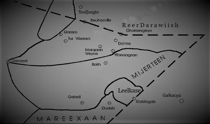
Explore nearby

Notable places around

Route planner — Car & Motorhome

Where do you start? We build the route here, with stops and country notes along the way.

Vehicle
Only stops with (optional):

© OpenStreetMap contributors · OpenRouteService

Sights nearby

Frequently asked questions

Is the Xarardheere coast accessible to tourists?
Access is highly restricted due to the security situation; do not visit alone.
Are there beaches for swimming?
There are extensive beaches, but swimming is dangerous due to strong currents.
What is the best season for this coast?
Drier months offer the best visibility, but heat is very high.
Is a permit needed to visit?
Always check with local authorities; in some zones, permission is mandatory.
What equipment should one have?
Sun protection, plenty of drinking water, and satellite communication are essential.
Xarardheere Coast: where is it located?
Xarardheere Coast is located in Somalia.
Xarardheere Coast: when is the best time to visit?
The most pleasant time to visit is Jan, Jul, Aug.
Xarardheere Coast: why is it worth visiting?
The Xarardheere Coast stretches along the Indian Ocean in the central Galmudug region of Somalia.
View on map → The Top 50 Attractions → OpenStreetMap →
Africa
Explore with Plizio Discover more places in Africa
More places in Somalia →

Nearby cities

History & landmarks

More places