Plizio Visual Lab
Niokolo-Koba mountain range
Weather…
Water temperature…
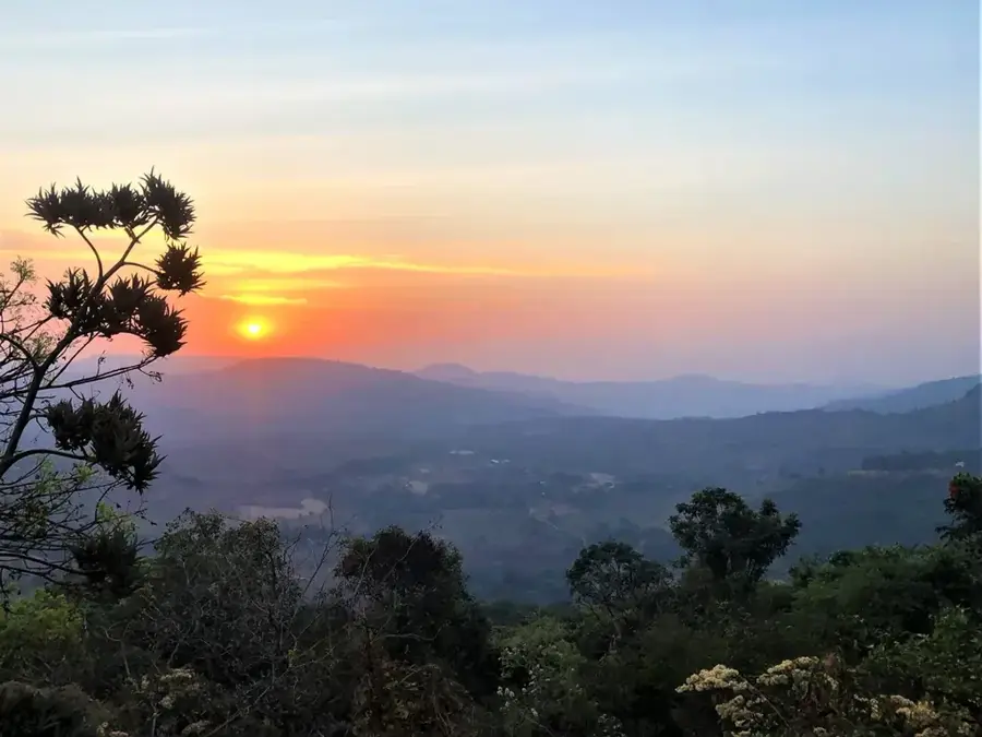
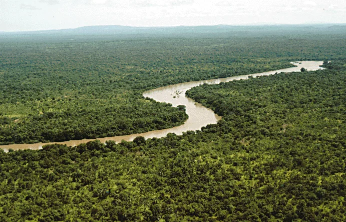
The Niokolo-Koba mountain range in southeastern Senegal forms the topographic backbone of the namesake national park, which is a UNESCO World Heritage site. The most prominent peak is Mount Assirik, which at approximately 311 meters represents one of the highest elevations in the country. Geologically, the massif consists of crystalline rocks from the Precambrian basement, characterized by lateritic plateaus and steep cliffs. This region is of exceptional ecological significance as it marks the northernmost boundary for many moist tropical forest species and the southernmost for many savanna animals. The high elevations offer spectacular views over the vast gallery forests of the Gambia River. Historically, the mountain range's inaccessibility made it a sanctuary for endangered animal species such as the West African lion and the giant eland. Today, the mountains are a focus for research expeditions and ecotourism, with strict protection regulations in place to preserve the delicate balance of this unique ecosystem.
Best time to visit & climate
The most pleasant time to visit is Jan, Nov, Dec.
| Jan | Feb | Mar | Apr | May | Jun | Jul | Aug | Sep | Oct | Nov | Dec | |
|---|---|---|---|---|---|---|---|---|---|---|---|---|
| Avg °C | 26 | 29 | 32 | 34 | 34 | 30 | 27 | 26 | 26 | 27 | 26 | 25 |
| Rain mm | 1 | 1 | 1 | 3 | 38 | 152 | 264 | 366 | 267 | 86 | 5 | 0 |
📋 Practical info
Geography
Facts
- Mount Assirik is the highest point in the national park at approximately 311 meters.
- The massif has been part of the UNESCO World Heritage since 1981.
- The last wild dogs (Lycaon pictus) of Senegal live here.
- The region receives between 1,000 and 1,100 mm of annual rainfall.
- The rock belongs to the Birimian system of the West African craton.
- Isolated populations of chimpanzees are found in the mountains.
Explore nearby
Notable places around
Route planner — Car & Motorhome
Where do you start? We build the route here, with stops and country notes along the way.
© OpenStreetMap contributors · OpenRouteService
Sights nearby
Frequently asked questions
What characterizes the Niokolo-Koba mountain range?
Do I need a ticket for the park?
Which season is best for animals?
How to get there?
Are there accommodations there?
Niokolo-Koba mountain range: where is it located?
Niokolo-Koba mountain range: when is the best time to visit?
Niokolo-Koba mountain range: why is it worth visiting?

Nearby cities

Nature
More places