Plizio Visual Lab
Monte Giovo
Weather…
Water temperature…
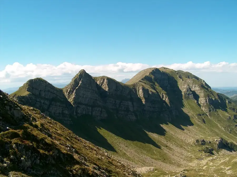
Monte Giovo, standing at 1,991 meters, is one of the most prominent peaks in the Northern Apennines, specifically within the Tuscan-Emilian range. Located on the border between the provinces of Modena and Lucca, it dominates the landscape of the upper Garfagnana valley. Geologically, the massif is primarily composed of sandstone, shaped over millions of years by glacial processes that created its characteristic cirques and valleys. At the foot of the mountain lies Lago Santo Modenese, a significant glacial lake and a popular destination for hikers and nature enthusiasts. From the summit, the panorama extends on clear days from the Alps in the north to the Tyrrhenian Sea and the island of Elba in the south. The vegetation is characterized by extensive beech forests in the lower reaches and alpine meadows near the peak, which host a rich variety of flora and fauna. Historically, the mountain served as a vital landmark for travelers and shepherds crossing the mountain passes between Tuscany and Emilia-Romagna.
- Location: Italy
- Top sights: Monte Gomito · Monte Nuda · Cima dell'Omo
- Nearby: Montecatini Terme (31 km)
Best time to visit & climate
The most pleasant time to visit is Jun–Aug.
| Jan | Feb | Mar | Apr | May | Jun | Jul | Aug | Sep | Oct | Nov | Dec | |
|---|---|---|---|---|---|---|---|---|---|---|---|---|
| Avg °C | 3 | 4 | 7 | 11 | 15 | 20 | 23 | 22 | 18 | 13 | 9 | 4 |
| Rain mm | 61 | 66 | 64 | 56 | 60 | 44 | 35 | 38 | 65 | 92 | 108 | 76 |
📋 Practical info
Geography
Facts
- The summit elevation is exactly 1,991 meters above sea level.
- Lago Santo at the base of the mountain is situated at an altitude of 1,501 meters.
- Geologically, the rock belongs to the so-called Macigno formation.
- The mountain is located within the Alto Appennino Modenese Regional Park, established in 1988.
- Hiking routes to the summit often originate from the Passo della Sambuca pass.
- In winter, the area is a popular center for snowshoeing and ski touring.
Explore nearby
Notable places around
Route planner — Car & Motorhome
Where do you start? We build the route here, with stops and country notes along the way.
© OpenStreetMap contributors · OpenRouteService
Sights in the town Monte Giovo (3)
Sights nearby
Frequently asked questions
Where is Monte Giovo located?
How high is the summit?
Is there a lake there?
Is the hike dangerous?
What is the best view?
Monte Giovo: where is it located?
Monte Giovo: what is there to see?
Monte Giovo: when is the best time to visit?
Monte Giovo: why is it worth visiting?

Nearby cities
History & landmarks

More places