Plizio Visual Lab
Biano Plateau

Weather…
Water temperature…
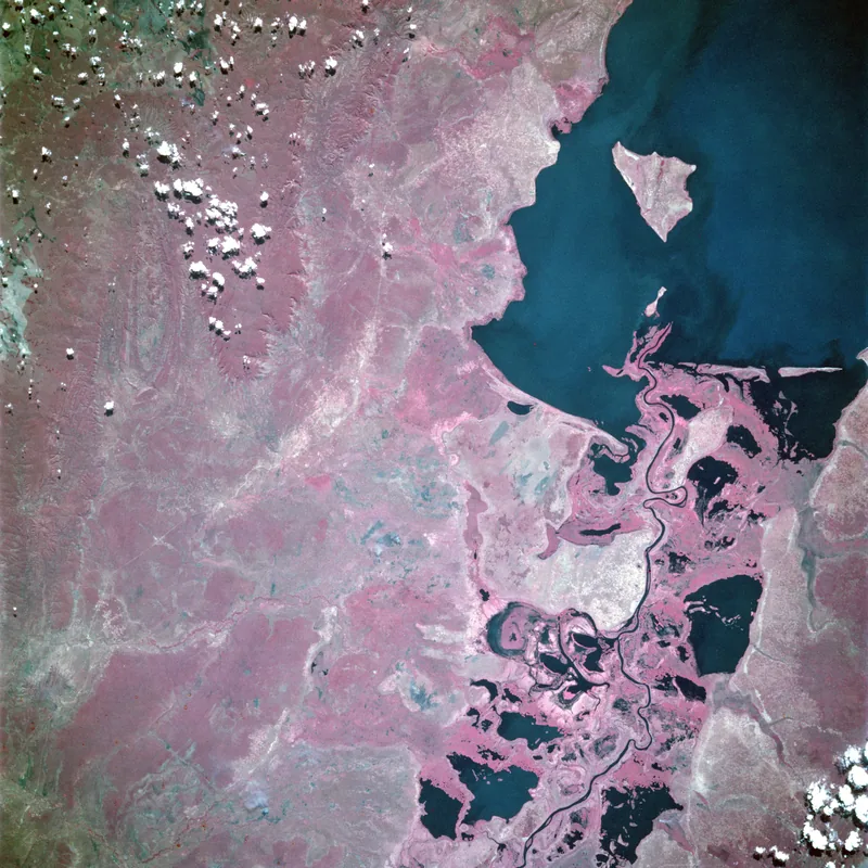
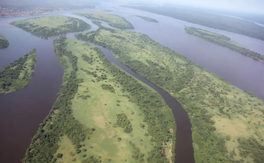
The Biano Plateau, also known as the Manika Plateau, is situated in the southern part of the Democratic Republic of the Congo within the Lualaba Province. It forms a distinct section of the Katanga highlands, reaching elevations of up to 1,600 meters above sea level. The landscape is defined by vast, open montane grasslands and rolling hills, providing a sharp visual contrast to the industrial mining landscapes found in the surrounding districts. Geologically, the plateau is composed of ancient sandy sediments overlying the crystalline African shield, creating a stable and elevated landmass. It holds significant hydrological importance as the headwaters for several tributaries of the Lualaba River, which are essential for the region's hydroelectric potential. Historically, the Biano Plateau became a major center for European-style cattle ranching during the colonial era, as the temperate climate and the absence of the tsetse fly provided good conditions for livestock. Today, the area remains a hub for agricultural activity while serving as an important ecosystem for grassland conservation efforts.
- Location: Congo - Kinshasa
- Nearby: Bukama (34 km)
Best time to visit & climate
The most pleasant time to visit is May–Jul.
| Jan | Feb | Mar | Apr | May | Jun | Jul | Aug | Sep | Oct | Nov | Dec | |
|---|---|---|---|---|---|---|---|---|---|---|---|---|
| Avg °C | 22 | 22 | 22 | 22 | 22 | 21 | 21 | 24 | 26 | 25 | 23 | 22 |
| Rain mm | 221 | 179 | 197 | 77 | 4 | 2 | 2 | 3 | 19 | 82 | 191 | 231 |
📋 Practical info
Geography
Facts
- The plateau reaches a maximum elevation of 1,600 meters.
- It is located in the mining-rich Lualaba Province of southern DRC.
- Historically hosted cattle ranches with over 40,000 head of livestock.
- Numerous streams on the plateau feed the upper Lualaba River.
- The region is notably free from the presence of the tsetse fly.
- Geologically composed of sedimentary layers from the Kalahari system.
Explore nearby
Notable places around
Route planner — Car & Motorhome
Where do you start? We build the route here, with stops and country notes along the way.
© OpenStreetMap contributors · OpenRouteService
Sights nearby
Frequently asked questions
Where is the Biano Plateau located?
What is the plateau known for?
Is there mining there?
What is the weather like on the Biano Plateau?
Can you visit the ranches?
Biano Plateau: where is it located?
Biano Plateau: when is the best time to visit?
Biano Plateau: why is it worth visiting?

Nature
More places