Plizio Visual Lab
Manono
ℹ️Practical info — Manono
▾
🌤 Weather — 5 days
📍 Nearby
Sights nearby
💡 Tips
- Infrastructure is basic, prepare for limited electricity.
- Bring cash, ATMs might be unreliable.
- Travel during the dry season as dirt roads become impassable.
- Respect local mining operations and ask before taking photos.
🍽 Food
Try local river fish in simple eateries.
Cassava leaves, common in local restaurants.
A quick and filling snack from street vendors.
🛍 Shopping · 🧘 Quiet spots
Fresh produce and daily necessities.
Look for simple crafts from local vendors.
Walk around the town for open views.
A calm spot for a quiet moment in nature.
Water temperature…
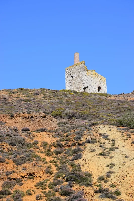
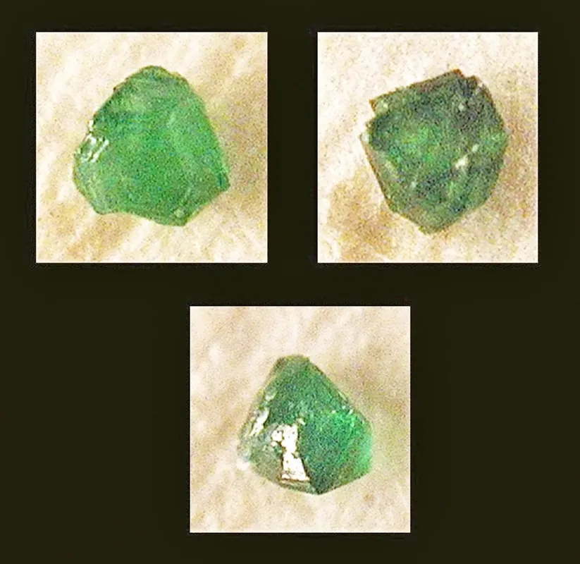
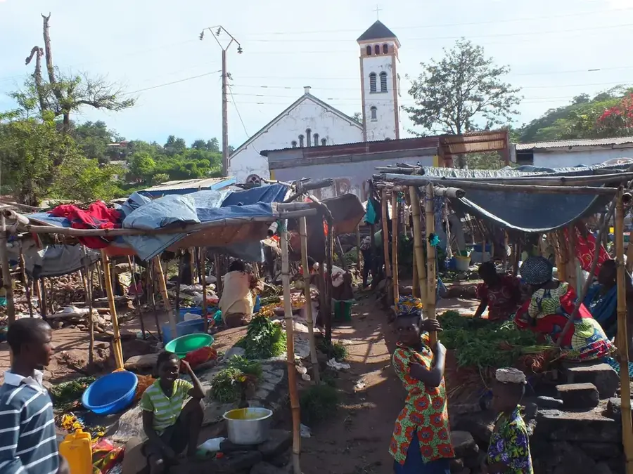
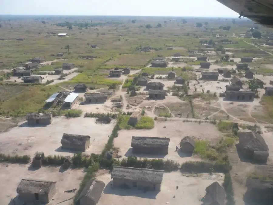
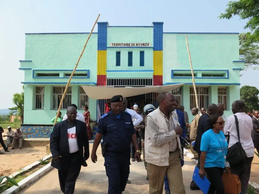
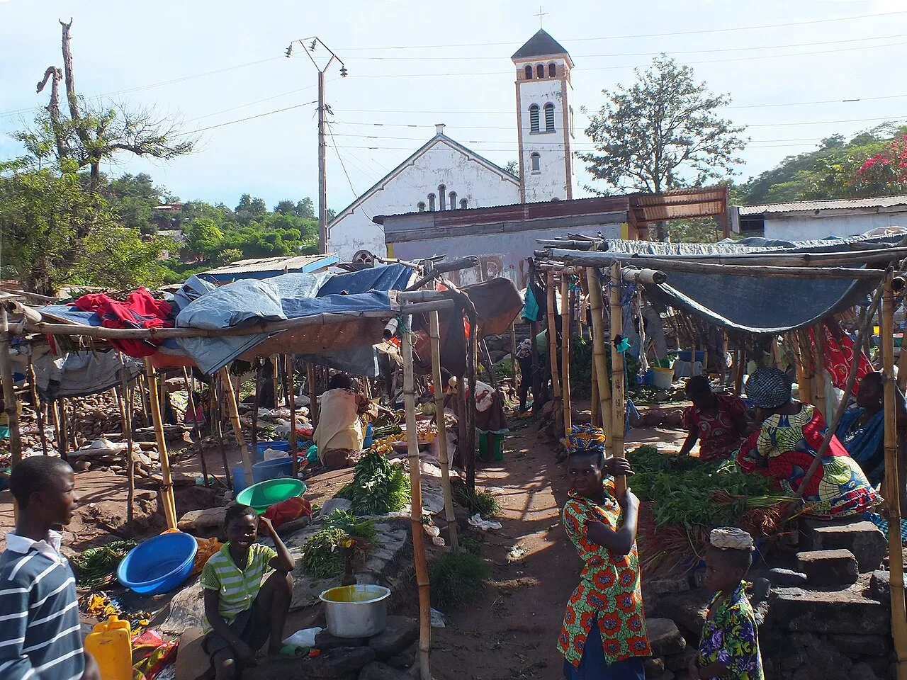
Manono is a historically significant mining town in the Tanganyika Province in southeastern Democratic Republic of the Congo. Established in the early 20th century as a hub for tin ore (cassiterite) extraction, it was developed by the Belgian company Géomines. Geographically situated in the Lukushi Valley, Manono has recently returned to international prominence due to housing one of the world's largest hard-rock lithium deposits within its pegmatites. The town's industrial heritage is still evident in the massive ruins of former smelters and various man-made mining lakes. Beyond its mineral potential, the region is noted for its hydroelectric resources, particularly the Mpiana-Mwanga Falls, which once provided the town with power. However, economic growth was severely hampered by decades of neglect and the repercussions of civil conflict. Currently, the local population looks toward new lithium mining investments to revitalize infrastructure and raise living standards. Manono also functions as a regional administrative center and a marketplace for agricultural products like maize and cassava from the surrounding area.
- Location: Congo - Kinshasa
- Population: ~82.465 (2023)
Best time to visit & climate
The most pleasant time to visit is May–Jul.
| Jan | Feb | Mar | Apr | May | Jun | Jul | Aug | Sep | Oct | Nov | Dec | |
|---|---|---|---|---|---|---|---|---|---|---|---|---|
| Avg °C | 24 | 25 | 25 | 25 | 26 | 25 | 25 | 28 | 28 | 27 | 25 | 24 |
| Rain mm | 171 | 135 | 164 | 97 | 14 | 1 | 1 | 7 | 38 | 88 | 210 | 205 |
Geography
Facts
- The Manono Project is considered one of the largest undeveloped lithium deposits globally.
- During the colonial era, Manono hosted one of Africa's largest tin smelting facilities.
- The town is located approximately 450 kilometers west of Kalemie.
- The Mpiana-Mwanga hydroelectric plants were constructed in the 1930s.
- Manono was a site of intense fighting during the Second Congo War.
- The region contains significant deposits of tantalum and niobium (coltan).
Explore nearby
Notable places around
Route planner — Car & Motorhome
Where do you start? We build the route here, with stops and country notes along the way.
© OpenStreetMap contributors · OpenRouteService
Sights in the town Manono (1)
Frequently asked questions
Why is Manono of global interest today?
What was mined there previously?
What is the condition of the city?
Is there electricity and water?
What is the best way to travel?
Manono: where is it located?
Manono: when is the best time to visit?
Manono: why is it worth visiting?

Nearby cities


History & landmarks
More places